Property Record
3035 N Los Altos Ave, Tucson, AZ 85705

This Property Is For Sale
NEARBY LISTINGS FOR SALE OR LEASE
Property Detail
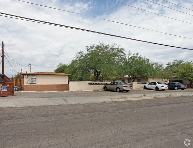
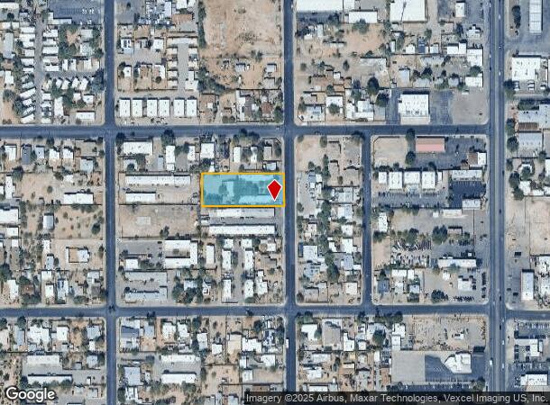
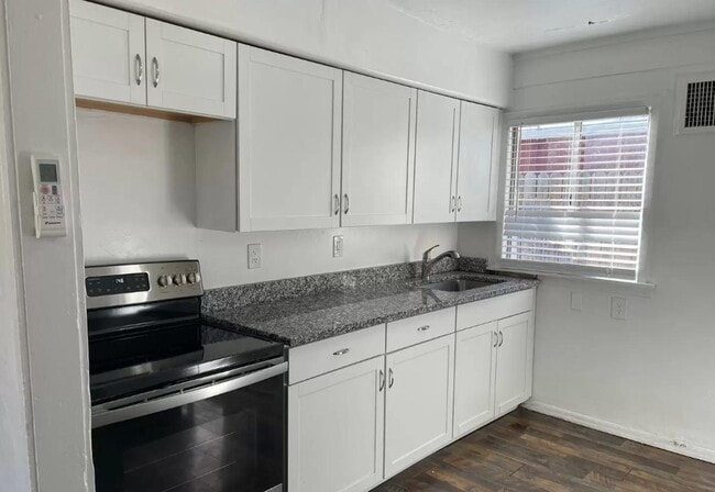
3035 N Los Altos Ave
Tucson, AZ
Coronado Heights
107-11-2760
CORONADO HEIGHTS LOT 4 BLK 15
Apartment
Pima
X
Arizona
04019C1689L
4
2025
0.83 AC
2025
Keeling
002603
Tucson
6,270 SF
DEMOGRAPHICS near 3035 N Los Altos Ave
1 Mile
3 Mile
5 Mile
2024 Total Population
21,968
127,085
253,444
2029 Population
22,832
131,492
262,945
Pop Growth 2024-2029
+ 3.93%
+ 3.47%
+ 3.75%
Average Age
35
37
39
2024 Total Households
10,234
58,652
115,368
HH Growth 2024-2029
+ 3.81%
+ 3.52%
+ 3.82%
Median Household Inc
$32,424
$37,609
$44,770
Avg Household Size
2.00
2.00
2.10
2024 Avg HH Vehicles
1.00
1.00
2.00
Median Home Value
$189,911
$208,887
$247,914
Median Year Built
1978
1974
1975
Nearby Places
- Restaurants
- Banks
- Shops
- Fitness
- Groceries
PUBLIC TRANSPORTATION
COMMUTER RAIL
Tucson Amtrak Station (Sunset Limited - Amtrak, Texas Eagle - Amtrak)
DRIVE
WALK
Distance
Tucson Amtrak Station (Sunset Limited - Amtrak, Texas Eagle - Amtrak)
8 min
3.4 mi
AIRPORT
Tucson International
DRIVE
WALK
Distance
Tucson International
24 min
11.0 mi
Freight Ports
Port of San Diego
DRIVE
WALK
Distance
Port of San Diego
434 min
407.6 mi
Nearby Properties
Address
Land Use
TOTAL SIZE
Lot Size
Zoning
Address
Land Use
TOTAL SIZE
Lot Size
Zoning
251,851 SF
0.74 AC
Address
Land Use
TOTAL SIZE
Lot Size
Zoning
6,665,241 SF
179.97 AC
Address
Land Use
TOTAL SIZE
Lot Size
Zoning
1,330,933 SF
12.21 AC
Address
Land Use
TOTAL SIZE
Lot Size
Zoning
1,811,513 SF
30.09 AC
Address
Land Use
TOTAL SIZE
Lot Size
Zoning
663,900 SF
14.54 AC
Address
Land Use
TOTAL SIZE
Lot Size
Zoning
134,710 SF
9.59 AC
I1
Address
Land Use
TOTAL SIZE
Lot Size
Zoning
839,498 SF
16.41 AC
R2
Address
Land Use
TOTAL SIZE
Lot Size
Zoning
813,186 SF
3.65 AC
OCR2
Address
Land Use
TOTAL SIZE
Lot Size
Zoning
640,899 SF
13.61 AC
Address
Land Use
TOTAL SIZE
Lot Size
Zoning
89,497 SF
0.51 AC
Address
Land Use
TOTAL SIZE
Lot Size
Zoning
106,852 SF
19.50 AC
I1
Address
Land Use
TOTAL SIZE
Lot Size
Zoning
326,845 SF
0.71 AC
Address
Land Use
TOTAL SIZE
Lot Size
Zoning
60,426 SF
0.43 AC
OCR2
Address
Land Use
TOTAL SIZE
Lot Size
Zoning
451,596 SF
18.92 AC
C3
Address
Land Use
TOTAL SIZE
Lot Size
Zoning
226,240 SF
0.33 AC
R2
Address
Land Use
TOTAL SIZE
Lot Size
Zoning
495,871 SF
3.56 AC
Address
Land Use
TOTAL SIZE
Lot Size
Zoning
299,658 SF
0.77 AC
Address
Land Use
TOTAL SIZE
Lot Size
Zoning
172,623 SF
0.15 AC
R1
Address
Land Use
TOTAL SIZE
Lot Size
Zoning
300,034 SF
2.45 AC
C3
Address
Land Use
TOTAL SIZE
Lot Size
Zoning
419,317 SF
7.23 AC
Address
Land Use
TOTAL SIZE
Lot Size
Zoning
293,092 SF
0.71 AC
Address
Land Use
TOTAL SIZE
Lot Size
Zoning
141,450 SF
0.14 AC
R1
Address
Land Use
TOTAL SIZE
Lot Size
Zoning
346,246 SF
0.14 AC
R2
Address
Land Use
TOTAL SIZE
Lot Size
Zoning
213,400 SF
0.46 AC
Address
Land Use
TOTAL SIZE
Lot Size
Zoning
468,481 SF
2.56 AC
Address
Land Use
TOTAL SIZE
Lot Size
Zoning
257,639 SF
7.57 AC
R2
Address
Land Use
TOTAL SIZE
Lot Size
Zoning
19,096 SF
2.53 AC
Address
Land Use
TOTAL SIZE
Lot Size
Zoning
27,678 SF
64.08 AC
R2
Address
Land Use
TOTAL SIZE
Lot Size
Zoning
157,054 SF
0.84 AC
Address
Land Use
TOTAL SIZE
Lot Size
Zoning
418,519 SF
2.36 AC
OCR2
The World's #1 Commercial Real Estate Marketplace
Connect with us
© 2025 CoStar Group
The information above has been obtained from sources believed reliable. While we do not doubt its accuracy we have not verified it and make no guarantee, warranty or representation about it. It is your responsibility to independently confirm its accuracy and completeness. Any projections, opinions, assumptions, or estimates used are for example only and do not represent the current or future performance of the property. The value of this transaction to you depends on tax and other factors which should be evaluated by your tax, financial, and legal advisors. You and your advisors should conduct a careful, independent investigation of the property to determine to your satisfaction the suitability of the property for your needs.