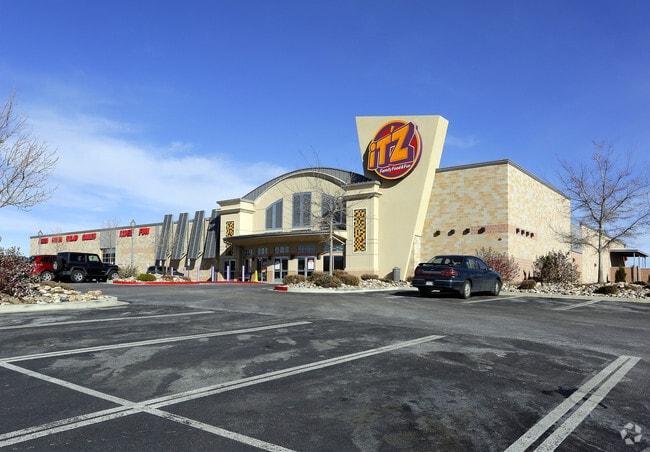
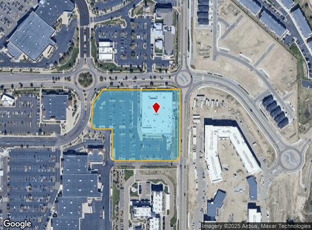
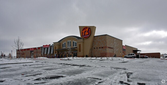
Property Record
3035 New Center Pt, Colorado Springs, CO 80922
NEARBY LISTINGS FOR SALE OR LEASE
Property Detail
3035 New Center Pt
Colorado Springs, CO
First And Main Town Center Fil No 14
53312-01-016
LOT 1 FIRST AND MAIN TOWN CENTER FIL NO 14
Religious
El Paso
X
Colorado
08041C0539G
1
0
4.50 AC
2025
Northeast
005118
Colorado Springs
45,579 SF
DEMOGRAPHICS near 3035 New Center Pt
1 Mile
3 Mile
5 Mile
2024 Total Population
12,698
108,696
249,521
2029 Population
13,200
113,052
260,725
Pop Growth 2024-2029
+ 3.95%
+ 4.01%
+ 4.49%
Average Age
40
38
37
2024 Total Households
4,972
42,315
97,092
HH Growth 2024-2029
+ 4.42%
+ 4.26%
+ 4.70%
Median Household Inc
$84,366
$74,980
$73,886
Avg Household Size
2.50
2.50
2.50
2024 Avg HH Vehicles
2.00
2.00
2.00
Median Home Value
$348,976
$345,290
$356,214
Median Year Built
1989
1986
1987
Nearby Places
Map Layers
Map Styles
 Street
 Aerial
- Restaurants
- Banks
- Shops
- Fitness
- Groceries
PUBLIC TRANSPORTATION
AIRPORT
City of Colorado Springs Municipal
DRIVE
WALK
Distance
City of Colorado Springs Municipal
13 min
6.4 mi
Freight Ports
Tulsa Port Of Catoosa
DRIVE
WALK
Distance
Tulsa Port Of Catoosa
733 min
689.8 mi
Nearby Properties
Address
Land Use
TOTAL SIZE
Lot Size
Zoning
Address
Land Use
TOTAL SIZE
Lot Size
Zoning
8,806 SF
124.24 AC
PZ
Address
Land Use
TOTAL SIZE
Lot Size
Zoning
32,792 SF
7 AC
MX-M AO
Address
Land Use
TOTAL SIZE
Lot Size
Zoning
126,860 SF
23.92 AC
MX-N/CR AO
Address
Land Use
TOTAL SIZE
Lot Size
Zoning
167,120 SF
10.59 AC
MX-L/CR CU
Address
Land Use
TOTAL SIZE
Lot Size
Zoning
197,578 SF
7.98 AC
PDZ
Address
Land Use
TOTAL SIZE
Lot Size
Zoning
172,822 SF
8.74 AC
R-5 AO
Address
Land Use
TOTAL SIZE
Lot Size
Zoning
126,756 SF
12.67 AC
PUD CAD-O
Address
Land Use
TOTAL SIZE
Lot Size
Zoning
109,808 SF
8.11 AC
MX-M
Address
Land Use
TOTAL SIZE
Lot Size
Zoning
131,545 SF
12.46 AC
R-5/CR CU
Address
Land Use
TOTAL SIZE
Lot Size
Zoning
138,773 SF
4.45 AC
R-5
Address
Land Use
TOTAL SIZE
Lot Size
Zoning
87,577 SF
14.24 AC
CS CAD-O
Address
Land Use
TOTAL SIZE
Lot Size
Zoning
83,441 SF
4.20 AC
MX-M/CR CU
Address
Land Use
TOTAL SIZE
Lot Size
Zoning
15,559 SF
6 AC
MX-M CU AO
Address
Land Use
TOTAL SIZE
Lot Size
Zoning
15,559 SF
6 AC
MX-M CU AO
Address
Land Use
TOTAL SIZE
Lot Size
Zoning
15,559 SF
6 AC
MX-M CU AO
Address
Land Use
TOTAL SIZE
Lot Size
Zoning
14,257 SF
6 AC
MX-M CU AO
Address
Land Use
TOTAL SIZE
Lot Size
Zoning
14,257 SF
6 AC
MX-M CU AO
Address
Land Use
TOTAL SIZE
Lot Size
Zoning
14,257 SF
6 AC
MX-M CU AO
Address
Land Use
TOTAL SIZE
Lot Size
Zoning
13,882 SF
6 AC
MX-M CU AO
Address
Land Use
TOTAL SIZE
Lot Size
Zoning
12,827 SF
6 AC
MX-M CU AO
Address
Land Use
TOTAL SIZE
Lot Size
Zoning
8,096 SF
123.01 AC
PF APZ2 AO
Address
Land Use
TOTAL SIZE
Lot Size
Zoning
86,290 SF
8.01 AC
I-2 CAD-O
Address
Land Use
TOTAL SIZE
Lot Size
Zoning
8,830 SF
6 AC
MX-M CU AO
Address
Land Use
TOTAL SIZE
Lot Size
Zoning
8,830 SF
6 AC
MX-M CU AO
Address
Land Use
TOTAL SIZE
Lot Size
Zoning
30,475 SF
13.03 AC
MX-M/CR AO
Address
Land Use
TOTAL SIZE
Lot Size
Zoning
39,627 SF
1.61 AC
R-5 SS
Address
Land Use
TOTAL SIZE
Lot Size
Zoning
5,934 SF
6 AC
MX-M CU AO
Address
Land Use
TOTAL SIZE
Lot Size
Zoning
75,169 SF
122.93 AC
I-3 CAD-O
Address
Land Use
TOTAL SIZE
Lot Size
Zoning
45,044 SF
2 AC
R-1 6
Address
Land Use
TOTAL SIZE
Lot Size
Zoning
4,752 SF
6 AC
MX-M CU AO
The World's #1 Commercial Real Estate Marketplace
Connect with us
© 2026 CoStar Group
The information above has been obtained from sources believed reliable. While we do not doubt its accuracy we have not verified it and make no guarantee, warranty or representation about it. It is your responsibility to independently confirm its accuracy and completeness. Any projections, opinions, assumptions, or estimates used are for example only and do not represent the current or future performance of the property. The value of this transaction to you depends on tax and other factors which should be evaluated by your tax, financial, and legal advisors. You and your advisors should conduct a careful, independent investigation of the property to determine to your satisfaction the suitability of the property for your needs.