Property Record
30379 Gratiot Ave, Roseville, MI 48066
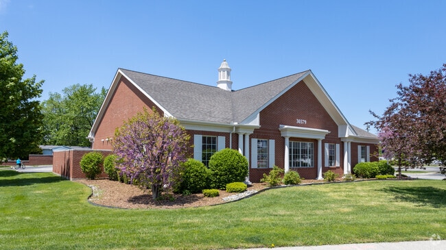


This Property Is For Sale
Current Lease Availabilities
NEARBY LISTINGS FOR SALE OR LEASE
Property Detail
30379 Gratiot Ave
Detroit-Warren-Dearborn, MI
Rose City Park
08-14-09-152-063
ROSE CITY PARK LOTS 5 THRU 14, LOT 130, 168, 169, & 170 INCL VAC ALLEY ADJ; EXC PART OF LOT 170 & VAC ALLEY ADJ DESC AS; COMM
Centrallyassessed
Macomb
X
Michigan
26099C0343G
5-14,13
2025
1.24 AC
2025
Macomb East
255200
Detroit
4,149 SF
DEMOGRAPHICS near 30379 Gratiot Ave
1 Mile
3 Mile
5 Mile
2024 Total Population
12,741
116,952
284,023
2029 Population
12,567
115,347
280,724
Pop Growth 2024-2029
(1.37%)
(1.37%)
(1.16%)
Average Age
42
42
42
2024 Total Households
5,676
50,343
120,923
HH Growth 2024-2029
(1.44%)
(1.42%)
(1.18%)
Median Household Inc
$53,240
$61,137
$61,665
Avg Household Size
2.20
2.30
2.30
2024 Avg HH Vehicles
2.00
2.00
2.00
Median Home Value
$142,437
$152,415
$158,209
Median Year Built
1963
1961
1963
Nearby Places
Map Layers
Map Styles
 Street
 Aerial
- Restaurants
- Banks
- Shops
- Fitness
- Groceries
PUBLIC TRANSPORTATION
AIRPORT
Windsor International
DRIVE
WALK
Distance
Windsor International
50 min
28.0 mi
Detroit Metro Wayne County
DRIVE
WALK
Distance
Detroit Metro Wayne County
54 min
37.5 mi
Nearby Properties
Address
Land Use
TOTAL SIZE
Lot Size
Zoning
Address
Land Use
TOTAL SIZE
Lot Size
Zoning
436,218 SF
36.43 AC
B-2
Address
Land Use
TOTAL SIZE
Lot Size
Zoning
153,882 SF
5.65 AC
RA
Address
Land Use
TOTAL SIZE
Lot Size
Zoning
249,162 SF
27.87 AC
IC
Address
Land Use
TOTAL SIZE
Lot Size
Zoning
10,070 SF
31.84 AC
RH
Address
Land Use
TOTAL SIZE
Lot Size
Zoning
236,221 SF
31.30 AC
B-2
Address
Land Use
TOTAL SIZE
Lot Size
Zoning
91,386 SF
B-2
Address
Land Use
TOTAL SIZE
Lot Size
Zoning
209,501 SF
17.74 AC
B-3
Address
Land Use
TOTAL SIZE
Lot Size
Zoning
247,177 SF
26.94 AC
CG
Address
Land Use
TOTAL SIZE
Lot Size
Zoning
217,369 SF
20.15 AC
B-2
Address
Land Use
TOTAL SIZE
Lot Size
Zoning
204,620 SF
13.73 AC
R-3
Address
Land Use
TOTAL SIZE
Lot Size
Zoning
129,502 SF
3.17 AC
RM-1
Address
Land Use
TOTAL SIZE
Lot Size
Zoning
376,278 SF
19.85 AC
RM-1
Address
Land Use
TOTAL SIZE
Lot Size
Zoning
179,653 SF
11.56 AC
B-2
Address
Land Use
TOTAL SIZE
Lot Size
Zoning
370,077 SF
18.24 AC
B-2
Address
Land Use
TOTAL SIZE
Lot Size
Zoning
10.37 AC
RML
Address
Land Use
TOTAL SIZE
Lot Size
Zoning
117,664 SF
6.66 AC
I-1
Address
Land Use
TOTAL SIZE
Lot Size
Zoning
10.89 AC
RML
Address
Land Use
TOTAL SIZE
Lot Size
Zoning
41,065 SF
4.30 AC
B-3
Address
Land Use
TOTAL SIZE
Lot Size
Zoning
131,812 SF
12.56 AC
B-3
Address
Land Use
TOTAL SIZE
Lot Size
Zoning
187,320 SF
9.55 AC
CG
Address
Land Use
TOTAL SIZE
Lot Size
Zoning
73,658 SF
14.94 AC
B-3
Address
Land Use
TOTAL SIZE
Lot Size
Zoning
86,010 SF
21.84 AC
I-2
Address
Land Use
TOTAL SIZE
Lot Size
Zoning
109,600 SF
10.54 AC
B-3
Address
Land Use
TOTAL SIZE
Lot Size
Zoning
118,673 SF
8.36 AC
B-3
Address
Land Use
TOTAL SIZE
Lot Size
Zoning
160,600 SF
9.62 AC
R-3
Address
Land Use
TOTAL SIZE
Lot Size
Zoning
178,358 SF
12.41 AC
B-2
Address
Land Use
TOTAL SIZE
Lot Size
Zoning
228,269 SF
10.37 AC
I-2
Address
Land Use
TOTAL SIZE
Lot Size
Zoning
167,589 SF
16.80 AC
B-3
Address
Land Use
TOTAL SIZE
Lot Size
Zoning
168,058 SF
19.75 AC
IC
Address
Land Use
TOTAL SIZE
Lot Size
Zoning
193,020 SF
13.62 AC
RM-1
The World's #1 Commercial Real Estate Marketplace
Connect with us
© 2026 CoStar Group
The information above has been obtained from sources believed reliable. While we do not doubt its accuracy we have not verified it and make no guarantee, warranty or representation about it. It is your responsibility to independently confirm its accuracy and completeness. Any projections, opinions, assumptions, or estimates used are for example only and do not represent the current or future performance of the property. The value of this transaction to you depends on tax and other factors which should be evaluated by your tax, financial, and legal advisors. You and your advisors should conduct a careful, independent investigation of the property to determine to your satisfaction the suitability of the property for your needs.