Property Record
3039 N Blackstock Rd, Spartanburg, SC 29301

NEARBY LISTINGS FOR SALE OR LEASE
Property Detail
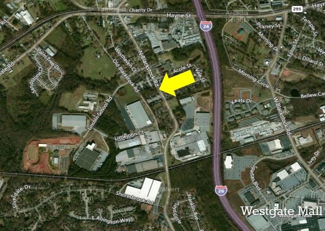
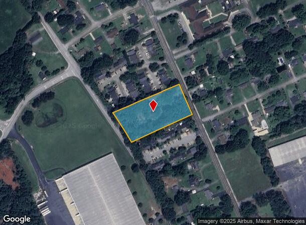
3039 N Blackstock Rd
Spartanburg, SC
Nannie Mae L Hughston Est
6-17-11-001.00
TR C NANNIE MAE L HUGHSTON EST SUR PB 94-903 & ADJ LOT
Commercialacreage
Spartanburg
X
South Carolina
45083C0234D
2.46 AC
2024
West Side
2025
Greenville/Spartanburg
021903
DEMOGRAPHICS near 3039 N Blackstock Rd
1 Mile
3 Mile
5 Mile
2024 Total Population
4,829
35,588
95,812
2029 Population
5,429
40,360
108,726
Pop Growth 2024-2029
+ 12.42%
+ 13.41%
+ 13.48%
Average Age
37
38
37
2024 Total Households
1,958
13,781
36,653
HH Growth 2024-2029
+ 12.67%
+ 13.70%
+ 13.99%
Median Household Inc
$50,905
$51,661
$48,598
Avg Household Size
2.40
2.40
2.40
2024 Avg HH Vehicles
2.00
2.00
2.00
Median Home Value
$168,454
$172,040
$167,398
Median Year Built
1986
1984
1985
Nearby Places
Map Layers
Map Styles
 Street
 Aerial
- Restaurants
- Banks
- Shops
- Fitness
- Groceries
PUBLIC TRANSPORTATION
COMMUTER RAIL
Spartanburg Amtrak Station (Crescent - Amtrak)
DRIVE
WALK
Distance
Spartanburg Amtrak Station (Crescent - Amtrak)
12 min
5.7 mi
AIRPORT
Greenville Spartanburg International
DRIVE
WALK
Distance
Greenville Spartanburg International
25 min
15.5 mi
Freight Ports
North Charleston Terminal
DRIVE
WALK
Distance
North Charleston Terminal
218 min
194.2 mi
SALE & LEASE HISTORY
LISTING DATE
SALE/LEASE

Sep 24, 2016
For Sale
Nearby Properties
Address
Land Use
TOTAL SIZE
Lot Size
Zoning
Address
Land Use
TOTAL SIZE
Lot Size
Zoning
5,130 SF
19.69 AC
Address
Land Use
TOTAL SIZE
Lot Size
Zoning
3,352 SF
14 AC
Address
Land Use
TOTAL SIZE
Lot Size
Zoning
2,134 SF
27.72 AC
Address
Land Use
TOTAL SIZE
Lot Size
Zoning
50,096 SF
5.88 AC
Address
Land Use
TOTAL SIZE
Lot Size
Zoning
2,112 SF
5.26 AC
Address
Land Use
TOTAL SIZE
Lot Size
Zoning
100,000 SF
8.29 AC
Address
Land Use
TOTAL SIZE
Lot Size
Zoning
6,148 SF
4.18 AC
Address
Land Use
TOTAL SIZE
Lot Size
Zoning
3,171 SF
21.41 AC
Address
Land Use
TOTAL SIZE
Lot Size
Zoning
2,297 SF
42.76 AC
Address
Land Use
TOTAL SIZE
Lot Size
Zoning
128,755 SF
4.47 AC
Address
Land Use
TOTAL SIZE
Lot Size
Zoning
11,830 SF
16.87 AC
Address
Land Use
TOTAL SIZE
Lot Size
Zoning
Address
Land Use
TOTAL SIZE
Lot Size
Zoning
8,140 SF
20.42 AC
Address
Land Use
TOTAL SIZE
Lot Size
Zoning
30,016 SF
1.07 AC
Address
Land Use
TOTAL SIZE
Lot Size
Zoning
64,092 SF
30.61 AC
Address
Land Use
TOTAL SIZE
Lot Size
Zoning
122,626 SF
7.70 AC
Address
Land Use
TOTAL SIZE
Lot Size
Zoning
37.35 AC
Address
Land Use
TOTAL SIZE
Lot Size
Zoning
402,619 SF
58.63 AC
Address
Land Use
TOTAL SIZE
Lot Size
Zoning
23,884 SF
3.90 AC
Address
Land Use
TOTAL SIZE
Lot Size
Zoning
1,475 SF
41.85 AC
Address
Land Use
TOTAL SIZE
Lot Size
Zoning
1,092 SF
67.55 AC
Address
Land Use
TOTAL SIZE
Lot Size
Zoning
1,221,473 SF
36.50 AC
Address
Land Use
TOTAL SIZE
Lot Size
Zoning
227,480 SF
22.22 AC
Address
Land Use
TOTAL SIZE
Lot Size
Zoning
2,740 SF
20.62 AC
Address
Land Use
TOTAL SIZE
Lot Size
Zoning
33,550 SF
3.77 AC
Address
Land Use
TOTAL SIZE
Lot Size
Zoning
101,622 SF
19.63 AC
Address
Land Use
TOTAL SIZE
Lot Size
Zoning
41,694 SF
4.01 AC
Address
Land Use
TOTAL SIZE
Lot Size
Zoning
5,888 SF
17.04 AC
Address
Land Use
TOTAL SIZE
Lot Size
Zoning
39.65 AC
Address
Land Use
TOTAL SIZE
Lot Size
Zoning
2,831 SF
10.07 AC
The World's #1 Commercial Real Estate Marketplace
Connect with us
© 2025 CoStar Group
The information above has been obtained from sources believed reliable. While we do not doubt its accuracy we have not verified it and make no guarantee, warranty or representation about it. It is your responsibility to independently confirm its accuracy and completeness. Any projections, opinions, assumptions, or estimates used are for example only and do not represent the current or future performance of the property. The value of this transaction to you depends on tax and other factors which should be evaluated by your tax, financial, and legal advisors. You and your advisors should conduct a careful, independent investigation of the property to determine to your satisfaction the suitability of the property for your needs.