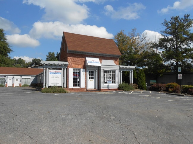
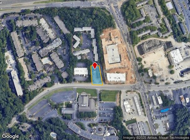
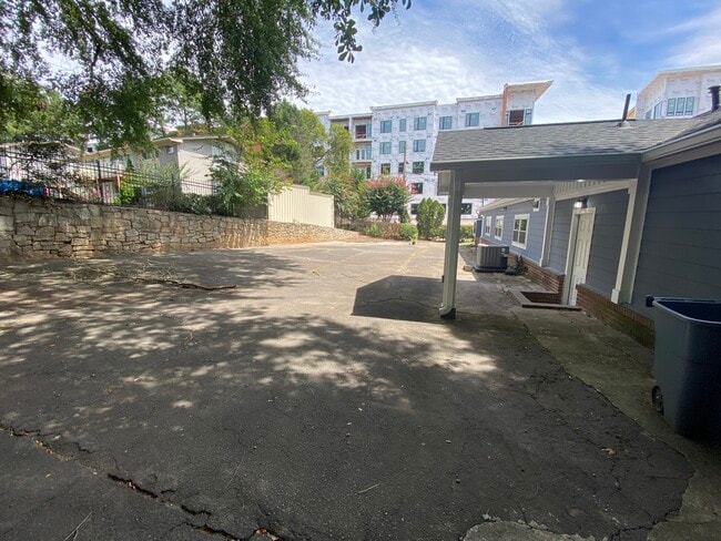
Property Record
3040 Briarcliff Rd Ne, Atlanta, GA 30329

Current Lease Availabilities
NEARBY LISTINGS FOR SALE OR LEASE
Property Detail
3040 Briarcliff Rd Ne
18-196-04-027
E L Chapman Surv
Officebuilding
DeKalb
X
Georgia
13089C0054K
27
2025
0.44 AC
2025
Chamblee/Dville/N D Hills
021607
Atlanta
3,654 SF
Atlanta-Sandy Springs-Roswell, GA
DEMOGRAPHICS near 3040 Briarcliff Rd Ne
1 Mile
3 Mile
5 Mile
2024 Total Population
14,892
130,238
337,853
2029 Population
14,875
130,487
341,466
Pop Growth 2024-2029
(0.11%)
+ 0.19%
+ 1.07%
Average Age
36
37
38
2024 Total Households
6,751
58,192
154,834
HH Growth 2024-2029
(0.28%)
+ 0.20%
+ 1.41%
Median Household Inc
$72,819
$97,472
$97,217
Avg Household Size
2.20
2.10
2.10
2024 Avg HH Vehicles
1.00
2.00
2.00
Median Home Value
$425,668
$490,855
$539,840
Median Year Built
1984
1987
1985
Nearby Places
- Restaurants
- Banks
- Shops
- Fitness
- Groceries
PUBLIC TRANSPORTATION
COMMUTER RAIL
Atlanta (Crescent - Amtrak)
DRIVE
WALK
Distance
Atlanta (Crescent - Amtrak)
10 min
6.1 mi
AIRPORT
Hartsfield - Jackson Atlanta International
DRIVE
WALK
Distance
Hartsfield - Jackson Atlanta International
28 min
18.9 mi
Freight Ports
Georgia Ports - Savannah
DRIVE
WALK
Distance
Georgia Ports - Savannah
291 min
258.2 mi
Nearby Properties
Address
Land Use
TOTAL SIZE
Lot Size
Zoning
Address
Land Use
TOTAL SIZE
Lot Size
Zoning
11,126,925 SF
43.33 AC
C3
Address
Land Use
TOTAL SIZE
Lot Size
Zoning
12,600 SF
508.30 AC
M
Address
Land Use
TOTAL SIZE
Lot Size
Zoning
345,125 SF
7.73 AC
C1
Address
Land Use
TOTAL SIZE
Lot Size
Zoning
169,435 SF
76.18 AC
M
Address
Land Use
TOTAL SIZE
Lot Size
Zoning
1,233,815 SF
2.18 AC
PDMU
Address
Land Use
TOTAL SIZE
Lot Size
Zoning
188,648 SF
4.39 AC
X
Address
Land Use
TOTAL SIZE
Lot Size
Zoning
589,761 SF
22.67 AC
RM-HD
Address
Land Use
TOTAL SIZE
Lot Size
Zoning
2,820,296 SF
9.58 AC
RG5
Address
Land Use
TOTAL SIZE
Lot Size
Zoning
458,822 SF
2.86 AC
RG2
Address
Land Use
TOTAL SIZE
Lot Size
Zoning
863,826 SF
3.79 AC
C4
Address
Land Use
TOTAL SIZE
Lot Size
Zoning
188,469 SF
4.06 AC
C-1
Address
Land Use
TOTAL SIZE
Lot Size
Zoning
389,560 SF
4.01 AC
C1
Address
Land Use
TOTAL SIZE
Lot Size
Zoning
431,259 SF
48.90 AC
RM100
Address
Land Use
TOTAL SIZE
Lot Size
Zoning
230,911 SF
6.29 AC
X
Address
Land Use
TOTAL SIZE
Lot Size
Zoning
187,172 SF
7.22 AC
OI
Address
Land Use
TOTAL SIZE
Lot Size
Zoning
191,941 SF
3.02 AC
OCR
Address
Land Use
TOTAL SIZE
Lot Size
Zoning
257,989 SF
12.41 AC
OI
Address
Land Use
TOTAL SIZE
Lot Size
Zoning
713,717 SF
2.82 AC
R3
Address
Land Use
TOTAL SIZE
Lot Size
Zoning
131,793 SF
4.30 AC
X
Address
Land Use
TOTAL SIZE
Lot Size
Zoning
600,502 SF
4.46 AC
R3
Address
Land Use
TOTAL SIZE
Lot Size
Zoning
307,824 SF
16.40 AC
X
Address
Land Use
TOTAL SIZE
Lot Size
Zoning
729,294 SF
0.01 AC
X
Address
Land Use
TOTAL SIZE
Lot Size
Zoning
166,377 SF
7.56 AC
X
Address
Land Use
TOTAL SIZE
Lot Size
Zoning
267,426 SF
6.90 AC
OI
Address
Land Use
TOTAL SIZE
Lot Size
Zoning
321,334 SF
12.70 AC
RM-HD
Address
Land Use
TOTAL SIZE
Lot Size
Zoning
150,894 SF
3.85 AC
C2
Address
Land Use
TOTAL SIZE
Lot Size
Zoning
457,330 SF
20.49 AC
RM-HD
Address
Land Use
TOTAL SIZE
Lot Size
Zoning
345,441 SF
25.78 AC
C1
Address
Land Use
TOTAL SIZE
Lot Size
Zoning
194,350 SF
4.68 AC
OCR
Address
Land Use
TOTAL SIZE
Lot Size
Zoning
144,380 SF
3.84 AC
X
The World's #1 Commercial Real Estate Marketplace
Connect with us
© 2025 CoStar Group
The information above has been obtained from sources believed reliable. While we do not doubt its accuracy we have not verified it and make no guarantee, warranty or representation about it. It is your responsibility to independently confirm its accuracy and completeness. Any projections, opinions, assumptions, or estimates used are for example only and do not represent the current or future performance of the property. The value of this transaction to you depends on tax and other factors which should be evaluated by your tax, financial, and legal advisors. You and your advisors should conduct a careful, independent investigation of the property to determine to your satisfaction the suitability of the property for your needs.