Property Record
3040 Evans St, Greenville, NC 27834

Current Lease Availabilities
Property Detail
3040 Evans St
055495
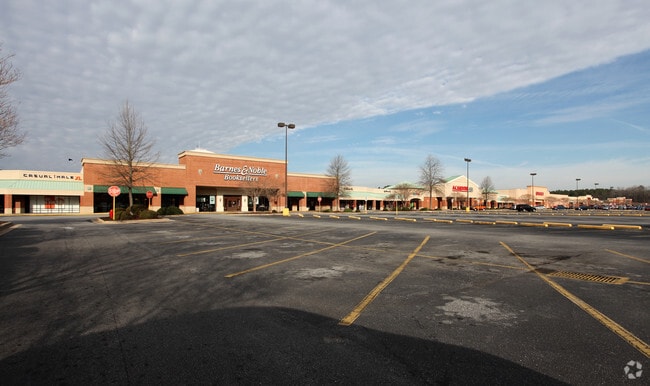
UNIVERSITY COMMONS SHOPPI
Stripcommercialcenter
PITT
CG
North Carolina
B and X Area of moderate flood hazard, usually the area between the limits of the 100-year and 500-year floods.
13.48 AC
2025
Southeast Greenville
2025
Other Market Areas
000501
Greenville, NC
124,845 SF
NEARBY LISTINGS FOR SALE OR LEASE
DEMOGRAPHICS near 3040 Evans St
1 mile
3 mile
5 mile
2025 Total Population
7,719
82,693
123,507
2030 Population
7,981
85,909
127,963
Pop Growth 2025-2030
+ 3.39%
+ 3.89%
+ 3.61%
Average Age
38
35
36
2025 Total Households
3,400
34,899
50,999
HH Growth 2025-2030
+ 3.53%
+ 4.35%
+ 3.96%
Median Household Inc
$48,024
$55,070
$59,950
Avg Household Size
2.20
2.10
2.20
2025 Avg HH Vehicles
2.00
2.00
2.00
Median Home Value
$197,772
$251,424
$252,125
Median Year Built
1987
1992
1994
Nearby Places
Map Layers
Map Styles
 Street
 Aerial
Layers
 Traffic
 Biking
Places
Listings with unknown addresses are not visible on the map
- Restaurants
- Banks
- Shops
- Fitness
- Groceries
PUBLIC TRANSPORTATION
AIRPORT
Pitt-Greenville
Drive
Walk
Distance
Pitt-Greenville
15 min
7.8 mi
Freight Ports
Port of Morehead City
Drive
Walk
Distance
Port of Morehead City
126 min
83.6 mi
Nearby Properties
Address
Land Use
TOTAL SIZE
Lot Size
Zoning
Address
Land Use
TOTAL SIZE
Lot Size
Zoning
1,674,744 SF
55.66 AC
MI
Address
Land Use
TOTAL SIZE
Lot Size
Zoning
1,555,005 SF
61.20 AC
OR
Address
Land Use
TOTAL SIZE
Lot Size
Zoning
207,166 SF
36.57 AC
OR
Address
Land Use
TOTAL SIZE
Lot Size
Zoning
466,175 SF
14.08 AC
MS
Address
Land Use
TOTAL SIZE
Lot Size
Zoning
780,261 SF
36.60 AC
OR
Address
Land Use
TOTAL SIZE
Lot Size
Zoning
1,002,223 SF
39.45 AC
OR
Address
Land Use
TOTAL SIZE
Lot Size
Zoning
302,575 SF
29.53 AC
MI
Address
Land Use
TOTAL SIZE
Lot Size
Zoning
678,883 SF
41.95 AC
MI
Address
Land Use
TOTAL SIZE
Lot Size
Zoning
473,026 SF
0.69 AC
OR
Address
Land Use
TOTAL SIZE
Lot Size
Zoning
275,664 SF
93.97 AC
R6
Address
Land Use
TOTAL SIZE
Lot Size
Zoning
186,634 SF
14.40 AC
MI
Address
Land Use
TOTAL SIZE
Lot Size
Zoning
682,180 SF
4.57 AC
CDF-UC
Address
Land Use
TOTAL SIZE
Lot Size
Zoning
184,433 SF
71.40 AC
MI
Address
Land Use
TOTAL SIZE
Lot Size
Zoning
146,413 SF
12.18 AC
MO
Address
Land Use
TOTAL SIZE
Lot Size
Zoning
33,163 SF
20.14 AC
OR
Address
Land Use
TOTAL SIZE
Lot Size
Zoning
512,349 SF
39.27 AC
CG
Address
Land Use
TOTAL SIZE
Lot Size
Zoning
282,000 SF
0.94 AC
OR
Address
Land Use
TOTAL SIZE
Lot Size
Zoning
180,500 SF
2.17 AC
CD
Address
Land Use
TOTAL SIZE
Lot Size
Zoning
29,832 SF
24.89 AC
MR
Address
Land Use
TOTAL SIZE
Lot Size
Zoning
33,791 SF
21.01 AC
OR
Address
Land Use
TOTAL SIZE
Lot Size
Zoning
24,993 SF
15.81 AC
OR
Address
Land Use
TOTAL SIZE
Lot Size
Zoning
130,632 SF
5.06 AC
MI
Address
Land Use
TOTAL SIZE
Lot Size
Zoning
348,438 SF
3.89 AC
CD
Address
Land Use
TOTAL SIZE
Lot Size
Zoning
328,680 SF
2.04 AC
CD
Address
Land Use
TOTAL SIZE
Lot Size
Zoning
24,032 SF
22.74 AC
R6
Address
Land Use
TOTAL SIZE
Lot Size
Zoning
356,216 SF
4.08 AC
CDF-UC
Address
Land Use
TOTAL SIZE
Lot Size
Zoning
138,115 SF
13.60 AC
OR
Address
Land Use
TOTAL SIZE
Lot Size
Zoning
109,461 SF
1.89 AC
CD
Address
Land Use
TOTAL SIZE
Lot Size
Zoning
142,831 SF
13.61 AC
MO
Address
Land Use
TOTAL SIZE
Lot Size
Zoning
25,290 SF
18.26 AC
OR
The World's #1 Commercial Real Estate Marketplace
Connect with us
© 2026 CoStar Group
The information above has been obtained from sources believed reliable. While we do not doubt its accuracy we have not verified it and make no guarantee, warranty or representation about it. It is your responsibility to independently confirm its accuracy and completeness. Any projections, opinions, assumptions, or estimates used are for example only and do not represent the current or future performance of the property. The value of this transaction to you depends on tax and other factors which should be evaluated by your tax, financial, and legal advisors. You and your advisors should conduct a careful, independent investigation of the property to determine to your satisfaction the suitability of the property for your needs.