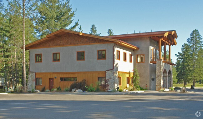
Property Record
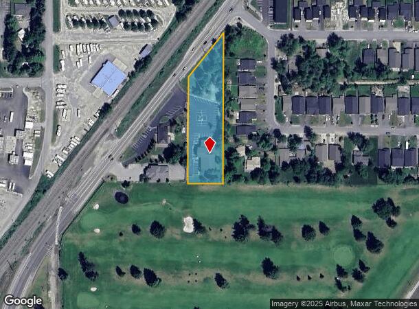
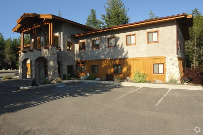
30410 Highway 200, Ponderay, ID 83852

NEARBY LISTINGS FOR SALE OR LEASE
Property Detail
30410 Highway 200
RPP00-000-116275A
11-57N-2W W2SWSW, S & E OF H/W LESS PT TAX 1 & LESS TAX 110 & 111 KHS MEDICAL
Commercialnec
Bonner
X
Idaho
16017C0716E
1.50 AC
2025
Bonner
2025
Coeur D'Alene
950203
Sandpoint, ID
10,896 SF
DEMOGRAPHICS near 30410 Highway 200
1 Mile
3 Mile
5 Mile
2024 Total Population
1,733
16,701
20,739
2029 Population
2,101
20,485
25,416
Pop Growth 2024-2029
+ 21.23%
+ 22.66%
+ 22.55%
Average Age
41
43
43
2024 Total Households
777
7,103
8,725
HH Growth 2024-2029
+ 20.72%
+ 22.38%
+ 22.29%
Median Household Inc
$47,862
$58,597
$61,292
Avg Household Size
2.10
2.30
2.30
2024 Avg HH Vehicles
2.00
2.00
2.00
Median Home Value
$363,571
$379,287
$395,339
Median Year Built
2002
1993
1993
Nearby Places
Map Layers
Map Styles
 Street
 Aerial
- Restaurants
- Banks
- Shops
- Fitness
- Groceries
PUBLIC TRANSPORTATION
COMMUTER RAIL
DRIVE
WALK
Distance
3 min
1.7 mi
SALE & LEASE HISTORY
LISTING DATE
SALE/LEASE

Feb 24, 2022
For Lease
Nearby Properties
Address
Land Use
TOTAL SIZE
Lot Size
Zoning
Address
Land Use
TOTAL SIZE
Lot Size
Zoning
54,573 SF
0.75 AC
Address
Land Use
TOTAL SIZE
Lot Size
Zoning
3.84 AC
Address
Land Use
TOTAL SIZE
Lot Size
Zoning
24,639 SF
3 AC
Address
Land Use
TOTAL SIZE
Lot Size
Zoning
66,673 SF
3.17 AC
Address
Land Use
TOTAL SIZE
Lot Size
Zoning
86,100 SF
1.79 AC
Address
Land Use
TOTAL SIZE
Lot Size
Zoning
49,500 SF
16.53 AC
Address
Land Use
TOTAL SIZE
Lot Size
Zoning
Address
Land Use
TOTAL SIZE
Lot Size
Zoning
4,413 SF
4.79 AC
Address
Land Use
TOTAL SIZE
Lot Size
Zoning
4,512 SF
3.90 AC
Address
Land Use
TOTAL SIZE
Lot Size
Zoning
155,334 SF
11.97 AC
Address
Land Use
TOTAL SIZE
Lot Size
Zoning
156,891 SF
14.84 AC
Address
Land Use
TOTAL SIZE
Lot Size
Zoning
29,154 SF
3.80 AC
Address
Land Use
TOTAL SIZE
Lot Size
Zoning
92,969 SF
15.72 AC
Address
Land Use
TOTAL SIZE
Lot Size
Zoning
82,053 SF
5.26 AC
Address
Land Use
TOTAL SIZE
Lot Size
Zoning
35,708 SF
2.47 AC
Address
Land Use
TOTAL SIZE
Lot Size
Zoning
57,611 SF
2.37 AC
Address
Land Use
TOTAL SIZE
Lot Size
Zoning
12,024 SF
2.86 AC
Address
Land Use
TOTAL SIZE
Lot Size
Zoning
53,580 SF
5.63 AC
Address
Land Use
TOTAL SIZE
Lot Size
Zoning
106,375 SF
11.87 AC
Address
Land Use
TOTAL SIZE
Lot Size
Zoning
5,148 SF
0.91 AC
Address
Land Use
TOTAL SIZE
Lot Size
Zoning
38,980 SF
2.71 AC
Address
Land Use
TOTAL SIZE
Lot Size
Zoning
88,699 SF
6.93 AC
Address
Land Use
TOTAL SIZE
Lot Size
Zoning
16,462 SF
1.63 AC
Address
Land Use
TOTAL SIZE
Lot Size
Zoning
32,130 SF
4.33 AC
Address
Land Use
TOTAL SIZE
Lot Size
Zoning
17,828 SF
1.21 AC
Address
Land Use
TOTAL SIZE
Lot Size
Zoning
16,000 SF
2.32 AC
Address
Land Use
TOTAL SIZE
Lot Size
Zoning
20,396 SF
1.40 AC
Address
Land Use
TOTAL SIZE
Lot Size
Zoning
29,910 SF
2.96 AC
Address
Land Use
TOTAL SIZE
Lot Size
Zoning
33,287 SF
8.05 AC
Address
Land Use
TOTAL SIZE
Lot Size
Zoning
3.30 AC
The World's #1 Commercial Real Estate Marketplace
Connect with us
© 2026 CoStar Group
The information above has been obtained from sources believed reliable. While we do not doubt its accuracy we have not verified it and make no guarantee, warranty or representation about it. It is your responsibility to independently confirm its accuracy and completeness. Any projections, opinions, assumptions, or estimates used are for example only and do not represent the current or future performance of the property. The value of this transaction to you depends on tax and other factors which should be evaluated by your tax, financial, and legal advisors. You and your advisors should conduct a careful, independent investigation of the property to determine to your satisfaction the suitability of the property for your needs.