Property Record
3042 Nw Button Rd, Topeka, KS 66618
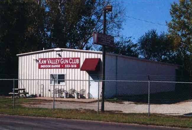

Property Detail
3042 Nw Button Rd
Topeka, KS
S13, T11, R15, ACRES 12.54, POB 20 FT E OF NW COR NW 1/4 TH E 645(S) S 888 W 565(S) N 75 W 80(S) N 813 TO POB LESS S 40
096-13-0-20-02-002-000
SHAWNEE
Miningfacilityoilgasmineralpreciousmetals
Kansas
I2
12.54 AC
2024
Topeka
2025
Kansas City
003401
NEARBY LISTINGS FOR SALE OR LEASE
DEMOGRAPHICS near 3042 Nw Button Rd
1 mile
3 mile
5 mile
2025 Total Population
744
17,311
67,231
2030 Population
728
17,261
67,461
Pop Growth 2025-2030
(2.15%)
(0.29%)
+ 0.34%
Average Age
43
42
41
2025 Total Households
274
7,068
28,829
HH Growth 2025-2030
(2.19%)
(0.27%)
+ 0.40%
Median Household Inc
$106,250
$66,492
$56,444
Avg Household Size
2.70
2.40
2.20
2025 Avg HH Vehicles
2.00
2.00
2.00
Median Home Value
$246,000
$183,343
$151,277
Median Year Built
1982
1971
1958
Nearby Places
Map Layers
Map Styles
 Street
 Aerial
Layers
 Traffic
 Biking
Places
Listings with unknown addresses are not visible on the map
- Restaurants
- Banks
- Shops
- Fitness
- Groceries
PUBLIC TRANSPORTATION
COMMUTER RAIL
Topeka Amtrak Station (Southwest Chief - Amtrak)
Drive
Walk
Distance
Topeka Amtrak Station (Southwest Chief - Amtrak)
12 min
5.6 mi
Freight Ports
Tulsa Port Of Catoosa
Drive
Walk
Distance
Tulsa Port Of Catoosa
285 min
234.2 mi
SALE & LEASE HISTORY
LISTING DATE
SALE/LEASE

Oct 17, 2016
For Sale
Nearby Properties
Address
Land Use
TOTAL SIZE
Lot Size
Zoning
Address
Land Use
TOTAL SIZE
Lot Size
Zoning
90,929 SF
8.68 AC
PUD,OI3,I1
Address
Land Use
TOTAL SIZE
Lot Size
Zoning
174,115 SF
61.82 AC
RR1
Address
Land Use
TOTAL SIZE
Lot Size
Zoning
123,795 SF
16.45 AC
PUD,R1,I1,
Address
Land Use
TOTAL SIZE
Lot Size
Zoning
129,425 SF
96.26 AC
R1
Address
Land Use
TOTAL SIZE
Lot Size
Zoning
116,026 SF
47.17 AC
R1
Address
Land Use
TOTAL SIZE
Lot Size
Zoning
55,353 SF
12.40 AC
OI2
Address
Land Use
TOTAL SIZE
Lot Size
Zoning
67,302 SF
6.62 AC
OI2,OI3
Address
Land Use
TOTAL SIZE
Lot Size
Zoning
135,164 SF
11.01 AC
PUD,I1
Address
Land Use
TOTAL SIZE
Lot Size
Zoning
39,790 SF
3.76 AC
PUD
Address
Land Use
TOTAL SIZE
Lot Size
Zoning
64,310 SF
12.95 AC
PUD,R1,I1,
Address
Land Use
TOTAL SIZE
Lot Size
Zoning
17,544 SF
42.80 AC
PUD,I1,M2,
Address
Land Use
TOTAL SIZE
Lot Size
Zoning
26,269 SF
8.18 AC
RR1
Address
Land Use
TOTAL SIZE
Lot Size
Zoning
64,318 SF
10.17 AC
RR1
Address
Land Use
TOTAL SIZE
Lot Size
Zoning
51,285 SF
36.63 AC
PUD,I1,M2,
Address
Land Use
TOTAL SIZE
Lot Size
Zoning
91,840 SF
13.75 AC
PUD,I1
Address
Land Use
TOTAL SIZE
Lot Size
Zoning
20,304 SF
13.48 AC
RR1
Address
Land Use
TOTAL SIZE
Lot Size
Zoning
26,783 SF
3.11 AC
PUD,I1,M2,
Address
Land Use
TOTAL SIZE
Lot Size
Zoning
421,639 SF
30.15 AC
PUD,I1
Address
Land Use
TOTAL SIZE
Lot Size
Zoning
63,903 SF
5.05 AC
R2
Address
Land Use
TOTAL SIZE
Lot Size
Zoning
67,997 SF
7.83 AC
PUD
Address
Land Use
TOTAL SIZE
Lot Size
Zoning
35,713 SF
4.03 AC
OI2
Address
Land Use
TOTAL SIZE
Lot Size
Zoning
244,943 SF
75.15 AC
PUD,I1
Address
Land Use
TOTAL SIZE
Lot Size
Zoning
72,295 SF
13.39 AC
R1
Address
Land Use
TOTAL SIZE
Lot Size
Zoning
2,595,744 SF
197.79 AC
I2
Address
Land Use
TOTAL SIZE
Lot Size
Zoning
281,973 SF
28.43 AC
I2
Address
Land Use
TOTAL SIZE
Lot Size
Zoning
18,768 SF
14.94 AC
PUD,M2
Address
Land Use
TOTAL SIZE
Lot Size
Zoning
194,614 SF
23.42 AC
PUD,C4,R1
Address
Land Use
TOTAL SIZE
Lot Size
Zoning
101,470 SF
6.33 AC
I2
Address
Land Use
TOTAL SIZE
Lot Size
Zoning
20,481 SF
19.65 AC
PUD,OI3,I1
Address
Land Use
TOTAL SIZE
Lot Size
Zoning
17,814 SF
47.48 AC
PUD,I1,M2,
The World's #1 Commercial Real Estate Marketplace
Connect with us
© 2026 CoStar Group
The information above has been obtained from sources believed reliable. While we do not doubt its accuracy we have not verified it and make no guarantee, warranty or representation about it. It is your responsibility to independently confirm its accuracy and completeness. Any projections, opinions, assumptions, or estimates used are for example only and do not represent the current or future performance of the property. The value of this transaction to you depends on tax and other factors which should be evaluated by your tax, financial, and legal advisors. You and your advisors should conduct a careful, independent investigation of the property to determine to your satisfaction the suitability of the property for your needs.