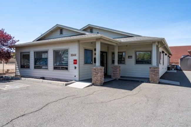
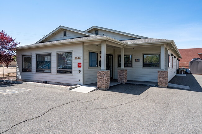
Property Record
3044 N Tani Rd, Prescott Valley, AZ 86314
This Property Is For Sale
NEARBY LISTINGS FOR SALE OR LEASE
Property Detail
3044 N Tani Rd
Prescott, AZ
Prescott Valley
103-26-473A
PRESCOTT VALLEY UNIT 6 LOTS 2225 & 2226 REVERSIONARY PLAT LOT 222 5A CONT .28AC SEC 13-14-1W M&P 51/100
Hospitalprivate
Yavapai
X
Arizona
04025C2079H
222
2024
0.28 AC
2026
Prescott & Sedona
000615
Other Market Areas
2,844 SF
DEMOGRAPHICS near 3044 N Tani Rd
1 Mile
3 Mile
5 Mile
2024 Total Population
6,847
37,163
56,462
2029 Population
7,506
40,961
62,520
Pop Growth 2024-2029
+ 9.62%
+ 10.22%
+ 10.73%
Average Age
40
43
46
2024 Total Households
2,889
15,092
23,892
HH Growth 2024-2029
+ 10.14%
+ 10.74%
+ 11.27%
Median Household Inc
$48,339
$59,511
$60,683
Avg Household Size
2.30
2.40
2.30
2024 Avg HH Vehicles
2.00
2.00
2.00
Median Home Value
$255,530
$306,183
$317,829
Median Year Built
1992
1995
1997
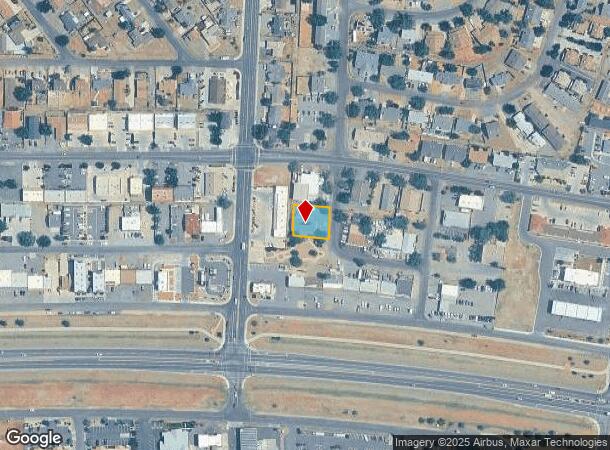
Nearby Places
Map Layers
Map Styles
 Street
 Aerial
- Restaurants
- Banks
- Shops
- Fitness
- Groceries
Nearby Properties
Address
Land Use
TOTAL SIZE
Lot Size
Zoning
Address
Land Use
TOTAL SIZE
Lot Size
Zoning
208,851 SF
27.27 AC
Address
Land Use
TOTAL SIZE
Lot Size
Zoning
271,471 SF
60.72 AC
Address
Land Use
TOTAL SIZE
Lot Size
Zoning
905,092 SF
45.06 AC
Address
Land Use
TOTAL SIZE
Lot Size
Zoning
160,494 SF
11.45 AC
Address
Land Use
TOTAL SIZE
Lot Size
Zoning
124,220 SF
2.85 AC
Address
Land Use
TOTAL SIZE
Lot Size
Zoning
135,064 SF
5.09 AC
Address
Land Use
TOTAL SIZE
Lot Size
Zoning
162,490 SF
18.78 AC
Address
Land Use
TOTAL SIZE
Lot Size
Zoning
80,137 SF
20 AC
Address
Land Use
TOTAL SIZE
Lot Size
Zoning
265,055 SF
20.24 AC
Address
Land Use
TOTAL SIZE
Lot Size
Zoning
107,574 SF
10.20 AC
Address
Land Use
TOTAL SIZE
Lot Size
Zoning
104,615 SF
8.54 AC
Address
Land Use
TOTAL SIZE
Lot Size
Zoning
18,241 SF
66.38 AC
Address
Land Use
TOTAL SIZE
Lot Size
Zoning
68,093 SF
4.78 AC
Address
Land Use
TOTAL SIZE
Lot Size
Zoning
59,348 SF
10.25 AC
Address
Land Use
TOTAL SIZE
Lot Size
Zoning
134,888 SF
12.32 AC
Address
Land Use
TOTAL SIZE
Lot Size
Zoning
60,263 SF
18.14 AC
Address
Land Use
TOTAL SIZE
Lot Size
Zoning
59,859 SF
2.05 AC
Address
Land Use
TOTAL SIZE
Lot Size
Zoning
72,690 SF
2.44 AC
Address
Land Use
TOTAL SIZE
Lot Size
Zoning
106,184 SF
11.64 AC
Address
Land Use
TOTAL SIZE
Lot Size
Zoning
51,437 SF
5.90 AC
Address
Land Use
TOTAL SIZE
Lot Size
Zoning
41,251 SF
4.79 AC
Address
Land Use
TOTAL SIZE
Lot Size
Zoning
53,736 SF
12.56 AC
Address
Land Use
TOTAL SIZE
Lot Size
Zoning
82,099 SF
7.58 AC
Address
Land Use
TOTAL SIZE
Lot Size
Zoning
52,282 SF
9.44 AC
Address
Land Use
TOTAL SIZE
Lot Size
Zoning
86,175 SF
6.46 AC
Address
Land Use
TOTAL SIZE
Lot Size
Zoning
54,552 SF
49.31 AC
Address
Land Use
TOTAL SIZE
Lot Size
Zoning
19,609 SF
26.50 AC
Address
Land Use
TOTAL SIZE
Lot Size
Zoning
102,281 SF
11.81 AC
Address
Land Use
TOTAL SIZE
Lot Size
Zoning
41,370 SF
4.94 AC
Address
Land Use
TOTAL SIZE
Lot Size
Zoning
67,322 SF
5 AC
The World's #1 Commercial Real Estate Marketplace
Connect with us
© 2026 CoStar Group
The information above has been obtained from sources believed reliable. While we do not doubt its accuracy we have not verified it and make no guarantee, warranty or representation about it. It is your responsibility to independently confirm its accuracy and completeness. Any projections, opinions, assumptions, or estimates used are for example only and do not represent the current or future performance of the property. The value of this transaction to you depends on tax and other factors which should be evaluated by your tax, financial, and legal advisors. You and your advisors should conduct a careful, independent investigation of the property to determine to your satisfaction the suitability of the property for your needs.