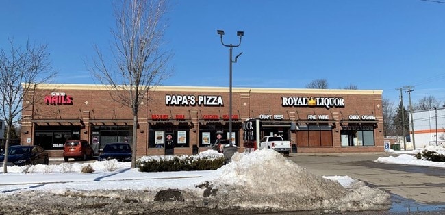
Property Record
30440 W 8 Mile Rd, Farmington, MI 48336


NEARBY LISTINGS FOR SALE OR LEASE
Property Detail
30440 W 8 Mile Rd
23-35-377-045
T1N, R9E, SEC 35 E 133.16 FT OF N 160.95 FT OF S 220.95 FT OF E 1/2 OF SW 1/4, ALSO W 45 FT OF E 178.15 FT OF N 160.95 FT OF
Stripcommercialcenter
Oakland
X
Michigan
26163C0055E
0.87 AC
2024
Farmington/Farm Hills
2024
Detroit
167500
Detroit-Warren-Dearborn, MI
7,038 SF
DEMOGRAPHICS near 30440 W 8 Mile Rd
1 Mile
3 Mile
5 Mile
2024 Total Population
8,476
77,952
210,484
2029 Population
8,284
75,689
204,799
Pop Growth 2024-2029
(2.27%)
(2.90%)
(2.70%)
Average Age
45
43
42
2024 Total Households
3,927
33,163
90,807
HH Growth 2024-2029
(2.29%)
(2.89%)
(2.65%)
Median Household Inc
$65,944
$75,447
$72,488
Avg Household Size
2.00
2.30
2.30
2024 Avg HH Vehicles
2.00
2.00
2.00
Median Home Value
$191,765
$219,788
$226,457
Median Year Built
1969
1965
1967
Nearby Places
Map Layers
Map Styles
 Street
 Aerial
- Restaurants
- Banks
- Shops
- Fitness
- Groceries
PUBLIC TRANSPORTATION
AIRPORT
Detroit City
DRIVE
WALK
Distance
Detroit City
37 min
26.3 mi
Detroit Metro Wayne County
DRIVE
WALK
Distance
Detroit Metro Wayne County
30 min
26.6 mi
Freight Ports
Port of Baltimore
DRIVE
WALK
Distance
Port of Baltimore
1 min
415.3 mi
SALE & LEASE HISTORY
LISTING DATE
SALE/LEASE

Feb 20, 2019
For Lease
Nearby Properties
Address
Land Use
TOTAL SIZE
Lot Size
Zoning
Address
Land Use
TOTAL SIZE
Lot Size
Zoning
406,560 SF
46.04 AC
AI
Address
Land Use
TOTAL SIZE
Lot Size
Zoning
228,748 SF
25.06 AC
AI
Address
Land Use
TOTAL SIZE
Lot Size
Zoning
Address
Land Use
TOTAL SIZE
Lot Size
Zoning
214,242 SF
22.40 AC
AI
Address
Land Use
TOTAL SIZE
Lot Size
Zoning
311,298 SF
31.66 AC
BI
Address
Land Use
TOTAL SIZE
Lot Size
Zoning
264,994 SF
19.75 AC
AI
Address
Land Use
TOTAL SIZE
Lot Size
Zoning
204 SF
11.31 AC
RM
Address
Land Use
TOTAL SIZE
Lot Size
Zoning
160,935 SF
10.63 AC
AI
Address
Land Use
TOTAL SIZE
Lot Size
Zoning
192,755 SF
Address
Land Use
TOTAL SIZE
Lot Size
Zoning
16.21 AC
R-7
Address
Land Use
TOTAL SIZE
Lot Size
Zoning
158,092 SF
11.75 AC
B-3
Address
Land Use
TOTAL SIZE
Lot Size
Zoning
164,964 SF
14.96 AC
R-7
Address
Land Use
TOTAL SIZE
Lot Size
Zoning
126,180 SF
11.62 AC
C-2
Address
Land Use
TOTAL SIZE
Lot Size
Zoning
152 SF
7.32 AC
RM
Address
Land Use
TOTAL SIZE
Lot Size
Zoning
225,520 SF
9.93 AC
PO
Address
Land Use
TOTAL SIZE
Lot Size
Zoning
138,104 SF
8.66 AC
AI
Address
Land Use
TOTAL SIZE
Lot Size
Zoning
2,025 SF
14.78 AC
R-7
Address
Land Use
TOTAL SIZE
Lot Size
Zoning
100,887 SF
5.34 AC
C-4
Address
Land Use
TOTAL SIZE
Lot Size
Zoning
192,038 SF
16.26 AC
C-2
Address
Land Use
TOTAL SIZE
Lot Size
Zoning
9.19 AC
R3
Address
Land Use
TOTAL SIZE
Lot Size
Zoning
123,198 SF
2.90 AC
CBD
Address
Land Use
TOTAL SIZE
Lot Size
Zoning
115,270 SF
7.07 AC
AI
Address
Land Use
TOTAL SIZE
Lot Size
Zoning
133,841 SF
23.21 AC
II
Address
Land Use
TOTAL SIZE
Lot Size
Zoning
92,720 SF
7.91 AC
AI
Address
Land Use
TOTAL SIZE
Lot Size
Zoning
101,249 SF
8.48 AC
AI
Address
Land Use
TOTAL SIZE
Lot Size
Zoning
98,311 SF
6 AC
AI
Address
Land Use
TOTAL SIZE
Lot Size
Zoning
104 SF
8.93 AC
RM
Address
Land Use
TOTAL SIZE
Lot Size
Zoning
142,058 SF
10.02 AC
R-7
Address
Land Use
TOTAL SIZE
Lot Size
Zoning
86,830 SF
7.46 AC
C2
Address
Land Use
TOTAL SIZE
Lot Size
Zoning
65,373 SF
1.69 AC
CBD
The World's #1 Commercial Real Estate Marketplace
Connect with us
© 2026 CoStar Group
The information above has been obtained from sources believed reliable. While we do not doubt its accuracy we have not verified it and make no guarantee, warranty or representation about it. It is your responsibility to independently confirm its accuracy and completeness. Any projections, opinions, assumptions, or estimates used are for example only and do not represent the current or future performance of the property. The value of this transaction to you depends on tax and other factors which should be evaluated by your tax, financial, and legal advisors. You and your advisors should conduct a careful, independent investigation of the property to determine to your satisfaction the suitability of the property for your needs.