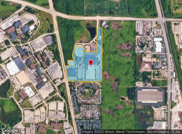
Property Record
30465 N Waukegan Rd, Libertyville, IL 60048

NEARBY LISTINGS FOR SALE OR LEASE
Property Detail
30465 N Waukegan Rd
11-12-400-474
PT SEC 12;BEG NECOR SE1/4;S00D0744W 1166.55,N89D1847W 1287.30,N10D21262 278.43,NLY ALG CUV 255.61,N11D3758W 84.87,S89D1847E 137.67,N33D1249W 106.78,N00D3448E
Industrialgeneral
Lake
X
Illinois
17097C0167K
40.08 AC
2023
Far North
2024
Chicago
863701
Chicago-Naperville-Elgin, IL-IN-WI
DEMOGRAPHICS near 30465 N Waukegan Rd
1 Mile
3 Mile
5 Mile
2024 Total Population
2,980
44,494
133,620
2029 Population
2,925
44,230
131,798
Pop Growth 2024-2029
(1.85%)
(0.59%)
(1.36%)
Average Age
40
35
38
2024 Total Households
1,339
14,071
45,113
HH Growth 2024-2029
(2.46%)
(0.71%)
(1.39%)
Median Household Inc
$77,763
$71,454
$79,805
Avg Household Size
2.20
2.60
2.70
2024 Avg HH Vehicles
1.00
2.00
2.00
Median Home Value
$285,416
$352,899
$344,371
Median Year Built
1984
1979
1975
Nearby Places
- Restaurants
- Banks
- Shops
- Fitness
- Groceries
PUBLIC TRANSPORTATION
COMMUTER RAIL
Great Lakes Station (Union Pacific North Line - Northeast Illinois Regional Commuter Railroad (Metra))
DRIVE
WALK
Distance
Great Lakes Station (Union Pacific North Line - Northeast Illinois Regional Commuter Railroad (Metra))
5 min
2.5 mi
North Chicago Station (Union Pacific North Line - Northeast Illinois Regional Commuter Railroad (Metra))
DRIVE
WALK
Distance
North Chicago Station (Union Pacific North Line - Northeast Illinois Regional Commuter Railroad (Metra))
7 min
4.1 mi
AIRPORT
Chicago O'Hare International
DRIVE
WALK
Distance
Chicago O'Hare International
59 min
32.7 mi
Freight Ports
Port Milwaukee
DRIVE
WALK
Distance
Port Milwaukee
62 min
51.9 mi
Nearby Properties
Address
Land Use
TOTAL SIZE
Lot Size
Zoning
Address
Land Use
TOTAL SIZE
Lot Size
Zoning
182.08 AC
Address
Land Use
TOTAL SIZE
Lot Size
Zoning
74.05 AC
Address
Land Use
TOTAL SIZE
Lot Size
Zoning
296.29 AC
Address
Land Use
TOTAL SIZE
Lot Size
Zoning
13.85 AC
Address
Land Use
TOTAL SIZE
Lot Size
Zoning
545,716 SF
31.05 AC
Address
Land Use
TOTAL SIZE
Lot Size
Zoning
625,928 SF
32.17 AC
Address
Land Use
TOTAL SIZE
Lot Size
Zoning
500,160 SF
28.37 AC
Address
Land Use
TOTAL SIZE
Lot Size
Zoning
Address
Land Use
TOTAL SIZE
Lot Size
Zoning
4,116,168 SF
17.20 AC
Address
Land Use
TOTAL SIZE
Lot Size
Zoning
12.45 AC
Address
Land Use
TOTAL SIZE
Lot Size
Zoning
66.57 AC
Address
Land Use
TOTAL SIZE
Lot Size
Zoning
763,840 SF
19.85 AC
Address
Land Use
TOTAL SIZE
Lot Size
Zoning
14.03 AC
Address
Land Use
TOTAL SIZE
Lot Size
Zoning
401,949 SF
20.18 AC
Address
Land Use
TOTAL SIZE
Lot Size
Zoning
306,160 SF
15.43 AC
Address
Land Use
TOTAL SIZE
Lot Size
Zoning
Address
Land Use
TOTAL SIZE
Lot Size
Zoning
225,626 SF
4.11 AC
Address
Land Use
TOTAL SIZE
Lot Size
Zoning
329,752 SF
15.60 AC
Address
Land Use
TOTAL SIZE
Lot Size
Zoning
2,155,686 SF
7.97 AC
Address
Land Use
TOTAL SIZE
Lot Size
Zoning
14.49 AC
Address
Land Use
TOTAL SIZE
Lot Size
Zoning
1,082,769 SF
31.84 AC
Address
Land Use
TOTAL SIZE
Lot Size
Zoning
362,809 SF
21.48 AC
Address
Land Use
TOTAL SIZE
Lot Size
Zoning
394,910 SF
20.13 AC
Address
Land Use
TOTAL SIZE
Lot Size
Zoning
1,915,680 SF
8.37 AC
Address
Land Use
TOTAL SIZE
Lot Size
Zoning
Address
Land Use
TOTAL SIZE
Lot Size
Zoning
460,216 SF
14.33 AC
Address
Land Use
TOTAL SIZE
Lot Size
Zoning
19.86 AC
Address
Land Use
TOTAL SIZE
Lot Size
Zoning
2,514,840 SF
14.22 AC
Address
Land Use
TOTAL SIZE
Lot Size
Zoning
239,930 SF
13.32 AC
The World's #1 Commercial Real Estate Marketplace
Connect with us
© 2025 CoStar Group
The information above has been obtained from sources believed reliable. While we do not doubt its accuracy we have not verified it and make no guarantee, warranty or representation about it. It is your responsibility to independently confirm its accuracy and completeness. Any projections, opinions, assumptions, or estimates used are for example only and do not represent the current or future performance of the property. The value of this transaction to you depends on tax and other factors which should be evaluated by your tax, financial, and legal advisors. You and your advisors should conduct a careful, independent investigation of the property to determine to your satisfaction the suitability of the property for your needs.