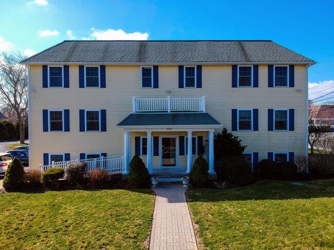
Property Record
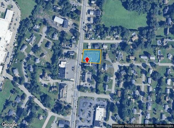
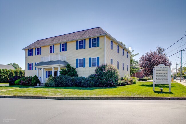
3047 E Main Rd, Portsmouth, RI 02871

NEARBY LISTINGS FOR SALE OR LEASE
Property Detail
3047 E Main Rd
Commercialbuilding
Newport
X
Rhode Island
44005C0101J
0.80 AC
2025
Newport County
2025
Providence
040102
Providence-Warwick, RI-MA
8,369 SF
PORT-000031-000000-000129A
DEMOGRAPHICS near 3047 E Main Rd
1 Mile
3 Mile
5 Mile
2024 Total Population
3,598
15,484
38,007
2029 Population
3,540
15,262
37,371
Pop Growth 2024-2029
(1.61%)
(1.43%)
(1.67%)
Average Age
45
46
45
2024 Total Households
1,463
6,277
15,347
HH Growth 2024-2029
(1.85%)
(1.62%)
(1.80%)
Median Household Inc
$96,857
$104,675
$96,097
Avg Household Size
2.40
2.40
2.30
2024 Avg HH Vehicles
2.00
2.00
2.00
Median Home Value
$511,663
$530,725
$440,645
Median Year Built
1970
1968
1965
Nearby Places
Map Layers
Map Styles
 Street
 Aerial
- Restaurants
- Banks
- Shops
- Fitness
- Groceries
PUBLIC TRANSPORTATION
AIRPORT
Rhode Island Tf Green International
DRIVE
WALK
Distance
Rhode Island Tf Green International
45 min
27.6 mi
Freight Ports
Port of Davisville, RI
DRIVE
WALK
Distance
Port of Davisville, RI
48 min
25.7 mi
SALE & LEASE HISTORY
LISTING DATE
SALE/LEASE

Sep 25, 2016
For Lease
Mar 30, 2020
For Sale
Jul 26, 2018
For Lease
Nearby Properties
Address
Land Use
TOTAL SIZE
Lot Size
Zoning
Address
Land Use
TOTAL SIZE
Lot Size
Zoning
42 AC
R20
Address
Land Use
TOTAL SIZE
Lot Size
Zoning
13,478 SF
1 AC
HI
Address
Land Use
TOTAL SIZE
Lot Size
Zoning
150,156 SF
8.77 AC
R40
Address
Land Use
TOTAL SIZE
Lot Size
Zoning
3,512 SF
30.88 AC
EI
Address
Land Use
TOTAL SIZE
Lot Size
Zoning
9.01 AC
R20
Address
Land Use
TOTAL SIZE
Lot Size
Zoning
23.78 AC
WD
Address
Land Use
TOTAL SIZE
Lot Size
Zoning
16 AC
WD
Address
Land Use
TOTAL SIZE
Lot Size
Zoning
Address
Land Use
TOTAL SIZE
Lot Size
Zoning
6 AC
HI
Address
Land Use
TOTAL SIZE
Lot Size
Zoning
74,293 SF
10.77 AC
TC
Address
Land Use
TOTAL SIZE
Lot Size
Zoning
367.97 AC
OS
Address
Land Use
TOTAL SIZE
Lot Size
Zoning
44,815 SF
5 AC
R20
Address
Land Use
TOTAL SIZE
Lot Size
Zoning
48,351 SF
10.75 AC
R20
Address
Land Use
TOTAL SIZE
Lot Size
Zoning
44.80 AC
R20
Address
Land Use
TOTAL SIZE
Lot Size
Zoning
36,324 SF
24 AC
R-40
Address
Land Use
TOTAL SIZE
Lot Size
Zoning
1 AC
R60
Address
Land Use
TOTAL SIZE
Lot Size
Zoning
60,480 SF
3.88 AC
R20
Address
Land Use
TOTAL SIZE
Lot Size
Zoning
5.85 AC
LI
Address
Land Use
TOTAL SIZE
Lot Size
Zoning
78,182 SF
10 AC
R10
Address
Land Use
TOTAL SIZE
Lot Size
Zoning
10.46 AC
R20
Address
Land Use
TOTAL SIZE
Lot Size
Zoning
33,916 SF
5.75 AC
TC
Address
Land Use
TOTAL SIZE
Lot Size
Zoning
244 AC
R60/HI
Address
Land Use
TOTAL SIZE
Lot Size
Zoning
2.79 AC
R10
Address
Land Use
TOTAL SIZE
Lot Size
Zoning
R60/HI
Address
Land Use
TOTAL SIZE
Lot Size
Zoning
2.81 AC
C
Address
Land Use
TOTAL SIZE
Lot Size
Zoning
18,773 SF
1 AC
R60
Address
Land Use
TOTAL SIZE
Lot Size
Zoning
13.80 AC
R20
Address
Land Use
TOTAL SIZE
Lot Size
Zoning
7,179 SF
9.50 AC
R-40
Address
Land Use
TOTAL SIZE
Lot Size
Zoning
4.50 AC
R20
Address
Land Use
TOTAL SIZE
Lot Size
Zoning
48,718 SF
5 AC
LI
The World's #1 Commercial Real Estate Marketplace
Connect with us
© 2026 CoStar Group
The information above has been obtained from sources believed reliable. While we do not doubt its accuracy we have not verified it and make no guarantee, warranty or representation about it. It is your responsibility to independently confirm its accuracy and completeness. Any projections, opinions, assumptions, or estimates used are for example only and do not represent the current or future performance of the property. The value of this transaction to you depends on tax and other factors which should be evaluated by your tax, financial, and legal advisors. You and your advisors should conduct a careful, independent investigation of the property to determine to your satisfaction the suitability of the property for your needs.