Property Record
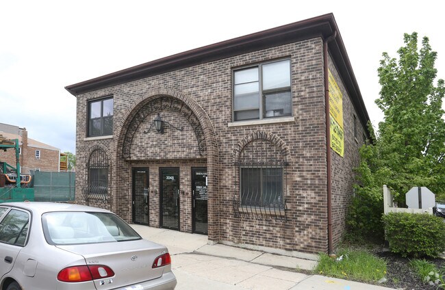
3048 N Harlem Ave, Chicago, IL 60634

NEARBY LISTINGS FOR SALE OR LEASE
Property Detail
3048 N Harlem Ave
Chicago-Naperville-Elgin, IL-IN
Stone & Companys
12-25-215-018-0000
H O (STONE) & (COMPANYS) SUB OF E60ACS OF EX PT DED F OR BELMONT AVE NH NE SEC 25-40-12
Miscresidentialimprovement
Cook
X
Illinois
17031C0395J
5,6
2023
0.07 AC
2025
Northwest City
170900
Chicago
5,016 SF
DEMOGRAPHICS near 3048 N Harlem Ave
1 Mile
3 Mile
5 Mile
2024 Total Population
45,000
258,616
696,177
2029 Population
43,012
245,037
659,824
Pop Growth 2024-2029
(4.42%)
(5.25%)
(5.22%)
Average Age
41
41
40
2024 Total Households
16,028
91,307
256,566
HH Growth 2024-2029
(4.70%)
(5.50%)
(5.46%)
Median Household Inc
$73,634
$74,608
$71,192
Avg Household Size
2.70
2.70
2.60
2024 Avg HH Vehicles
2.00
2.00
2.00
Median Home Value
$289,503
$311,970
$319,815
Median Year Built
1952
1950
1949
Nearby Places
Map Layers
Map Styles
 Street
 Aerial
- Restaurants
- Banks
- Shops
- Fitness
- Groceries
PUBLIC TRANSPORTATION
COMMUTER RAIL
Mont Clare Station (Milwaukee District West Line - Northeast Illinois Regional Commuter Railroad (Metra), North Central Service - Northeast Illinois Regional Commuter Railroad (Metra))
DRIVE
WALK
Distance
Mont Clare Station (Milwaukee District West Line - Northeast Illinois Regional Commuter Railroad (Metra), North Central Service - Northeast Illinois Regional Commuter Railroad (Metra))
3 min
1.2 mi
Elmwood Park Station (Milwaukee District West Line - Northeast Illinois Regional Commuter Railroad (Metra), North Central Service - Northeast Illinois Regional Commuter Railroad (Metra))
DRIVE
WALK
Distance
Elmwood Park Station (Milwaukee District West Line - Northeast Illinois Regional Commuter Railroad (Metra), North Central Service - Northeast Illinois Regional Commuter Railroad (Metra))
3 min
1.3 mi
AIRPORT
Chicago O'Hare International
DRIVE
WALK
Distance
Chicago O'Hare International
16 min
8.4 mi
Chicago Midway International
DRIVE
WALK
Distance
Chicago Midway International
24 min
13.2 mi
Freight Ports
Port Milwaukee
DRIVE
WALK
Distance
Port Milwaukee
100 min
80.8 mi
SALE & LEASE HISTORY
LISTING DATE
SALE/LEASE

Nov 16, 2016
For Lease
Nov 16, 2016
For Sale
Mar 17, 2017
For Lease
Apr 10, 2019
For Sale
Nearby Properties
Address
Land Use
TOTAL SIZE
Lot Size
Zoning
Address
Land Use
TOTAL SIZE
Lot Size
Zoning
Address
Land Use
TOTAL SIZE
Lot Size
Zoning
595,800 SF
9.40 AC
Address
Land Use
TOTAL SIZE
Lot Size
Zoning
9.90 AC
Address
Land Use
TOTAL SIZE
Lot Size
Zoning
422,063 SF
18.88 AC
Address
Land Use
TOTAL SIZE
Lot Size
Zoning
192,365 SF
21.34 AC
PD 127
Address
Land Use
TOTAL SIZE
Lot Size
Zoning
396,650 SF
19.12 AC
Address
Land Use
TOTAL SIZE
Lot Size
Zoning
Address
Land Use
TOTAL SIZE
Lot Size
Zoning
Address
Land Use
TOTAL SIZE
Lot Size
Zoning
548,206 SF
21.13 AC
Address
Land Use
TOTAL SIZE
Lot Size
Zoning
1.04 AC
PD 130
Address
Land Use
TOTAL SIZE
Lot Size
Zoning
531,227 SF
18.32 AC
Address
Land Use
TOTAL SIZE
Lot Size
Zoning
6.31 AC
PD 1013
Address
Land Use
TOTAL SIZE
Lot Size
Zoning
3.33 AC
PD 1013
Address
Land Use
TOTAL SIZE
Lot Size
Zoning
194,219 SF
17.26 AC
Address
Land Use
TOTAL SIZE
Lot Size
Zoning
Address
Land Use
TOTAL SIZE
Lot Size
Zoning
13.33 AC
PD 127
Address
Land Use
TOTAL SIZE
Lot Size
Zoning
325,045 SF
13.79 AC
Address
Land Use
TOTAL SIZE
Lot Size
Zoning
95,614 SF
4.20 AC
Address
Land Use
TOTAL SIZE
Lot Size
Zoning
348,133 SF
2.69 AC
Address
Land Use
TOTAL SIZE
Lot Size
Zoning
Address
Land Use
TOTAL SIZE
Lot Size
Zoning
277,819 SF
10.58 AC
PD 127
Address
Land Use
TOTAL SIZE
Lot Size
Zoning
897,723 SF
23.04 AC
PMD 15
Address
Land Use
TOTAL SIZE
Lot Size
Zoning
141,095 SF
9.15 AC
PD 127
Address
Land Use
TOTAL SIZE
Lot Size
Zoning
Address
Land Use
TOTAL SIZE
Lot Size
Zoning
65,243 SF
3.70 AC
Address
Land Use
TOTAL SIZE
Lot Size
Zoning
138,042 SF
11.74 AC
PD 127
Address
Land Use
TOTAL SIZE
Lot Size
Zoning
197,709 SF
2.41 AC
Address
Land Use
TOTAL SIZE
Lot Size
Zoning
165,574 SF
3.91 AC
Address
Land Use
TOTAL SIZE
Lot Size
Zoning
152,533 SF
12.64 AC
Address
Land Use
TOTAL SIZE
Lot Size
Zoning
70,345 SF
5.09 AC
The World's #1 Commercial Real Estate Marketplace
Connect with us
© 2026 CoStar Group
The information above has been obtained from sources believed reliable. While we do not doubt its accuracy we have not verified it and make no guarantee, warranty or representation about it. It is your responsibility to independently confirm its accuracy and completeness. Any projections, opinions, assumptions, or estimates used are for example only and do not represent the current or future performance of the property. The value of this transaction to you depends on tax and other factors which should be evaluated by your tax, financial, and legal advisors. You and your advisors should conduct a careful, independent investigation of the property to determine to your satisfaction the suitability of the property for your needs.