Property Record
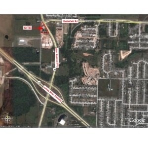
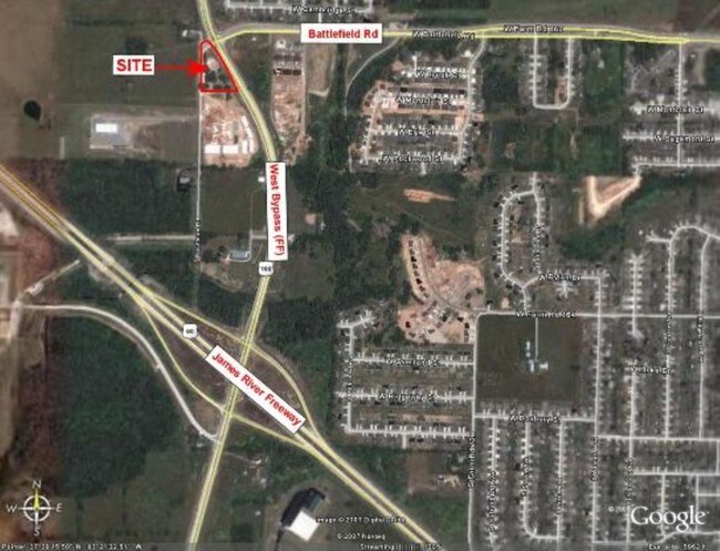
3048 S Kauffman Rd, Springfield, MO 65807

Property Detail
3048 S Kauffman Rd
18-05-300-020
8.89A M/L W1/2 NE1/4 SW1/4 5/28/22 LY W OF HWY FF
Publicstorage
Greene
INC
Missouri
B and X Area of moderate flood hazard, usually the area between the limits of the 100-year and 500-year floods.
8.89 AC
2025
Southwest
2025
Springfield
004201
Springfield, MO
85,030 SF
NEARBY LISTINGS FOR SALE OR LEASE
DEMOGRAPHICS near 3048 S Kauffman Rd
1 mile
3 mile
5 mile
2025 Total Population
4,505
44,191
121,531
2030 Population
4,539
45,216
124,673
Pop Growth 2025-2030
+ 0.75%
+ 2.32%
+ 2.59%
Average Age
42
39
39
2025 Total Households
1,910
18,740
52,694
HH Growth 2025-2030
+ 0.89%
+ 2.48%
+ 2.72%
Median Household Inc
$67,892
$63,611
$57,072
Avg Household Size
2.30
2.30
2.20
2025 Avg HH Vehicles
2.00
2.00
2.00
Median Home Value
$236,363
$233,437
$214,213
Median Year Built
1996
1995
1989
Nearby Places
Map Layers
Map Styles
 Street
 Aerial
Layers
 Traffic
 Biking
Places
Listings with unknown addresses are not visible on the map
- Restaurants
- Banks
- Shops
- Fitness
- Groceries
PUBLIC TRANSPORTATION
AIRPORT
Springfield-Branson Ntl
Drive
Walk
Distance
Springfield-Branson Ntl
22 min
9.8 mi
Freight Ports
Tulsa Port of Inola
Drive
Walk
Distance
Tulsa Port of Inola
187 min
168.5 mi
SALE & LEASE HISTORY
LISTING DATE
SALE/LEASE

Sep 24, 2016
For Sale
Nearby Properties
Address
Land Use
TOTAL SIZE
Lot Size
Zoning
Address
Land Use
TOTAL SIZE
Lot Size
Zoning
18.52 AC
INC
Address
Land Use
TOTAL SIZE
Lot Size
Zoning
22.64 AC
INC
Address
Land Use
TOTAL SIZE
Lot Size
Zoning
Address
Land Use
TOTAL SIZE
Lot Size
Zoning
312,092 SF
38 AC
INC
Address
Land Use
TOTAL SIZE
Lot Size
Zoning
614,588 SF
57.27 AC
INC
Address
Land Use
TOTAL SIZE
Lot Size
Zoning
129,652 SF
16.40 AC
INC
Address
Land Use
TOTAL SIZE
Lot Size
Zoning
334,594 SF
17.75 AC
INC
Address
Land Use
TOTAL SIZE
Lot Size
Zoning
9.82 AC
INC
Address
Land Use
TOTAL SIZE
Lot Size
Zoning
159,007 SF
16.05 AC
INC
Address
Land Use
TOTAL SIZE
Lot Size
Zoning
30,400 SF
9.05 AC
INC
Address
Land Use
TOTAL SIZE
Lot Size
Zoning
6.24 AC
INC
Address
Land Use
TOTAL SIZE
Lot Size
Zoning
12.81 AC
INC
Address
Land Use
TOTAL SIZE
Lot Size
Zoning
157,773 SF
18.55 AC
INC
Address
Land Use
TOTAL SIZE
Lot Size
Zoning
16.39 AC
INC
Address
Land Use
TOTAL SIZE
Lot Size
Zoning
8.26 AC
INC
Address
Land Use
TOTAL SIZE
Lot Size
Zoning
Address
Land Use
TOTAL SIZE
Lot Size
Zoning
10.58 AC
INC
Address
Land Use
TOTAL SIZE
Lot Size
Zoning
47,500 SF
5.24 AC
INC
Address
Land Use
TOTAL SIZE
Lot Size
Zoning
117,757 SF
6.50 AC
INC
Address
Land Use
TOTAL SIZE
Lot Size
Zoning
137,716 SF
11.08 AC
INC
Address
Land Use
TOTAL SIZE
Lot Size
Zoning
43,884 SF
2.42 AC
INC
Address
Land Use
TOTAL SIZE
Lot Size
Zoning
44,000 SF
3.05 AC
INC
Address
Land Use
TOTAL SIZE
Lot Size
Zoning
115,212 SF
6.70 AC
INC
Address
Land Use
TOTAL SIZE
Lot Size
Zoning
126,242 SF
4.75 AC
INC
Address
Land Use
TOTAL SIZE
Lot Size
Zoning
128,448 SF
4.30 AC
INC
Address
Land Use
TOTAL SIZE
Lot Size
Zoning
200,942 SF
15.70 AC
INC
Address
Land Use
TOTAL SIZE
Lot Size
Zoning
113,712 SF
11.10 AC
INC
Address
Land Use
TOTAL SIZE
Lot Size
Zoning
5.63 AC
INC
Address
Land Use
TOTAL SIZE
Lot Size
Zoning
6.65 AC
INC
The World's #1 Commercial Real Estate Marketplace
Connect with us
© 2026 CoStar Group
The information above has been obtained from sources believed reliable. While we do not doubt its accuracy we have not verified it and make no guarantee, warranty or representation about it. It is your responsibility to independently confirm its accuracy and completeness. Any projections, opinions, assumptions, or estimates used are for example only and do not represent the current or future performance of the property. The value of this transaction to you depends on tax and other factors which should be evaluated by your tax, financial, and legal advisors. You and your advisors should conduct a careful, independent investigation of the property to determine to your satisfaction the suitability of the property for your needs.