Property Record
30487 Lorain Rd, North Olmsted, OH 44070
NEARBY LISTINGS FOR SALE OR LEASE
Property Detail
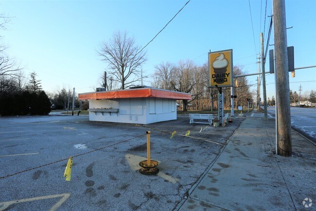
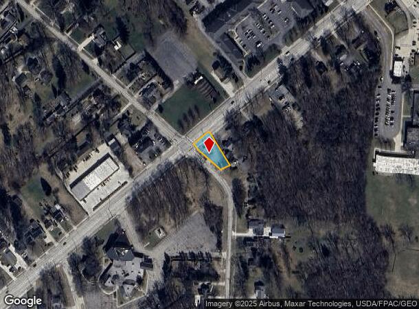
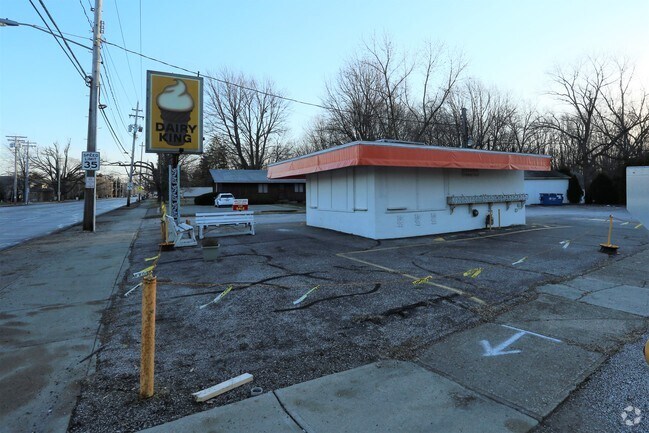
30487 Lorain Rd
234-15-011
OL 8
Restaurantdrivein
Cuyahoga
X
Ohio
39035C0139E
8
2024
0.18 AC
2024
West
174203
Cleveland
432 SF
Cleveland-Elyria, OH
DEMOGRAPHICS near 30487 Lorain Rd
1 Mile
3 Mile
5 Mile
2024 Total Population
6,008
52,409
129,097
2029 Population
5,917
52,181
128,610
Pop Growth 2024-2029
(1.51%)
(0.44%)
(0.38%)
Average Age
46
44
43
2024 Total Households
2,390
21,564
53,079
HH Growth 2024-2029
(1.67%)
(0.52%)
(0.60%)
Median Household Inc
$86,955
$83,101
$86,345
Avg Household Size
2.40
2.40
2.40
2024 Avg HH Vehicles
2.00
2.00
2.00
Median Home Value
$202,058
$203,623
$228,512
Median Year Built
1974
1978
1979
Nearby Places
Map Layers
Map Styles
 Street
 Aerial
- Restaurants
- Banks
- Shops
- Fitness
- Groceries
PUBLIC TRANSPORTATION
COMMUTER RAIL
DRIVE
WALK
Distance
16 min
8.3 mi
AIRPORT
Cleveland-Hopkins International
DRIVE
WALK
Distance
Cleveland-Hopkins International
14 min
6.5 mi
Nearby Properties
Address
Land Use
TOTAL SIZE
Lot Size
Zoning
Address
Land Use
TOTAL SIZE
Lot Size
Zoning
327,732 SF
57.22 AC
1F
Address
Land Use
TOTAL SIZE
Lot Size
Zoning
321,868 SF
71.81 AC
Address
Land Use
TOTAL SIZE
Lot Size
Zoning
457,220 SF
41.84 AC
CRG
Address
Land Use
TOTAL SIZE
Lot Size
Zoning
633,719 SF
17.16 AC
CRG
Address
Land Use
TOTAL SIZE
Lot Size
Zoning
278,056 SF
42.71 AC
R-40
Address
Land Use
TOTAL SIZE
Lot Size
Zoning
195,990 SF
46.88 AC
RMF-A
Address
Land Use
TOTAL SIZE
Lot Size
Zoning
64,528 SF
17.67 AC
1F-4
Address
Land Use
TOTAL SIZE
Lot Size
Zoning
176,857 SF
8.62 AC
B-2
Address
Land Use
TOTAL SIZE
Lot Size
Zoning
46,133 SF
35.03 AC
RMF-A
Address
Land Use
TOTAL SIZE
Lot Size
Zoning
209,822 SF
26.92 AC
R-40
Address
Land Use
TOTAL SIZE
Lot Size
Zoning
50,668 SF
9.04 AC
Address
Land Use
TOTAL SIZE
Lot Size
Zoning
130,030 SF
5.69 AC
RMF-A
Address
Land Use
TOTAL SIZE
Lot Size
Zoning
37,464 SF
11.14 AC
Address
Land Use
TOTAL SIZE
Lot Size
Zoning
128,416 SF
13.42 AC
R-40
Address
Land Use
TOTAL SIZE
Lot Size
Zoning
163,501 SF
9.88 AC
CRG
Address
Land Use
TOTAL SIZE
Lot Size
Zoning
174,721 SF
15.60 AC
Address
Land Use
TOTAL SIZE
Lot Size
Zoning
179,879 SF
5.34 AC
RMF-A
Address
Land Use
TOTAL SIZE
Lot Size
Zoning
330,163 SF
5.06 AC
MRC2
Address
Land Use
TOTAL SIZE
Lot Size
Zoning
43,950 SF
9.40 AC
Address
Land Use
TOTAL SIZE
Lot Size
Zoning
89,153 SF
29.03 AC
1F-4
Address
Land Use
TOTAL SIZE
Lot Size
Zoning
67,047 SF
5 AC
1F-4
Address
Land Use
TOTAL SIZE
Lot Size
Zoning
122,421 SF
16.38 AC
1F-4
Address
Land Use
TOTAL SIZE
Lot Size
Zoning
39,418 SF
6.05 AC
Address
Land Use
TOTAL SIZE
Lot Size
Zoning
54,718 SF
149.12 AC
R-40
Address
Land Use
TOTAL SIZE
Lot Size
Zoning
57,126 SF
11.74 AC
Address
Land Use
TOTAL SIZE
Lot Size
Zoning
109,240 SF
7.32 AC
CRG
Address
Land Use
TOTAL SIZE
Lot Size
Zoning
30,264 SF
6.50 AC
CRG
Address
Land Use
TOTAL SIZE
Lot Size
Zoning
18,697 SF
4.47 AC
Address
Land Use
TOTAL SIZE
Lot Size
Zoning
122,273 SF
8 AC
CRG
Address
Land Use
TOTAL SIZE
Lot Size
Zoning
73,673 SF
6.80 AC
SR
The World's #1 Commercial Real Estate Marketplace
Connect with us
© 2025 CoStar Group
The information above has been obtained from sources believed reliable. While we do not doubt its accuracy we have not verified it and make no guarantee, warranty or representation about it. It is your responsibility to independently confirm its accuracy and completeness. Any projections, opinions, assumptions, or estimates used are for example only and do not represent the current or future performance of the property. The value of this transaction to you depends on tax and other factors which should be evaluated by your tax, financial, and legal advisors. You and your advisors should conduct a careful, independent investigation of the property to determine to your satisfaction the suitability of the property for your needs.