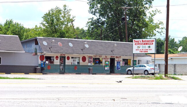
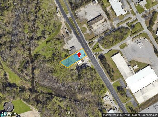
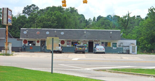
Property Record
3049 Bluff Rd, Columbia, SC 29209
NEARBY LISTINGS FOR SALE OR LEASE
Property Detail
3049 Bluff Rd
Columbia, SC
Bluff Induscommercial Properties
13507-01-11
PARCEL 1 107.2X284.1X99.8X26X332.3 #SU #PR Z-1934; RB2774-3589
Commercialnec
Richland
AE
South Carolina
45079C0378L
2
2025
0.80 AC
2024
Southeast Columbia
011702
Columbia
3,020 SF
DEMOGRAPHICS near 3049 Bluff Rd
1 Mile
3 Mile
5 Mile
2024 Total Population
1,065
26,067
99,415
2029 Population
1,132
26,657
101,807
Pop Growth 2024-2029
+ 6.29%
+ 2.26%
+ 2.41%
Average Age
33
35
34
2024 Total Households
541
12,381
39,550
HH Growth 2024-2029
+ 6.84%
+ 2.57%
+ 2.82%
Median Household Inc
$38,870
$45,928
$51,778
Avg Household Size
2.00
2.00
2.10
2024 Avg HH Vehicles
2.00
2.00
2.00
Median Home Value
$89,325
$183,697
$231,233
Median Year Built
2000
1986
1973
Nearby Places
Map Layers
Map Styles
 Street
 Aerial
- Restaurants
- Banks
- Shops
- Fitness
- Groceries
PUBLIC TRANSPORTATION
COMMUTER RAIL
DRIVE
WALK
Distance
10 min
5.1 mi
AIRPORT
Columbia Metro
DRIVE
WALK
Distance
Columbia Metro
23 min
12.6 mi
Nearby Properties
Address
Land Use
TOTAL SIZE
Lot Size
Zoning
Address
Land Use
TOTAL SIZE
Lot Size
Zoning
603,525 SF
26.45 AC
RM-HD
Address
Land Use
TOTAL SIZE
Lot Size
Zoning
604,350 SF
10.33 AC
EC
Address
Land Use
TOTAL SIZE
Lot Size
Zoning
316,116 SF
21.73 AC
RG-2
Address
Land Use
TOTAL SIZE
Lot Size
Zoning
241,878 SF
14.03 AC
C-3
Address
Land Use
TOTAL SIZE
Lot Size
Zoning
3,000 SF
52.49 AC
O-I
Address
Land Use
TOTAL SIZE
Lot Size
Zoning
300,636 SF
21.58 AC
LI
Address
Land Use
TOTAL SIZE
Lot Size
Zoning
95.26 AC
C-1
Address
Land Use
TOTAL SIZE
Lot Size
Zoning
486,050 SF
24.18 AC
RM-HD
Address
Land Use
TOTAL SIZE
Lot Size
Zoning
254,900 SF
14 AC
M-1
Address
Land Use
TOTAL SIZE
Lot Size
Zoning
216,180 SF
15.66 AC
C-1
Address
Land Use
TOTAL SIZE
Lot Size
Zoning
230,053 SF
18.35 AC
C-3
Address
Land Use
TOTAL SIZE
Lot Size
Zoning
32,640 SF
23.73 AC
RSF-2
Address
Land Use
TOTAL SIZE
Lot Size
Zoning
239,827 SF
22.35 AC
HI
Address
Land Use
TOTAL SIZE
Lot Size
Zoning
174,424 SF
7.66 AC
LI
Address
Land Use
TOTAL SIZE
Lot Size
Zoning
55,003 SF
4.26 AC
M-1
Address
Land Use
TOTAL SIZE
Lot Size
Zoning
281,304 SF
22.86 AC
RG-2
Address
Land Use
TOTAL SIZE
Lot Size
Zoning
62,250 SF
8.15 AC
GC
Address
Land Use
TOTAL SIZE
Lot Size
Zoning
100 SF
16.95 AC
C-3
Address
Land Use
TOTAL SIZE
Lot Size
Zoning
199,263 SF
18.29 AC
C-3
Address
Land Use
TOTAL SIZE
Lot Size
Zoning
247,744 SF
15.32 AC
RM-HD
Address
Land Use
TOTAL SIZE
Lot Size
Zoning
59,864 SF
24.97 AC
M-1
Address
Land Use
TOTAL SIZE
Lot Size
Zoning
129,820 SF
11.12 AC
HI
Address
Land Use
TOTAL SIZE
Lot Size
Zoning
125,486 SF
9.97 AC
C-3
Address
Land Use
TOTAL SIZE
Lot Size
Zoning
68,216 SF
1.84 AC
C-3
Address
Land Use
TOTAL SIZE
Lot Size
Zoning
297,892 SF
10.99 AC
M-2
Address
Land Use
TOTAL SIZE
Lot Size
Zoning
183,098 SF
13.04 AC
RG-2
Address
Land Use
TOTAL SIZE
Lot Size
Zoning
107,824 SF
7.93 AC
R-3
Address
Land Use
TOTAL SIZE
Lot Size
Zoning
68,012 SF
13.18 AC
M-1
Address
Land Use
TOTAL SIZE
Lot Size
Zoning
140,100 SF
7.12 AC
M-2
Address
Land Use
TOTAL SIZE
Lot Size
Zoning
51,000 SF
6.25 AC
C-3
The World's #1 Commercial Real Estate Marketplace
Connect with us
© 2026 CoStar Group
The information above has been obtained from sources believed reliable. While we do not doubt its accuracy we have not verified it and make no guarantee, warranty or representation about it. It is your responsibility to independently confirm its accuracy and completeness. Any projections, opinions, assumptions, or estimates used are for example only and do not represent the current or future performance of the property. The value of this transaction to you depends on tax and other factors which should be evaluated by your tax, financial, and legal advisors. You and your advisors should conduct a careful, independent investigation of the property to determine to your satisfaction the suitability of the property for your needs.