Property Record
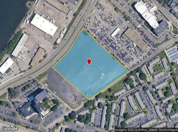
365 William F Mcclellan Hwy, East Boston, MA 02128
NEARBY LISTINGS FOR SALE OR LEASE
Property Detail
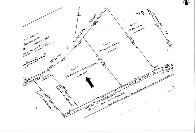
365 William F Mcclellan Hwy
EBOS-000000-000001-000549-000005
Suffolk
Commercialacreage
Massachusetts
AE
6 AC
25025C0019J
Charlestown/East Boston
2025
Boston
2025
Boston-Cambridge-Newton, MA-NH
050700
DEMOGRAPHICS near 365 William F Mcclellan Hwy
1 Mile
3 Mile
5 Mile
2024 Total Population
26,142
220,151
590,143
2029 Population
24,443
208,240
569,089
Pop Growth 2024-2029
(6.50%)
(5.41%)
(3.57%)
Average Age
37
38
38
2024 Total Households
8,680
86,170
250,648
HH Growth 2024-2029
(6.94%)
(5.60%)
(3.67%)
Median Household Inc
$61,480
$81,224
$93,759
Avg Household Size
2.80
2.50
2.20
2024 Avg HH Vehicles
1.00
1.00
1.00
Median Home Value
$512,838
$623,132
$725,421
Median Year Built
1948
1949
1951
Nearby Places
- Restaurants
- Banks
- Shops
- Fitness
- Groceries
PUBLIC TRANSPORTATION
TRANSIT/SUBWAY
Orient Heights Station (Blue Line - Massachusetts Bay Transportation Authority Subway (The T))
DRIVE
WALK
Distance
Orient Heights Station (Blue Line - Massachusetts Bay Transportation Authority Subway (The T))
2 min
11 min
0.6 mi
Suffolk Downs Station (Blue Line - Massachusetts Bay Transportation Authority Subway (The T))
DRIVE
WALK
Distance
Suffolk Downs Station (Blue Line - Massachusetts Bay Transportation Authority Subway (The T))
3 min
20 min
1.0 mi
COMMUTER RAIL
Chelsea (Newburyport/Rockport Line - MBTA)
DRIVE
WALK
Distance
Chelsea (Newburyport/Rockport Line - MBTA)
9 min
3.3 mi
North Station (Fitchburg/South Acton Line - Massachusetts Bay Transportation Authority Commuter Rail (Purple Line), Haverhill Line - Massachusetts Bay Transportation Authority Commuter Rail (Purple Line), Lowell Line - Massachusetts Bay Transportation Authority Commuter Rail (Purple Line), Newburyport/Rockport Line - Massachusetts Bay Transportation Authority Commuter Rail (Purple Line))
DRIVE
WALK
Distance
North Station (Fitchburg/South Acton Line - Massachusetts Bay Transportation Authority Commuter Rail (Purple Line), Haverhill Line - Massachusetts Bay Transportation Authority Commuter Rail (Purple Line), Lowell Line - Massachusetts Bay Transportation Authority Commuter Rail (Purple Line), Newburyport/Rockport Line - Massachusetts Bay Transportation Authority Commuter Rail (Purple Line))
9 min
3.9 mi
AIRPORT
General Edward Lawrence Logan International
DRIVE
WALK
Distance
General Edward Lawrence Logan International
6 min
2.8 mi
Freight Ports
Port of Boston
DRIVE
WALK
Distance
Port of Boston
12 min
5.5 mi
Nearby Properties
Address
Land Use
TOTAL SIZE
Lot Size
Zoning
Address
Land Use
TOTAL SIZE
Lot Size
Zoning
646,546 SF
89.28 AC
ROD
Address
Land Use
TOTAL SIZE
Lot Size
Zoning
401,310 SF
1.32 AC
C
Address
Land Use
TOTAL SIZE
Lot Size
Zoning
526,171 SF
8.39 AC
A
Address
Land Use
TOTAL SIZE
Lot Size
Zoning
410,642 SF
4.68 AC
CTED
Address
Land Use
TOTAL SIZE
Lot Size
Zoning
247,013 SF
1.13 AC
RC2
Address
Land Use
TOTAL SIZE
Lot Size
Zoning
230,544 SF
2.25 AC
E
Address
Land Use
TOTAL SIZE
Lot Size
Zoning
284,685 SF
0.61 AC
C
Address
Land Use
TOTAL SIZE
Lot Size
Zoning
234,450 SF
3.49 AC
I
Address
Land Use
TOTAL SIZE
Lot Size
Zoning
297,396 SF
2.79 AC
CTED
Address
Land Use
TOTAL SIZE
Lot Size
Zoning
424,000 SF
2.63 AC
RC
Address
Land Use
TOTAL SIZE
Lot Size
Zoning
378,339 SF
3.02 AC
E
Address
Land Use
TOTAL SIZE
Lot Size
Zoning
223,214 SF
1.01 AC
E
Address
Land Use
TOTAL SIZE
Lot Size
Zoning
755,000 SF
3.36 AC
C
Address
Land Use
TOTAL SIZE
Lot Size
Zoning
365,569 SF
4.81 AC
C
Address
Land Use
TOTAL SIZE
Lot Size
Zoning
145,000 SF
0.69 AC
C
Address
Land Use
TOTAL SIZE
Lot Size
Zoning
324,870 SF
9.37 AC
E
Address
Land Use
TOTAL SIZE
Lot Size
Zoning
274,720 SF
0.55 AC
C
Address
Land Use
TOTAL SIZE
Lot Size
Zoning
613,125 SF
15.74 AC
RC
Address
Land Use
TOTAL SIZE
Lot Size
Zoning
302,840 SF
5.83 AC
E
Address
Land Use
TOTAL SIZE
Lot Size
Zoning
211,294 SF
1.66 AC
RC2
Address
Land Use
TOTAL SIZE
Lot Size
Zoning
90,855 SF
7.87 AC
E
Address
Land Use
TOTAL SIZE
Lot Size
Zoning
382,500 SF
3.06 AC
C
Address
Land Use
TOTAL SIZE
Lot Size
Zoning
129,898 SF
43.82 AC
ID
Address
Land Use
TOTAL SIZE
Lot Size
Zoning
226,431 SF
4.31 AC
HB
Address
Land Use
TOTAL SIZE
Lot Size
Zoning
217,970 SF
0.44 AC
C
Address
Land Use
TOTAL SIZE
Lot Size
Zoning
1.65 AC
RC2
Address
Land Use
TOTAL SIZE
Lot Size
Zoning
237,393 SF
7.15 AC
A
Address
Land Use
TOTAL SIZE
Lot Size
Zoning
208,865 SF
7.69 AC
E
Address
Land Use
TOTAL SIZE
Lot Size
Zoning
941,186 SF
9.70 AC
C
Address
Land Use
TOTAL SIZE
Lot Size
Zoning
6.02 AC
TED
The World's #1 Commercial Real Estate Marketplace
Connect with us
© 2025 CoStar Group
The information above has been obtained from sources believed reliable. While we do not doubt its accuracy we have not verified it and make no guarantee, warranty or representation about it. It is your responsibility to independently confirm its accuracy and completeness. Any projections, opinions, assumptions, or estimates used are for example only and do not represent the current or future performance of the property. The value of this transaction to you depends on tax and other factors which should be evaluated by your tax, financial, and legal advisors. You and your advisors should conduct a careful, independent investigation of the property to determine to your satisfaction the suitability of the property for your needs.