Property Record
305 44Th St, Marion, IA 52302
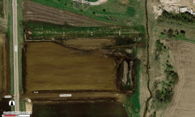

Property Detail
305 44Th St
Cedar Rapids, IA
INDUSTRIAL CENTER EAST 2ND LOTS 5 & LOT 6
15051-76010-00000
LINN
Officebuilding
Iowa
B and X Area of moderate flood hazard, usually the area between the limits of the 100-year and 500-year floods.
5,6
2024
26.90 AC
2025
Iowa City/Waterloo
000103
Other Market Areas
88,352 SF
NEARBY LISTINGS FOR SALE OR LEASE
DEMOGRAPHICS near 305 44Th St
1 mile
3 mile
5 mile
2025 Total Population
4,231
34,086
76,954
2030 Population
4,259
34,234
77,769
Pop Growth 2025-2030
+ 0.66%
+ 0.43%
+ 1.06%
Average Age
40
41
41
2025 Total Households
1,734
14,391
32,324
HH Growth 2025-2030
+ 0.58%
+ 0.54%
+ 1.07%
Median Household Inc
$76,366
$77,775
$80,906
Avg Household Size
2.40
2.30
2.30
2025 Avg HH Vehicles
2.00
2.00
2.00
Median Home Value
$226,361
$233,166
$236,312
Median Year Built
1993
1986
1979
Nearby Places
Map Layers
Map Styles
 Street
 Aerial
Layers
 Traffic
 Biking
Places
Listings with unknown addresses are not visible on the map
- Restaurants
- Banks
- Shops
- Fitness
- Groceries
PUBLIC TRANSPORTATION
AIRPORT
The Eastern Iowa
Drive
Walk
Distance
The Eastern Iowa
29 min
20.3 mi
Freight Ports
Port Milwaukee
Drive
Walk
Distance
Port Milwaukee
281 min
237.6 mi
Nearby Properties
Address
Land Use
TOTAL SIZE
Lot Size
Zoning
Address
Land Use
TOTAL SIZE
Lot Size
Zoning
4,413,839 SF
3,841.80 AC
Address
Land Use
TOTAL SIZE
Lot Size
Zoning
585,444 SF
95.41 AC
Address
Land Use
TOTAL SIZE
Lot Size
Zoning
980,058 SF
107.75 AC
Address
Land Use
TOTAL SIZE
Lot Size
Zoning
180,790 SF
24.39 AC
Address
Land Use
TOTAL SIZE
Lot Size
Zoning
22,809 SF
21.48 AC
Address
Land Use
TOTAL SIZE
Lot Size
Zoning
203,166 SF
14.16 AC
Address
Land Use
TOTAL SIZE
Lot Size
Zoning
106,317 SF
8.84 AC
Address
Land Use
TOTAL SIZE
Lot Size
Zoning
155,200 SF
32.40 AC
Address
Land Use
TOTAL SIZE
Lot Size
Zoning
50,344 SF
2.92 AC
Address
Land Use
TOTAL SIZE
Lot Size
Zoning
218,390 SF
50.24 AC
Address
Land Use
TOTAL SIZE
Lot Size
Zoning
155,200 SF
28.66 AC
Address
Land Use
TOTAL SIZE
Lot Size
Zoning
155,185 SF
171 AC
AG
Address
Land Use
TOTAL SIZE
Lot Size
Zoning
1,472,473 SF
395.89 AC
Address
Land Use
TOTAL SIZE
Lot Size
Zoning
154,687 SF
59.08 AC
Address
Land Use
TOTAL SIZE
Lot Size
Zoning
1,440 SF
82.59 AC
Address
Land Use
TOTAL SIZE
Lot Size
Zoning
92,704 SF
10.30 AC
Address
Land Use
TOTAL SIZE
Lot Size
Zoning
178,650 SF
19.02 AC
Address
Land Use
TOTAL SIZE
Lot Size
Zoning
39,051 SF
9.85 AC
Address
Land Use
TOTAL SIZE
Lot Size
Zoning
20,870 SF
28 AC
Address
Land Use
TOTAL SIZE
Lot Size
Zoning
195,744 SF
4.44 AC
Address
Land Use
TOTAL SIZE
Lot Size
Zoning
202,224 SF
81.20 AC
Address
Land Use
TOTAL SIZE
Lot Size
Zoning
202,224 SF
102.24 AC
Address
Land Use
TOTAL SIZE
Lot Size
Zoning
202,653 SF
35.12 AC
Address
Land Use
TOTAL SIZE
Lot Size
Zoning
22,068 SF
5.06 AC
Address
Land Use
TOTAL SIZE
Lot Size
Zoning
29,960 SF
45 AC
Address
Land Use
TOTAL SIZE
Lot Size
Zoning
53,994 SF
4.40 AC
Address
Land Use
TOTAL SIZE
Lot Size
Zoning
57,277 SF
6.78 AC
Address
Land Use
TOTAL SIZE
Lot Size
Zoning
110,746 SF
8.72 AC
Address
Land Use
TOTAL SIZE
Lot Size
Zoning
808,173 SF
91.74 AC
Address
Land Use
TOTAL SIZE
Lot Size
Zoning
20,710 SF
4.96 AC
The World's #1 Commercial Real Estate Marketplace
Connect with us
© 2026 CoStar Group
The information above has been obtained from sources believed reliable. While we do not doubt its accuracy we have not verified it and make no guarantee, warranty or representation about it. It is your responsibility to independently confirm its accuracy and completeness. Any projections, opinions, assumptions, or estimates used are for example only and do not represent the current or future performance of the property. The value of this transaction to you depends on tax and other factors which should be evaluated by your tax, financial, and legal advisors. You and your advisors should conduct a careful, independent investigation of the property to determine to your satisfaction the suitability of the property for your needs.