Property Record
Mccormack Ave, Sacramento, CA 95811

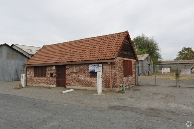

Property Detail
Mccormack Ave
Sacramento-Roseville-Folsom, CA
POR LOT 55 SIXTEENTH STREET INDUSTRIAL TRACT, EXC ANYTHING LYING NLY OF N RW OF MC CORMACK ST
001-0142-001
SACRAMENTO
Industrialacreage
California
C-4-SPD
55
2024
0.37 AC
2025
Richards
001103
Sacramento
NEARBY LISTINGS FOR SALE OR LEASE
DEMOGRAPHICS near Mccormack Ave
1 mile
3 mile
5 mile
2025 Total Population
14,173
172,371
400,801
2030 Population
14,630
176,404
408,852
Pop Growth 2025-2030
+ 3.22%
+ 2.34%
+ 2.01%
Average Age
39
39
38
2025 Total Households
5,944
72,498
157,490
HH Growth 2025-2030
+ 4.24%
+ 2.63%
+ 2.19%
Median Household Inc
$76,456
$83,134
$79,660
Avg Household Size
1.70
2.20
2.40
2025 Avg HH Vehicles
1.00
2.00
2.00
Median Home Value
$758,143
$602,176
$535,157
Median Year Built
1968
1970
1971
Nearby Places
Map Layers
Map Styles
 Street
 Aerial
Layers
 Traffic
 Biking
Places
Listings with unknown addresses are not visible on the map
- Restaurants
- Banks
- Shops
- Fitness
- Groceries
PUBLIC TRANSPORTATION
TRANSIT/SUBWAY
Alkali Flat/La Valentina (Blue Line - Sacramento Regional Transit District Light Rail (The RT))
Drive
Walk
Distance
Alkali Flat/La Valentina (Blue Line - Sacramento Regional Transit District Light Rail (The RT))
1 min
16 min
0.7 mi
Township 9 Station (Eb) (13th - Richards/Township 9 - Sacramento Regional Transit)
Drive
Walk
Distance
Township 9 Station (Eb) (13th - Richards/Township 9 - Sacramento Regional Transit)
2 min
16 min
0.9 mi
Township 9 Station (Wb) (13th - Richards/Township 9 - Sacramento Regional Transit)
Drive
Walk
Distance
Township 9 Station (Wb) (13th - Richards/Township 9 - Sacramento Regional Transit)
2 min
18 min
0.9 mi
12Th & I (Blue Line - Sacramento Regional Transit District Light Rail (The RT))
Drive
Walk
Distance
12Th & I (Blue Line - Sacramento Regional Transit District Light Rail (The RT))
2 min
19 min
1.0 mi
COMMUTER RAIL
Sacramento (Capitol Corridor - Capitol Corridor Joint Powers Authority)
Drive
Walk
Distance
Sacramento (Capitol Corridor - Capitol Corridor Joint Powers Authority)
4 min
1.7 mi
AIRPORT
Sacramento International
Drive
Walk
Distance
Sacramento International
17 min
11.5 mi
Freight Ports
Port of Stockton
Drive
Walk
Distance
Port of Stockton
57 min
48.2 mi
Nearby Properties
Address
Land Use
TOTAL SIZE
Lot Size
Zoning
Address
Land Use
TOTAL SIZE
Lot Size
Zoning
1,095,507 SF
1.39 AC
H-SPD C-2-
Address
Land Use
TOTAL SIZE
Lot Size
Zoning
5.64 AC
C-3-SPD
Address
Land Use
TOTAL SIZE
Lot Size
Zoning
10.28 AC
H
Address
Land Use
TOTAL SIZE
Lot Size
Zoning
487,483 SF
1.12 AC
C-3-SPD
Address
Land Use
TOTAL SIZE
Lot Size
Zoning
756,831 SF
1.39 AC
C-2-SPD
Address
Land Use
TOTAL SIZE
Lot Size
Zoning
399,626 SF
2.41 AC
C-3-SPD
Address
Land Use
TOTAL SIZE
Lot Size
Zoning
366,730 SF
0.89 AC
C-3-SPD
Address
Land Use
TOTAL SIZE
Lot Size
Zoning
200,616 SF
2.54 AC
C-2-SPD
Address
Land Use
TOTAL SIZE
Lot Size
Zoning
2.87 AC
C-2
Address
Land Use
TOTAL SIZE
Lot Size
Zoning
594,942 SF
2.39 AC
C-3-SPD
Address
Land Use
TOTAL SIZE
Lot Size
Zoning
10.49 AC
C-2
Address
Land Use
TOTAL SIZE
Lot Size
Zoning
676,447 SF
1.43 AC
C-3-SPD
Address
Land Use
TOTAL SIZE
Lot Size
Zoning
319,856 SF
12.27 AC
R-3-R-PUD
Address
Land Use
TOTAL SIZE
Lot Size
Zoning
193,521 SF
0.60 AC
C-3-SPD
Address
Land Use
TOTAL SIZE
Lot Size
Zoning
339,329 SF
6.40 AC
R-5-PUD-SP
Address
Land Use
TOTAL SIZE
Lot Size
Zoning
213,557 SF
2.33 AC
C-3-SPD
Address
Land Use
TOTAL SIZE
Lot Size
Zoning
226,731 SF
15.73 AC
OB-PUD
Address
Land Use
TOTAL SIZE
Lot Size
Zoning
0.65 AC
C-4-SPD
Address
Land Use
TOTAL SIZE
Lot Size
Zoning
467,970 SF
4.59 AC
W-F
Address
Land Use
TOTAL SIZE
Lot Size
Zoning
390,860 SF
20.17 AC
R-3-R-PUD
Address
Land Use
TOTAL SIZE
Lot Size
Zoning
410,420 SF
0.95 AC
C-3-SPD
Address
Land Use
TOTAL SIZE
Lot Size
Zoning
320,072 SF
2.65 AC
C-2
Address
Land Use
TOTAL SIZE
Lot Size
Zoning
318,616 SF
16.40 AC
R-2B-PUD
Address
Land Use
TOTAL SIZE
Lot Size
Zoning
R-4-PUD C-
Address
Land Use
TOTAL SIZE
Lot Size
Zoning
0.13 AC
WF
Address
Land Use
TOTAL SIZE
Lot Size
Zoning
26,712 SF
1.90 AC
R-5-PUD-SP
Address
Land Use
TOTAL SIZE
Lot Size
Zoning
26,712 SF
1.85 AC
R-5-PUD-SP
Address
Land Use
TOTAL SIZE
Lot Size
Zoning
2.88 AC
C-3-SPD
Address
Land Use
TOTAL SIZE
Lot Size
Zoning
508,916 SF
0.71 AC
C-3-SPD
Address
Land Use
TOTAL SIZE
Lot Size
Zoning
303,254 SF
10.63 AC
OB-PUD
The World's #1 Commercial Real Estate Marketplace
Connect with us
© 2026 CoStar Group
The information above has been obtained from sources believed reliable. While we do not doubt its accuracy we have not verified it and make no guarantee, warranty or representation about it. It is your responsibility to independently confirm its accuracy and completeness. Any projections, opinions, assumptions, or estimates used are for example only and do not represent the current or future performance of the property. The value of this transaction to you depends on tax and other factors which should be evaluated by your tax, financial, and legal advisors. You and your advisors should conduct a careful, independent investigation of the property to determine to your satisfaction the suitability of the property for your needs.