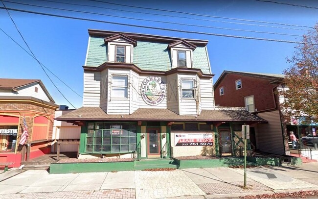
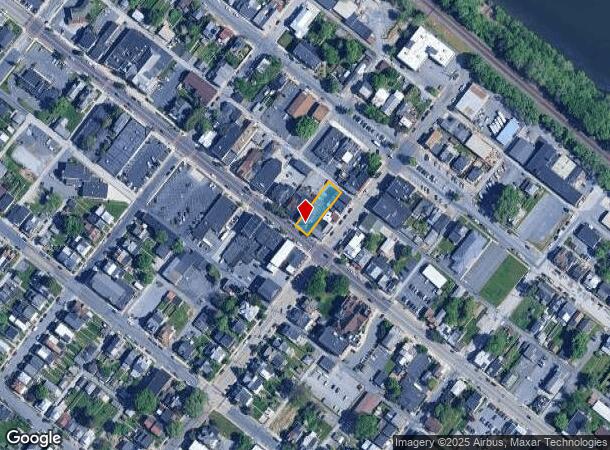
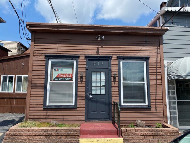
Property Record
305 Bridge St, New Cumberland, PA 17070
NEARBY LISTINGS FOR SALE OR LEASE
Property Detail
305 Bridge St
Harrisburg-Carlisle, PA
& 307 BRIDGE STREET OFFICAL PLAN LOT 143 PB2 PG 23
25-24-0813-109
Cumberland
Commercialofficeresidentialmixeduse
Pennsylvania
X
143
42041C0301F
0.17 AC
2025
Harrisburg Area West
2025
Philadelphia
010800
DEMOGRAPHICS near 305 Bridge St
1 Mile
3 Mile
5 Mile
2024 Total Population
7,962
75,446
172,889
2029 Population
8,522
78,422
179,529
Pop Growth 2024-2029
+ 7.03%
+ 3.94%
+ 3.84%
Average Age
40
38
39
2024 Total Households
3,679
30,370
71,140
HH Growth 2024-2029
+ 7.07%
+ 4.27%
+ 4.12%
Median Household Inc
$68,230
$57,801
$62,994
Avg Household Size
2.10
2.30
2.30
2024 Avg HH Vehicles
2.00
1.00
2.00
Median Home Value
$186,297
$168,998
$181,538
Median Year Built
1956
1954
1958
Nearby Places
Map Layers
Map Styles
 Street
 Aerial
- Restaurants
- Banks
- Shops
- Fitness
- Groceries
PUBLIC TRANSPORTATION
COMMUTER RAIL
DRIVE
WALK
Distance
7 min
3.6 mi
AIRPORT
Harrisburg International
DRIVE
WALK
Distance
Harrisburg International
19 min
10.6 mi
SALE & LEASE HISTORY
LISTING DATE
SALE/LEASE

May 25, 2021
For Lease
Dec 07, 2017
For Lease
Nearby Properties
Address
Land Use
TOTAL SIZE
Lot Size
Zoning
Address
Land Use
TOTAL SIZE
Lot Size
Zoning
474,282 SF
4.71 AC
Address
Land Use
TOTAL SIZE
Lot Size
Zoning
725,856 SF
2.15 AC
Address
Land Use
TOTAL SIZE
Lot Size
Zoning
372,234 SF
1.01 AC
Address
Land Use
TOTAL SIZE
Lot Size
Zoning
15,480 SF
17.80 AC
Address
Land Use
TOTAL SIZE
Lot Size
Zoning
365,162 SF
19.11 AC
Address
Land Use
TOTAL SIZE
Lot Size
Zoning
Address
Land Use
TOTAL SIZE
Lot Size
Zoning
0.67 AC
Address
Land Use
TOTAL SIZE
Lot Size
Zoning
38.26 AC
Address
Land Use
TOTAL SIZE
Lot Size
Zoning
122,301 SF
32.30 AC
Address
Land Use
TOTAL SIZE
Lot Size
Zoning
349,587 SF
0.53 AC
Address
Land Use
TOTAL SIZE
Lot Size
Zoning
307,080 SF
25 AC
Address
Land Use
TOTAL SIZE
Lot Size
Zoning
570,800 SF
1.29 AC
Address
Land Use
TOTAL SIZE
Lot Size
Zoning
91,929 SF
45.10 AC
Address
Land Use
TOTAL SIZE
Lot Size
Zoning
352,350 SF
2.90 AC
Address
Land Use
TOTAL SIZE
Lot Size
Zoning
215,800 SF
16 AC
Address
Land Use
TOTAL SIZE
Lot Size
Zoning
5,588 SF
9.29 AC
Address
Land Use
TOTAL SIZE
Lot Size
Zoning
358,680 SF
3.79 AC
Address
Land Use
TOTAL SIZE
Lot Size
Zoning
186,900 SF
Address
Land Use
TOTAL SIZE
Lot Size
Zoning
167,935 SF
0.57 AC
Address
Land Use
TOTAL SIZE
Lot Size
Zoning
218,468 SF
0.76 AC
Address
Land Use
TOTAL SIZE
Lot Size
Zoning
27,632 SF
59.50 AC
Address
Land Use
TOTAL SIZE
Lot Size
Zoning
10.55 AC
CH
Address
Land Use
TOTAL SIZE
Lot Size
Zoning
4.15 AC
Address
Land Use
TOTAL SIZE
Lot Size
Zoning
1,744 SF
21.79 AC
Address
Land Use
TOTAL SIZE
Lot Size
Zoning
12.86 AC
Address
Land Use
TOTAL SIZE
Lot Size
Zoning
24,567 SF
15.33 AC
Address
Land Use
TOTAL SIZE
Lot Size
Zoning
116,216 SF
0.77 AC
Address
Land Use
TOTAL SIZE
Lot Size
Zoning
257,615 SF
0.80 AC
Address
Land Use
TOTAL SIZE
Lot Size
Zoning
109,912 SF
1.05 AC
Address
Land Use
TOTAL SIZE
Lot Size
Zoning
159,894 SF
0.27 AC
The World's #1 Commercial Real Estate Marketplace
Connect with us
© 2025 CoStar Group
The information above has been obtained from sources believed reliable. While we do not doubt its accuracy we have not verified it and make no guarantee, warranty or representation about it. It is your responsibility to independently confirm its accuracy and completeness. Any projections, opinions, assumptions, or estimates used are for example only and do not represent the current or future performance of the property. The value of this transaction to you depends on tax and other factors which should be evaluated by your tax, financial, and legal advisors. You and your advisors should conduct a careful, independent investigation of the property to determine to your satisfaction the suitability of the property for your needs.