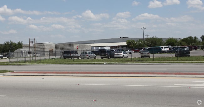
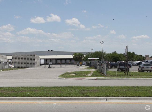
Property Record
305 E Main St, Immokalee, FL 34142

Property Detail
305 E Main St
00116720009
3 47 29 BEG AT PT 1733.6FT S OF NE COR OF SW1/4 OF NW1/4, BEING INTERS OF E LI NW1/4 OF SW1/4 + SW BDRY LI OF ACL WYE TRACK, THENCE NWLY ALG BDRY OF WYE TRACK 90.1FT TO PC, THENCE SWLY ALG BDRY ON CURVE TO LEFT 649FT TO E BDRY OF R/W OF TRACK NO 1, T
Packing
Collier
C-5-AOSD
Florida
AH Areas with a 1% annual chance of shallow flooding, usually in the form of a pond, withan average depth ranging from 1 to 3 feet. These areas have a 26% chance of flooding over the life of a 30-year mortgage.
1
2024
4.62 AC
2025
Outlying Collier County
011205
Southwest Florida
80,989 SF
Naples-Marco Island, FL
NEARBY LISTINGS FOR SALE OR LEASE
DEMOGRAPHICS near 305 E Main St
1 mile
3 mile
5 mile
2024 Total Population
4,794
18,407
21,430
2029 Population
4,782
19,018
22,173
Pop Growth 2024-2029
(0.25%)
+ 3.32%
+ 3.47%
Average Age
34
32
32
2024 Total Households
1,261
4,818
5,549
HH Growth 2024-2029
(1.67%)
+ 2.26%
+ 2.43%
Median Household Inc
$41,657
$44,870
$47,939
Avg Household Size
3.30
3.40
3.50
2024 Avg HH Vehicles
1.00
2.00
2.00
Median Home Value
$217,273
$221,814
$247,395
Median Year Built
1989
1989
1991
Nearby Places
Map Layers
Map Styles
 Street
 Aerial
Transit
 Traffic
 Biking
Places
Listings with unknown addresses are not visible on the map
- Restaurants
- Banks
- Shops
- Fitness
- Groceries
PUBLIC TRANSPORTATION
AIRPORT
Southwest Florida International
Drive
Walk
Distance
Southwest Florida International
43 min
29.3 mi
Freight Ports
Port Everglades
Drive
Walk
Distance
Port Everglades
115 min
99.4 mi
Nearby Properties
Address
Land Use
TOTAL SIZE
Lot Size
Zoning
Address
Land Use
TOTAL SIZE
Lot Size
Zoning
217,887 SF
564.45 AC
A-MHO
Address
Land Use
TOTAL SIZE
Lot Size
Zoning
243,268 SF
43.41 AC
RSF-3
Address
Land Use
TOTAL SIZE
Lot Size
Zoning
467,375 SF
79.87 AC
RMF-6
Address
Land Use
TOTAL SIZE
Lot Size
Zoning
150,228 SF
172.69 AC
I
Address
Land Use
TOTAL SIZE
Lot Size
Zoning
139,063 SF
22.83 AC
RSF-3
Address
Land Use
TOTAL SIZE
Lot Size
Zoning
182,696 SF
12.78 AC
MPUD
Address
Land Use
TOTAL SIZE
Lot Size
Zoning
59,982 SF
23.58 AC
A-MHO
Address
Land Use
TOTAL SIZE
Lot Size
Zoning
39,880 SF
6.52 AC
RMF-6
Address
Land Use
TOTAL SIZE
Lot Size
Zoning
152,819 SF
17.50 AC
I-FMOSD
Address
Land Use
TOTAL SIZE
Lot Size
Zoning
336.06 AC
AOPUD
Address
Land Use
TOTAL SIZE
Lot Size
Zoning
39,087 SF
3.47 AC
C-4-MSOSD
Address
Land Use
TOTAL SIZE
Lot Size
Zoning
80,165 SF
20 AC
A-MHO
Address
Land Use
TOTAL SIZE
Lot Size
Zoning
74,473 SF
10.29 AC
VR
Address
Land Use
TOTAL SIZE
Lot Size
Zoning
38,837 SF
9.41 AC
PUD
Address
Land Use
TOTAL SIZE
Lot Size
Zoning
40,862 SF
6.57 AC
PUD
Address
Land Use
TOTAL SIZE
Lot Size
Zoning
90,082 SF
9.37 AC
MPUD
Address
Land Use
TOTAL SIZE
Lot Size
Zoning
25,308 SF
5.96 AC
PUD
Address
Land Use
TOTAL SIZE
Lot Size
Zoning
33,530 SF
3.83 AC
PUD
Address
Land Use
TOTAL SIZE
Lot Size
Zoning
45,799 SF
8.70 AC
RMF-6
Address
Land Use
TOTAL SIZE
Lot Size
Zoning
59,859 SF
18.04 AC
RMF-6
Address
Land Use
TOTAL SIZE
Lot Size
Zoning
20,484 SF
3.03 AC
C-5-AOSD
Address
Land Use
TOTAL SIZE
Lot Size
Zoning
4,719 SF
2.95 AC
C-4-MSOSD
Address
Land Use
TOTAL SIZE
Lot Size
Zoning
78,445 SF
6.40 AC
RMF-16
Address
Land Use
TOTAL SIZE
Lot Size
Zoning
20,566 SF
7.42 AC
C-4-MSOSD
Address
Land Use
TOTAL SIZE
Lot Size
Zoning
48,224 SF
4 AC
I
Address
Land Use
TOTAL SIZE
Lot Size
Zoning
27,951 SF
7.95 AC
RSF3
Address
Land Use
TOTAL SIZE
Lot Size
Zoning
91,633 SF
45.30 AC
I
Address
Land Use
TOTAL SIZE
Lot Size
Zoning
93,715 SF
8.97 AC
PUD
Address
Land Use
TOTAL SIZE
Lot Size
Zoning
22,386 SF
5.66 AC
Address
Land Use
TOTAL SIZE
Lot Size
Zoning
20,525 SF
4.91 AC
C1
The World's #1 Commercial Real Estate Marketplace
Connect with us
© 2026 CoStar Group
The information above has been obtained from sources believed reliable. While we do not doubt its accuracy we have not verified it and make no guarantee, warranty or representation about it. It is your responsibility to independently confirm its accuracy and completeness. Any projections, opinions, assumptions, or estimates used are for example only and do not represent the current or future performance of the property. The value of this transaction to you depends on tax and other factors which should be evaluated by your tax, financial, and legal advisors. You and your advisors should conduct a careful, independent investigation of the property to determine to your satisfaction the suitability of the property for your needs.