Property Record
305 Glen Dr, Manchester, PA 17345


NEARBY LISTINGS FOR SALE OR LEASE
Property Detail
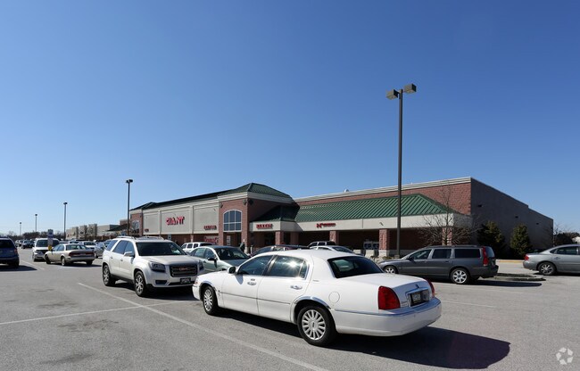
305 Glen Dr
26-000-MI-0127.00-00000
Preliminary Final Subdivision Plan
Stripcommercialcenter
LOT 3; PB 1950-2017
X
York
42133C0211F
Pennsylvania
2025
10.68 AC
2025
York County
021020
Philadelphia
62,664 SF
York-Hanover, PA
DEMOGRAPHICS near 305 Glen Dr
1 Mile
3 Mile
5 Mile
2024 Total Population
2,296
22,650
61,086
2029 Population
2,356
23,207
62,770
Pop Growth 2024-2029
+ 2.61%
+ 2.46%
+ 2.76%
Average Age
41
40
40
2024 Total Households
893
8,494
23,488
HH Growth 2024-2029
+ 2.58%
+ 2.47%
+ 2.79%
Median Household Inc
$81,724
$87,048
$79,581
Avg Household Size
2.50
2.60
2.50
2024 Avg HH Vehicles
2.00
2.00
2.00
Median Home Value
$179,058
$196,284
$197,189
Median Year Built
1992
1984
1981
Nearby Places
Map Layers
Map Styles
 Street
 Aerial
- Restaurants
- Banks
- Shops
- Fitness
- Groceries
PUBLIC TRANSPORTATION
AIRPORT
Harrisburg International
DRIVE
WALK
Distance
Harrisburg International
38 min
27.6 mi
Freight Ports
Port of Baltimore
DRIVE
WALK
Distance
Port of Baltimore
88 min
62.4 mi
SALE & LEASE HISTORY
LISTING DATE
SALE/LEASE

Sep 25, 2016
For Lease
Oct 18, 2017
For Lease
Nearby Properties
Address
Land Use
TOTAL SIZE
Lot Size
Zoning
Address
Land Use
TOTAL SIZE
Lot Size
Zoning
93.42 AC
Address
Land Use
TOTAL SIZE
Lot Size
Zoning
2,285 SF
121.20 AC
RS
Address
Land Use
TOTAL SIZE
Lot Size
Zoning
1,456 SF
97.78 AC
AG
Address
Land Use
TOTAL SIZE
Lot Size
Zoning
1,344 SF
274.50 AC
ID
Address
Land Use
TOTAL SIZE
Lot Size
Zoning
299,254 SF
Address
Land Use
TOTAL SIZE
Lot Size
Zoning
89.58 AC
ID
Address
Land Use
TOTAL SIZE
Lot Size
Zoning
603,000 SF
56.64 AC
AG
Address
Land Use
TOTAL SIZE
Lot Size
Zoning
1,120 SF
67.19 AC
ID
Address
Land Use
TOTAL SIZE
Lot Size
Zoning
216,544 SF
Address
Land Use
TOTAL SIZE
Lot Size
Zoning
708,000 SF
55.49 AC
I
Address
Land Use
TOTAL SIZE
Lot Size
Zoning
624,000 SF
50.30 AC
AG
Address
Land Use
TOTAL SIZE
Lot Size
Zoning
378,090 SF
38.70 AC
I
Address
Land Use
TOTAL SIZE
Lot Size
Zoning
496,062 SF
45.60 AC
I
Address
Land Use
TOTAL SIZE
Lot Size
Zoning
390,000 SF
32.13 AC
RS
Address
Land Use
TOTAL SIZE
Lot Size
Zoning
1,716 SF
11.30 AC
RS
Address
Land Use
TOTAL SIZE
Lot Size
Zoning
390,619 SF
46.36 AC
I
Address
Land Use
TOTAL SIZE
Lot Size
Zoning
342,160 SF
33.54 AC
I
Address
Land Use
TOTAL SIZE
Lot Size
Zoning
28.77 AC
I
Address
Land Use
TOTAL SIZE
Lot Size
Zoning
23.72 AC
AG
Address
Land Use
TOTAL SIZE
Lot Size
Zoning
193,025 SF
32.22 AC
I
Address
Land Use
TOTAL SIZE
Lot Size
Zoning
265,645 SF
18.19 AC
I
Address
Land Use
TOTAL SIZE
Lot Size
Zoning
12.12 AC
Address
Land Use
TOTAL SIZE
Lot Size
Zoning
14.22 AC
Address
Land Use
TOTAL SIZE
Lot Size
Zoning
40.04 AC
AG
Address
Land Use
TOTAL SIZE
Lot Size
Zoning
11.22 AC
Address
Land Use
TOTAL SIZE
Lot Size
Zoning
340,000 SF
24.63 AC
I
Address
Land Use
TOTAL SIZE
Lot Size
Zoning
15.88 AC
AG
Address
Land Use
TOTAL SIZE
Lot Size
Zoning
15.55 AC
I
Address
Land Use
TOTAL SIZE
Lot Size
Zoning
148,263 SF
36.42 AC
I
Address
Land Use
TOTAL SIZE
Lot Size
Zoning
174,733 SF
The World's #1 Commercial Real Estate Marketplace
Connect with us
© 2025 CoStar Group
The information above has been obtained from sources believed reliable. While we do not doubt its accuracy we have not verified it and make no guarantee, warranty or representation about it. It is your responsibility to independently confirm its accuracy and completeness. Any projections, opinions, assumptions, or estimates used are for example only and do not represent the current or future performance of the property. The value of this transaction to you depends on tax and other factors which should be evaluated by your tax, financial, and legal advisors. You and your advisors should conduct a careful, independent investigation of the property to determine to your satisfaction the suitability of the property for your needs.