Property Record
305 N Rice St, Hamilton, TX 76531
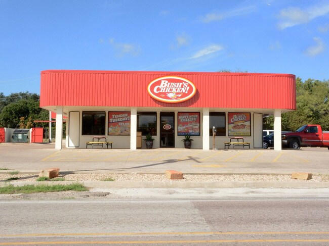

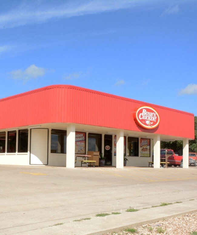
Property Detail
305 N Rice St
R17506
677 A PARKS 110X150
Commercialnec
Hamilton
2025
Texas
2025
0.21 AC
950300
Hamilton
8,658 SF
Other Market Areas
NEARBY LISTINGS FOR SALE OR LEASE
-
-
View all Hamilton listings for sale on LoopNet.com
DEMOGRAPHICS near 305 N Rice St
1 mile
3 mile
5 mile
2025 Total Population
2,907
3,717
3,974
2030 Population
3,091
3,949
4,218
Pop Growth 2025-2030
+ 6.33%
+ 6.24%
+ 6.14%
Average Age
43
44
44
2025 Total Households
1,217
1,553
1,660
HH Growth 2025-2030
+ 6.16%
+ 6.05%
+ 5.90%
Median Household Inc
$49,734
$49,494
$49,536
Avg Household Size
2.30
2.30
2.30
2025 Avg HH Vehicles
2.00
2.00
2.00
Median Home Value
$116,889
$120,496
$123,500
Median Year Built
1971
1971
1972
Nearby Places
Map Layers
Map Styles
 Street
 Aerial
Transit
 Traffic
 Biking
Places
Listings with unknown addresses are not visible on the map
- Restaurants
- Banks
- Shops
- Fitness
- Groceries
SALE & LEASE HISTORY
LISTING DATE
SALE/LEASE

Oct 28, 2016
For Sale
Oct 28, 2016
For Sale
Oct 24, 2017
For Lease
Oct 19, 2017
For Sale
Nov 15, 2017
For Sale
Nov 01, 2017
For Sale
Dec 04, 2017
For Sale
Nearby Properties
Address
Land Use
TOTAL SIZE
Lot Size
Zoning
Address
Land Use
TOTAL SIZE
Lot Size
Zoning
88,157 SF
0.26 AC
Address
Land Use
TOTAL SIZE
Lot Size
Zoning
79,153 SF
5 AC
Address
Land Use
TOTAL SIZE
Lot Size
Zoning
893.30 AC
Address
Land Use
TOTAL SIZE
Lot Size
Zoning
16,108 SF
0.40 AC
Address
Land Use
TOTAL SIZE
Lot Size
Zoning
27,525 SF
0.01 AC
Address
Land Use
TOTAL SIZE
Lot Size
Zoning
39,000 SF
0.80 AC
Address
Land Use
TOTAL SIZE
Lot Size
Zoning
29,140 SF
3.17 AC
Address
Land Use
TOTAL SIZE
Lot Size
Zoning
60,977 SF
2 AC
Address
Land Use
TOTAL SIZE
Lot Size
Zoning
32,440 SF
3.18 AC
Address
Land Use
TOTAL SIZE
Lot Size
Zoning
48,781 SF
2.50 AC
Address
Land Use
TOTAL SIZE
Lot Size
Zoning
106,820 SF
5.80 AC
Address
Land Use
TOTAL SIZE
Lot Size
Zoning
960 SF
259.69 AC
Address
Land Use
TOTAL SIZE
Lot Size
Zoning
9,200 SF
0.04 AC
Address
Land Use
TOTAL SIZE
Lot Size
Zoning
24,200 SF
0.51 AC
Address
Land Use
TOTAL SIZE
Lot Size
Zoning
5,440 SF
331 AC
Address
Land Use
TOTAL SIZE
Lot Size
Zoning
720 SF
326.20 AC
Address
Land Use
TOTAL SIZE
Lot Size
Zoning
15,900 SF
1.42 AC
Address
Land Use
TOTAL SIZE
Lot Size
Zoning
89,124 SF
4.99 AC
Address
Land Use
TOTAL SIZE
Lot Size
Zoning
37,376 SF
0.52 AC
Address
Land Use
TOTAL SIZE
Lot Size
Zoning
4,800 SF
256 AC
Address
Land Use
TOTAL SIZE
Lot Size
Zoning
10,000 SF
0.08 AC
Address
Land Use
TOTAL SIZE
Lot Size
Zoning
9,020 SF
0.48 AC
Address
Land Use
TOTAL SIZE
Lot Size
Zoning
32,270 SF
2.39 AC
Address
Land Use
TOTAL SIZE
Lot Size
Zoning
12,537 SF
0.34 AC
Address
Land Use
TOTAL SIZE
Lot Size
Zoning
69,026 SF
5 AC
Address
Land Use
TOTAL SIZE
Lot Size
Zoning
17,228 SF
0.52 AC
Address
Land Use
TOTAL SIZE
Lot Size
Zoning
5,550 SF
125.36 AC
Address
Land Use
TOTAL SIZE
Lot Size
Zoning
1,500 SF
159 AC
Address
Land Use
TOTAL SIZE
Lot Size
Zoning
5,400 SF
198.20 AC
Address
Land Use
TOTAL SIZE
Lot Size
Zoning
210.03 AC
The World's #1 Commercial Real Estate Marketplace
Connect with us
© 2026 CoStar Group
The information above has been obtained from sources believed reliable. While we do not doubt its accuracy we have not verified it and make no guarantee, warranty or representation about it. It is your responsibility to independently confirm its accuracy and completeness. Any projections, opinions, assumptions, or estimates used are for example only and do not represent the current or future performance of the property. The value of this transaction to you depends on tax and other factors which should be evaluated by your tax, financial, and legal advisors. You and your advisors should conduct a careful, independent investigation of the property to determine to your satisfaction the suitability of the property for your needs.