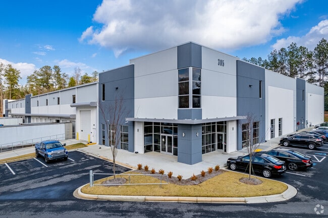
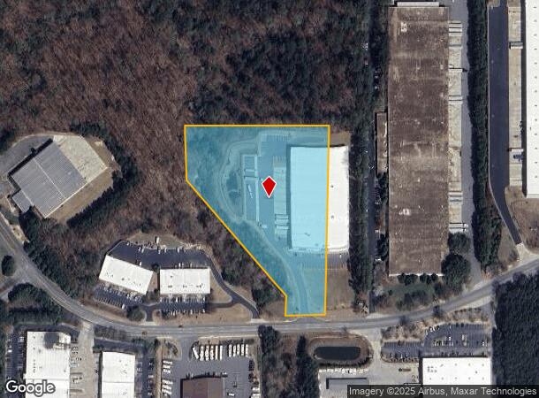
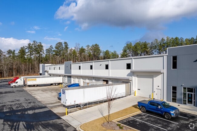
Property Record
305 Northpoint Pkwy Se, Acworth, GA 30102
NEARBY LISTINGS FOR SALE OR LEASE
Property Detail
305 Northpoint Pkwy Se
0117-1242-002
Com - Acworth
Industrialgeneral
TRACTS E K P/O 11 INERGROUP
X
Bartow
13057C0308E
Georgia
2024
7.71 AC
2025
Kennesaw/Acworth
091104
Atlanta
78,370 SF
Atlanta-Sandy Springs-Roswell, GA
DEMOGRAPHICS near 305 Northpoint Pkwy Se
1 Mile
3 Mile
5 Mile
2024 Total Population
3,897
47,543
118,134
2029 Population
4,155
50,503
124,673
Pop Growth 2024-2029
+ 6.62%
+ 6.23%
+ 5.54%
Average Age
38
39
39
2024 Total Households
1,466
17,320
42,969
HH Growth 2024-2029
+ 6.21%
+ 6.09%
+ 5.47%
Median Household Inc
$66,641
$82,916
$83,821
Avg Household Size
2.60
2.70
2.70
2024 Avg HH Vehicles
2.00
2.00
2.00
Median Home Value
$216,379
$265,875
$272,190
Median Year Built
1996
1995
1994
Nearby Places
Map Layers
Map Styles
 Street
 Aerial
- Restaurants
- Banks
- Shops
- Fitness
- Groceries
PUBLIC TRANSPORTATION
AIRPORT
Hartsfield - Jackson Atlanta International
DRIVE
WALK
Distance
Hartsfield - Jackson Atlanta International
53 min
39.7 mi
SALE & LEASE HISTORY
LISTING DATE
SALE/LEASE

Oct 02, 2019
For Lease
Nearby Properties
Address
Land Use
TOTAL SIZE
Lot Size
Zoning
Address
Land Use
TOTAL SIZE
Lot Size
Zoning
1,120 SF
42.20 AC
HI
Address
Land Use
TOTAL SIZE
Lot Size
Zoning
1,215,766 SF
39.92 AC
LI
Address
Land Use
TOTAL SIZE
Lot Size
Zoning
174,960 SF
3.99 AC
MU
Address
Land Use
TOTAL SIZE
Lot Size
Zoning
130,605 SF
21.38 AC
GC
Address
Land Use
TOTAL SIZE
Lot Size
Zoning
225,382 SF
18.67 AC
RM-8
Address
Land Use
TOTAL SIZE
Lot Size
Zoning
28,398 SF
22.95 AC
C1
Address
Land Use
TOTAL SIZE
Lot Size
Zoning
350,984 SF
23.10 AC
LI
Address
Land Use
TOTAL SIZE
Lot Size
Zoning
200,596 SF
16.04 AC
RM-8
Address
Land Use
TOTAL SIZE
Lot Size
Zoning
311,900 SF
24.69 AC
LI
Address
Land Use
TOTAL SIZE
Lot Size
Zoning
12,032 SF
17.14 AC
RM16
Address
Land Use
TOTAL SIZE
Lot Size
Zoning
195,600 SF
14.59 AC
LI
Address
Land Use
TOTAL SIZE
Lot Size
Zoning
652,178 SF
11.14 AC
LI
Address
Land Use
TOTAL SIZE
Lot Size
Zoning
128,292 SF
56.66 AC
I1
Address
Land Use
TOTAL SIZE
Lot Size
Zoning
138,482 SF
28.14 AC
R-40
Address
Land Use
TOTAL SIZE
Lot Size
Zoning
303,860 SF
LI
Address
Land Use
TOTAL SIZE
Lot Size
Zoning
107,514 SF
16.17 AC
LI
Address
Land Use
TOTAL SIZE
Lot Size
Zoning
156,945 SF
18.03 AC
RM-8
Address
Land Use
TOTAL SIZE
Lot Size
Zoning
216,432 SF
16.79 AC
LI
Address
Land Use
TOTAL SIZE
Lot Size
Zoning
61,867 SF
4 AC
Address
Land Use
TOTAL SIZE
Lot Size
Zoning
86,180 SF
54.76 AC
GC
Address
Land Use
TOTAL SIZE
Lot Size
Zoning
416,760 SF
12.74 AC
LI
Address
Land Use
TOTAL SIZE
Lot Size
Zoning
212,290 SF
17.54 AC
Address
Land Use
TOTAL SIZE
Lot Size
Zoning
258,400 SF
19.55 AC
Address
Land Use
TOTAL SIZE
Lot Size
Zoning
69,249 SF
2.96 AC
MU
Address
Land Use
TOTAL SIZE
Lot Size
Zoning
1,186 SF
3.74 AC
Address
Land Use
TOTAL SIZE
Lot Size
Zoning
104,247 SF
16.45 AC
GC
Address
Land Use
TOTAL SIZE
Lot Size
Zoning
2,016 SF
12.29 AC
HI
Address
Land Use
TOTAL SIZE
Lot Size
Zoning
166,200 SF
14.51 AC
C2
Address
Land Use
TOTAL SIZE
Lot Size
Zoning
108,860 SF
10.98 AC
LI
Address
Land Use
TOTAL SIZE
Lot Size
Zoning
33,504 SF
4.79 AC
SLC
The World's #1 Commercial Real Estate Marketplace
Connect with us
© 2026 CoStar Group
The information above has been obtained from sources believed reliable. While we do not doubt its accuracy we have not verified it and make no guarantee, warranty or representation about it. It is your responsibility to independently confirm its accuracy and completeness. Any projections, opinions, assumptions, or estimates used are for example only and do not represent the current or future performance of the property. The value of this transaction to you depends on tax and other factors which should be evaluated by your tax, financial, and legal advisors. You and your advisors should conduct a careful, independent investigation of the property to determine to your satisfaction the suitability of the property for your needs.