Property Record
305 S Interstate 35 E, Desoto, TX 75115
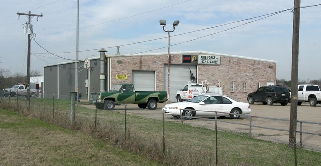


Property Detail
305 S Interstate 35 E
200009200A0010000
ARME BLK A LT 1 ACS 0.9986 VOL2003163/2018 DD08012003 CO-DC 0009200A00100 2200009200A
Warehouse
DALLAS
Z210
Texas
B and X Area of moderate flood hazard, usually the area between the limits of the 100-year and 500-year floods.
1
2024
1 AC
2025
SW Dallas/US 67
016627
Dallas/Ft Worth
4,800 SF
Dallas-Fort Worth-Arlington, TX
NEARBY LISTINGS FOR SALE OR LEASE
DEMOGRAPHICS near 305 S Interstate 35 E
1 mile
3 mile
5 mile
2025 Total Population
4,959
66,889
154,040
2030 Population
5,138
68,816
162,629
Pop Growth 2025-2030
+ 3.61%
+ 2.88%
+ 5.58%
Average Age
39
38
38
2025 Total Households
1,638
23,157
52,122
HH Growth 2025-2030
+ 3.60%
+ 2.79%
+ 5.53%
Median Household Inc
$87,500
$69,827
$74,575
Avg Household Size
2.90
2.80
2.90
2025 Avg HH Vehicles
2.00
2.00
2.00
Median Home Value
$257,565
$273,050
$296,059
Median Year Built
1990
1992
1995
Nearby Places
Map Layers
Map Styles
 Street
 Aerial
Layers
 Traffic
 Biking
Places
Listings with unknown addresses are not visible on the map
- Restaurants
- Banks
- Shops
- Fitness
- Groceries
PUBLIC TRANSPORTATION
AIRPORT
Dallas Love Field
Drive
Walk
Distance
Dallas Love Field
33 min
21.3 mi
Dallas-Fort Worth International
Drive
Walk
Distance
Dallas-Fort Worth International
46 min
35.0 mi
Nearby Properties
Address
Land Use
TOTAL SIZE
Lot Size
Zoning
Address
Land Use
TOTAL SIZE
Lot Size
Zoning
872,640 SF
46.97 AC
Z125
Address
Land Use
TOTAL SIZE
Lot Size
Zoning
123,880 SF
16.80 AC
Z236
Address
Land Use
TOTAL SIZE
Lot Size
Zoning
610,806 SF
33.66 AC
Z125
Address
Land Use
TOTAL SIZE
Lot Size
Zoning
610,806 SF
34.20 AC
Z125
Address
Land Use
TOTAL SIZE
Lot Size
Zoning
507,318 SF
28.40 AC
Z111
Address
Land Use
TOTAL SIZE
Lot Size
Zoning
552,200 SF
41.36 AC
Z109
Address
Land Use
TOTAL SIZE
Lot Size
Zoning
610,669 SF
41.65 AC
Z125
Address
Land Use
TOTAL SIZE
Lot Size
Zoning
227,423 SF
13.86 AC
Z236
Address
Land Use
TOTAL SIZE
Lot Size
Zoning
281,669 SF
16.02 AC
Z312
Address
Land Use
TOTAL SIZE
Lot Size
Zoning
453,600 SF
29.54 AC
Z236
Address
Land Use
TOTAL SIZE
Lot Size
Zoning
406,400 SF
22.15 AC
Z125
Address
Land Use
TOTAL SIZE
Lot Size
Zoning
253,794 SF
10.23 AC
Z201
Address
Land Use
TOTAL SIZE
Lot Size
Zoning
350,904 SF
18.46 AC
Z111
Address
Land Use
TOTAL SIZE
Lot Size
Zoning
140,590 SF
4.90 AC
Z236
Address
Land Use
TOTAL SIZE
Lot Size
Zoning
190,592 SF
101.54 AC
Z370
Address
Land Use
TOTAL SIZE
Lot Size
Zoning
473,176 SF
24.02 AC
Address
Land Use
TOTAL SIZE
Lot Size
Zoning
209,742 SF
9.45 AC
Z175
Address
Land Use
TOTAL SIZE
Lot Size
Zoning
206,992 SF
14.25 AC
Z188
Address
Land Use
TOTAL SIZE
Lot Size
Zoning
210,008 SF
8.53 AC
Z175
Address
Land Use
TOTAL SIZE
Lot Size
Zoning
94,407 SF
11.68 AC
Z239
Address
Land Use
TOTAL SIZE
Lot Size
Zoning
55,213 SF
11.83 AC
Z197
Address
Land Use
TOTAL SIZE
Lot Size
Zoning
298,000 SF
21.24 AC
Z175
Address
Land Use
TOTAL SIZE
Lot Size
Zoning
161,008 SF
10.62 AC
Z188
Address
Land Use
TOTAL SIZE
Lot Size
Zoning
383 SF
56.48 AC
Z07
Address
Land Use
TOTAL SIZE
Lot Size
Zoning
169,164 SF
10.79 AC
Z187
Address
Land Use
TOTAL SIZE
Lot Size
Zoning
191,240 SF
13.73 AC
Z109
Address
Land Use
TOTAL SIZE
Lot Size
Zoning
215,220 SF
11.95 AC
Address
Land Use
TOTAL SIZE
Lot Size
Zoning
210,202 SF
10.29 AC
Z111
Address
Land Use
TOTAL SIZE
Lot Size
Zoning
182,220 SF
9.25 AC
Z175
Address
Land Use
TOTAL SIZE
Lot Size
Zoning
109,500 SF
12.13 AC
Z370
The World's #1 Commercial Real Estate Marketplace
Connect with us
© 2026 CoStar Group
The information above has been obtained from sources believed reliable. While we do not doubt its accuracy we have not verified it and make no guarantee, warranty or representation about it. It is your responsibility to independently confirm its accuracy and completeness. Any projections, opinions, assumptions, or estimates used are for example only and do not represent the current or future performance of the property. The value of this transaction to you depends on tax and other factors which should be evaluated by your tax, financial, and legal advisors. You and your advisors should conduct a careful, independent investigation of the property to determine to your satisfaction the suitability of the property for your needs.