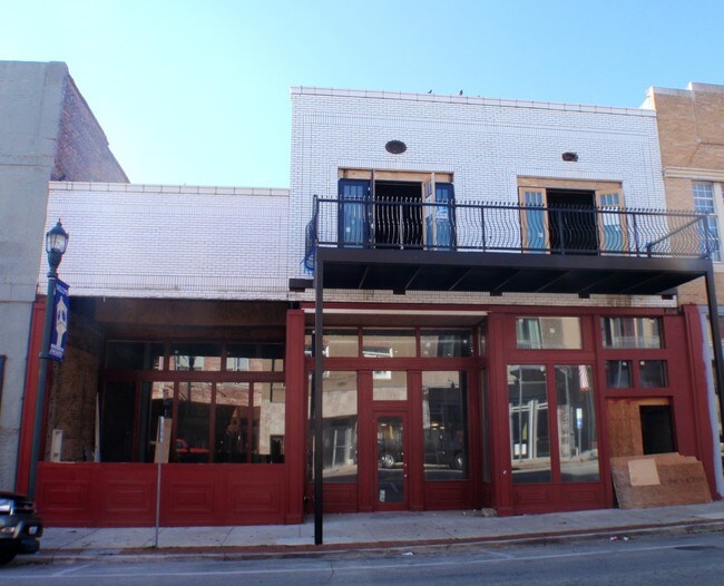
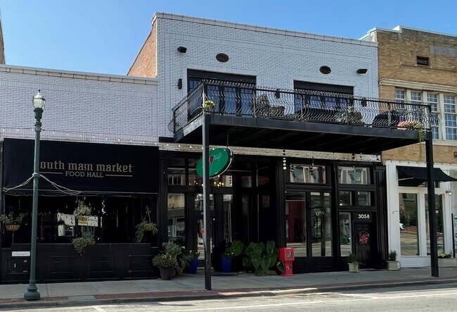
Property Record
305 S Main St, Jonesboro, AR 72401
NEARBY LISTINGS FOR SALE OR LEASE
Property Detail
305 S Main St
Jonesboro, AR
305 Main St Horizontal Regime
01-144183-48301
LEGAL WAS ROBERSTONS ADDN OF FLIINT BLK 14 LOT 3,4
Apartment
Craighead
X
Arkansas
05031C0254D
a
2024
0.12 AC
2025
Downtown Jonesboro
000101
Other Market Areas
8,784 SF
DEMOGRAPHICS near 305 S Main St
1 Mile
3 Mile
5 Mile
2024 Total Population
10,819
45,113
79,661
2029 Population
11,656
48,197
85,053
Pop Growth 2024-2029
+ 7.74%
+ 6.84%
+ 6.77%
Average Age
36
37
37
2024 Total Households
4,278
17,632
31,386
HH Growth 2024-2029
+ 8.09%
+ 7.02%
+ 6.82%
Median Household Inc
$31,897
$37,640
$46,870
Avg Household Size
2.30
2.30
2.40
2024 Avg HH Vehicles
2.00
2.00
2.00
Median Home Value
$160,302
$175,848
$185,785
Median Year Built
1977
1984
1992
Nearby Places
Map Layers
Map Styles
 Street
 Aerial
- Restaurants
- Banks
- Shops
- Fitness
- Groceries
SALE & LEASE HISTORY
LISTING DATE
SALE/LEASE

Sep 24, 2016
For Sale
Oct 26, 2018
For Lease
Oct 14, 2021
For Sale
Mar 31, 2017
For Sale
Mar 18, 2022
For Lease
Feb 21, 2017
For Sale
Feb 21, 2017
For Lease
Nearby Properties
Address
Land Use
TOTAL SIZE
Lot Size
Zoning
Address
Land Use
TOTAL SIZE
Lot Size
Zoning
38,357 SF
5.41 AC
Address
Land Use
TOTAL SIZE
Lot Size
Zoning
353,512 SF
15.01 AC
Address
Land Use
TOTAL SIZE
Lot Size
Zoning
45,783 SF
346.92 AC
Address
Land Use
TOTAL SIZE
Lot Size
Zoning
61,868 SF
15.69 AC
Address
Land Use
TOTAL SIZE
Lot Size
Zoning
56,279 SF
8.37 AC
Address
Land Use
TOTAL SIZE
Lot Size
Zoning
219,080 SF
10.93 AC
Address
Land Use
TOTAL SIZE
Lot Size
Zoning
141,878 SF
8.30 AC
Address
Land Use
TOTAL SIZE
Lot Size
Zoning
18,470 SF
1.54 AC
Address
Land Use
TOTAL SIZE
Lot Size
Zoning
120,208 SF
10.21 AC
Address
Land Use
TOTAL SIZE
Lot Size
Zoning
152,814 SF
13.62 AC
Address
Land Use
TOTAL SIZE
Lot Size
Zoning
82,744 SF
29.39 AC
Address
Land Use
TOTAL SIZE
Lot Size
Zoning
Address
Land Use
TOTAL SIZE
Lot Size
Zoning
65,020 SF
0.30 AC
Address
Land Use
TOTAL SIZE
Lot Size
Zoning
29,766 SF
2.41 AC
Address
Land Use
TOTAL SIZE
Lot Size
Zoning
79,649 SF
2.71 AC
Address
Land Use
TOTAL SIZE
Lot Size
Zoning
62,735 SF
5.05 AC
Address
Land Use
TOTAL SIZE
Lot Size
Zoning
104,717 SF
8.70 AC
Address
Land Use
TOTAL SIZE
Lot Size
Zoning
68,081 SF
1.90 AC
Address
Land Use
TOTAL SIZE
Lot Size
Zoning
47,512 SF
6.98 AC
Address
Land Use
TOTAL SIZE
Lot Size
Zoning
10,080 SF
2.88 AC
Address
Land Use
TOTAL SIZE
Lot Size
Zoning
60,004 SF
2.61 AC
Address
Land Use
TOTAL SIZE
Lot Size
Zoning
62,340 SF
6.78 AC
Address
Land Use
TOTAL SIZE
Lot Size
Zoning
49,568 SF
14 AC
Address
Land Use
TOTAL SIZE
Lot Size
Zoning
183,410 SF
16.48 AC
Address
Land Use
TOTAL SIZE
Lot Size
Zoning
150,439 SF
12.68 AC
Address
Land Use
TOTAL SIZE
Lot Size
Zoning
78,234 SF
4.12 AC
Address
Land Use
TOTAL SIZE
Lot Size
Zoning
66,624 SF
5 AC
Address
Land Use
TOTAL SIZE
Lot Size
Zoning
69,840 SF
7.73 AC
Address
Land Use
TOTAL SIZE
Lot Size
Zoning
18,550 SF
1.45 AC
Address
Land Use
TOTAL SIZE
Lot Size
Zoning
71,040 SF
3.09 AC
The World's #1 Commercial Real Estate Marketplace
Connect with us
© 2025 CoStar Group
The information above has been obtained from sources believed reliable. While we do not doubt its accuracy we have not verified it and make no guarantee, warranty or representation about it. It is your responsibility to independently confirm its accuracy and completeness. Any projections, opinions, assumptions, or estimates used are for example only and do not represent the current or future performance of the property. The value of this transaction to you depends on tax and other factors which should be evaluated by your tax, financial, and legal advisors. You and your advisors should conduct a careful, independent investigation of the property to determine to your satisfaction the suitability of the property for your needs.