Property Record
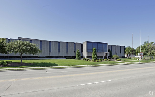
305 W Delavan Dr, Janesville, WI 53546

NEARBY LISTINGS FOR SALE OR LEASE
Property Detail
305 W Delavan Dr
Janesville-Beloit, WI
Willow Grange Addition
040-1200384
PT NE1/4 SEC 1-2-12 BND N BYW DELAVAN DR, E BY OGDENST, S BY SOO LN RR, W BY LN9.5' E OF C/L CNW RR. ALSOLOTS 1-9 & UNNUMBERE
Sfr
Rock
X
Wisconsin
55105C0192E
1-9
2024
9.10 AC
2024
Rock County
001000
Milwaukee/Madison
DEMOGRAPHICS near 305 W Delavan Dr
1 Mile
3 Mile
5 Mile
2024 Total Population
5,989
44,309
65,582
2029 Population
6,057
44,691
66,217
Pop Growth 2024-2029
+ 1.14%
+ 0.86%
+ 0.97%
Average Age
37
40
41
2024 Total Households
2,407
18,634
27,424
HH Growth 2024-2029
+ 1.12%
+ 0.91%
+ 1.00%
Median Household Inc
$49,012
$62,231
$64,530
Avg Household Size
2.40
2.30
2.30
2024 Avg HH Vehicles
2.00
2.00
2.00
Median Home Value
$131,715
$162,501
$180,237
Median Year Built
1948
1963
1971
Nearby Places
Map Layers
Map Styles
 Street
 Aerial
- Restaurants
- Banks
- Shops
- Fitness
- Groceries
Nearby Properties
Address
Land Use
TOTAL SIZE
Lot Size
Zoning
Address
Land Use
TOTAL SIZE
Lot Size
Zoning
2,580 SF
122.77 AC
M1
Address
Land Use
TOTAL SIZE
Lot Size
Zoning
56.41 AC
M2
Address
Land Use
TOTAL SIZE
Lot Size
Zoning
700,000 SF
50.74 AC
M1
Address
Land Use
TOTAL SIZE
Lot Size
Zoning
32,518 SF
26.74 AC
B4
Address
Land Use
TOTAL SIZE
Lot Size
Zoning
31,064 SF
11.57 AC
R3
Address
Land Use
TOTAL SIZE
Lot Size
Zoning
12,620 SF
8.05 AC
R3
Address
Land Use
TOTAL SIZE
Lot Size
Zoning
48,110 SF
13.04 AC
R3
Address
Land Use
TOTAL SIZE
Lot Size
Zoning
16,959 SF
47.11 AC
M1
Address
Land Use
TOTAL SIZE
Lot Size
Zoning
18,480 SF
14.50 AC
O1
Address
Land Use
TOTAL SIZE
Lot Size
Zoning
70,000 SF
63.05 AC
M1
Address
Land Use
TOTAL SIZE
Lot Size
Zoning
17.51 AC
M1
Address
Land Use
TOTAL SIZE
Lot Size
Zoning
24.75 AC
Address
Land Use
TOTAL SIZE
Lot Size
Zoning
250,000 SF
22.56 AC
M1
Address
Land Use
TOTAL SIZE
Lot Size
Zoning
7.52 AC
R3
Address
Land Use
TOTAL SIZE
Lot Size
Zoning
44,638 SF
91.27 AC
M1
Address
Land Use
TOTAL SIZE
Lot Size
Zoning
Address
Land Use
TOTAL SIZE
Lot Size
Zoning
161,629 SF
16.91 AC
M1
Address
Land Use
TOTAL SIZE
Lot Size
Zoning
17,183 SF
6.65 AC
B3
Address
Land Use
TOTAL SIZE
Lot Size
Zoning
178,710 SF
9.92 AC
M1
Address
Land Use
TOTAL SIZE
Lot Size
Zoning
178,710 SF
14.73 AC
M1
Address
Land Use
TOTAL SIZE
Lot Size
Zoning
12.42 AC
M1
Address
Land Use
TOTAL SIZE
Lot Size
Zoning
200,500 SF
22.73 AC
M1
Address
Land Use
TOTAL SIZE
Lot Size
Zoning
17.14 AC
M1
Address
Land Use
TOTAL SIZE
Lot Size
Zoning
110,000 SF
14.14 AC
M1
Address
Land Use
TOTAL SIZE
Lot Size
Zoning
101,195 SF
1.40 AC
B6
Address
Land Use
TOTAL SIZE
Lot Size
Zoning
39,485 SF
10.70 AC
M1
Address
Land Use
TOTAL SIZE
Lot Size
Zoning
2,480 SF
16.27 AC
M2
Address
Land Use
TOTAL SIZE
Lot Size
Zoning
49,524 SF
1.57 AC
B6
Address
Land Use
TOTAL SIZE
Lot Size
Zoning
110,100 SF
15.75 AC
M1
Address
Land Use
TOTAL SIZE
Lot Size
Zoning
94,053 SF
4.52 AC
R3
The World's #1 Commercial Real Estate Marketplace
Connect with us
© 2026 CoStar Group
The information above has been obtained from sources believed reliable. While we do not doubt its accuracy we have not verified it and make no guarantee, warranty or representation about it. It is your responsibility to independently confirm its accuracy and completeness. Any projections, opinions, assumptions, or estimates used are for example only and do not represent the current or future performance of the property. The value of this transaction to you depends on tax and other factors which should be evaluated by your tax, financial, and legal advisors. You and your advisors should conduct a careful, independent investigation of the property to determine to your satisfaction the suitability of the property for your needs.