Property Record
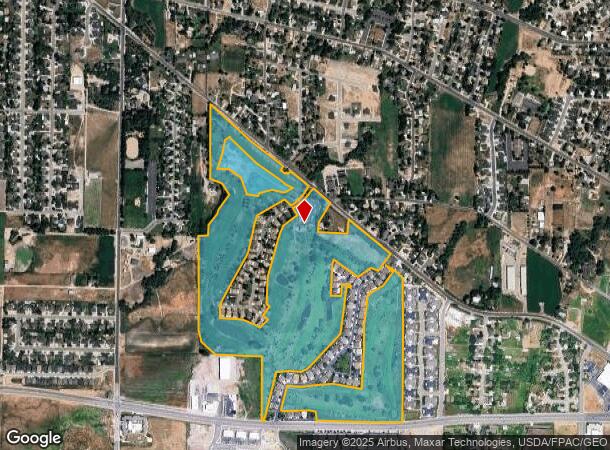
305 W Pleasant View Dr, Ogden, UT 84414
NEARBY LISTINGS FOR SALE OR LEASE
Property Detail
305 W Pleasant View Dr
17-050-0018
Pleasant Meadows Prud
Publicstorage
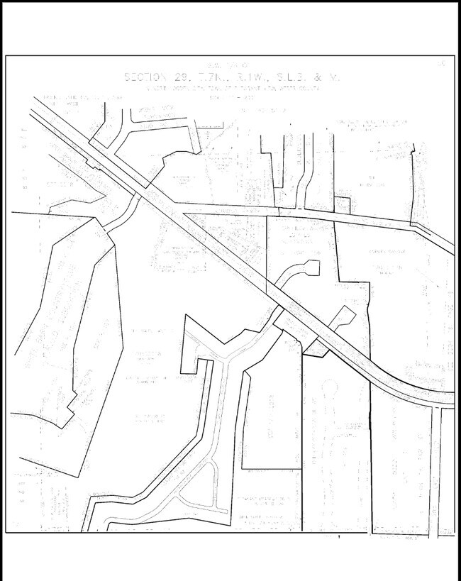
PART OF THE WEST HALF OF SECTION 29, THE EAST HALF OF SECTION 30 AND THE NORTHWEST QUARTER OF SECTION 32, TOWNSHIP 7 NORTH,
X
Weber
49057C0211F
Utah
2025
98.69 AC
2025
Davis/Weber Counties
210304
Salt Lake City
6,976 SF
Ogden-Clearfield, UT
DEMOGRAPHICS near 305 W Pleasant View Dr
1 Mile
3 Mile
5 Mile
2024 Total Population
9,305
53,181
92,606
2029 Population
10,031
57,343
99,933
Pop Growth 2024-2029
+ 7.80%
+ 7.83%
+ 7.91%
Average Age
36
36
36
2024 Total Households
3,032
16,816
30,062
HH Growth 2024-2029
+ 7.98%
+ 8.00%
+ 8.08%
Median Household Inc
$85,436
$90,015
$77,574
Avg Household Size
3.00
3.10
3.00
2024 Avg HH Vehicles
2.00
2.00
2.00
Median Home Value
$401,768
$385,041
$372,922
Median Year Built
2000
1996
1992
Nearby Places
Map Layers
Map Styles
 Street
 Aerial
- Restaurants
- Banks
- Shops
- Fitness
- Groceries
PUBLIC TRANSPORTATION
COMMUTER RAIL
Ogden (FrontRunner North - Utah Transit Authority (UTA))
DRIVE
WALK
Distance
Ogden (FrontRunner North - Utah Transit Authority (UTA))
15 min
7.3 mi
Nearby Properties
Address
Land Use
TOTAL SIZE
Lot Size
Zoning
Address
Land Use
TOTAL SIZE
Lot Size
Zoning
1,154,674 SF
133.48 AC
Address
Land Use
TOTAL SIZE
Lot Size
Zoning
1,001,933 SF
40.73 AC
Address
Land Use
TOTAL SIZE
Lot Size
Zoning
104,868 SF
22.96 AC
Address
Land Use
TOTAL SIZE
Lot Size
Zoning
292,940 SF
17.83 AC
Address
Land Use
TOTAL SIZE
Lot Size
Zoning
292,900 SF
14.54 AC
Address
Land Use
TOTAL SIZE
Lot Size
Zoning
264,373 SF
13.52 AC
Address
Land Use
TOTAL SIZE
Lot Size
Zoning
596 SF
8.08 AC
Address
Land Use
TOTAL SIZE
Lot Size
Zoning
202,499 SF
20.48 AC
Address
Land Use
TOTAL SIZE
Lot Size
Zoning
247,962 SF
19.14 AC
Address
Land Use
TOTAL SIZE
Lot Size
Zoning
7,632 SF
6.87 AC
Address
Land Use
TOTAL SIZE
Lot Size
Zoning
228,832 SF
4.61 AC
Address
Land Use
TOTAL SIZE
Lot Size
Zoning
26,418 SF
9.81 AC
Address
Land Use
TOTAL SIZE
Lot Size
Zoning
178,655 SF
11.61 AC
Address
Land Use
TOTAL SIZE
Lot Size
Zoning
21,756 SF
2.32 AC
Address
Land Use
TOTAL SIZE
Lot Size
Zoning
4,686 SF
28.74 AC
Address
Land Use
TOTAL SIZE
Lot Size
Zoning
102,522 SF
13.14 AC
Address
Land Use
TOTAL SIZE
Lot Size
Zoning
130,740 SF
21.64 AC
Address
Land Use
TOTAL SIZE
Lot Size
Zoning
9,744 SF
3.15 AC
Address
Land Use
TOTAL SIZE
Lot Size
Zoning
164,694 SF
10 AC
Address
Land Use
TOTAL SIZE
Lot Size
Zoning
36,456 SF
4.49 AC
Address
Land Use
TOTAL SIZE
Lot Size
Zoning
43,946 SF
5.83 AC
Address
Land Use
TOTAL SIZE
Lot Size
Zoning
5,368 SF
53.37 AC
Address
Land Use
TOTAL SIZE
Lot Size
Zoning
37,492 SF
5.84 AC
The World's #1 Commercial Real Estate Marketplace
Connect with us
© 2025 CoStar Group
The information above has been obtained from sources believed reliable. While we do not doubt its accuracy we have not verified it and make no guarantee, warranty or representation about it. It is your responsibility to independently confirm its accuracy and completeness. Any projections, opinions, assumptions, or estimates used are for example only and do not represent the current or future performance of the property. The value of this transaction to you depends on tax and other factors which should be evaluated by your tax, financial, and legal advisors. You and your advisors should conduct a careful, independent investigation of the property to determine to your satisfaction the suitability of the property for your needs.