Property Record
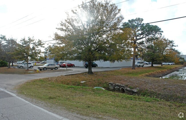
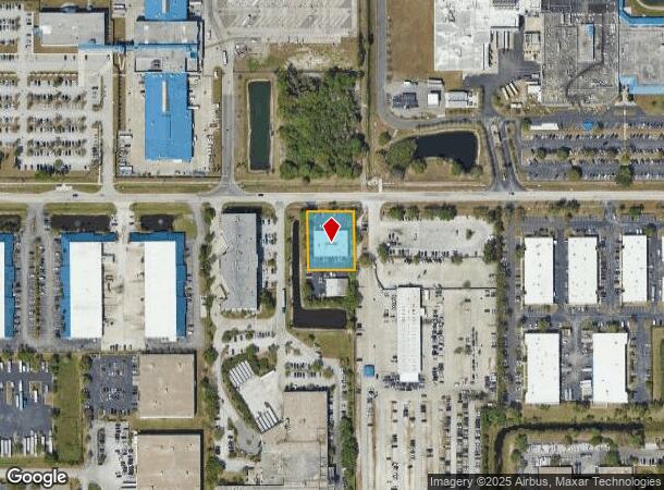
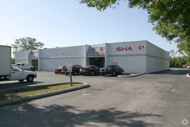
3050 Scherer Dr N, Saint Petersburg, FL 33716
NEARBY LISTINGS FOR SALE OR LEASE
Property Detail
3050 Scherer Dr N
11-30-16-00000-310-0200
From Nw Cor Of Sw 1/4 Th S
Warehouse
FROM NW COR OF SW 1/4 TH S 378FT(S) TH E ALG S R/W OF SCHERER DR 1450FT FOR POB TH E 150FT TH S 185.24FT TH W 150FT TH N 185.71FT TO POB
AE
Pinellas
12103C0143H
Florida
2024
0.64 AC
2025
South Pinellas
024512
Tampa/St Petersburg
8,480 SF
Tampa-St. Petersburg-Clearwater, FL
DEMOGRAPHICS near 3050 Scherer Dr N
1 Mile
3 Mile
5 Mile
2024 Total Population
3,906
50,773
164,491
2029 Population
4,053
51,202
165,106
Pop Growth 2024-2029
+ 3.76%
+ 0.84%
+ 0.37%
Average Age
38
43
43
2024 Total Households
1,907
25,198
76,078
HH Growth 2024-2029
+ 3.15%
+ 0.65%
+ 0.28%
Median Household Inc
$103,930
$58,781
$57,324
Avg Household Size
2.00
1.90
2.10
2024 Avg HH Vehicles
2.00
1.00
2.00
Median Home Value
$366,066
$201,182
$215,516
Median Year Built
1997
1982
1978
Nearby Places
Map Layers
Map Styles
 Street
 Aerial
- Restaurants
- Banks
- Shops
- Fitness
- Groceries
PUBLIC TRANSPORTATION
AIRPORT
St Pete-Clearwater International
DRIVE
WALK
Distance
St Pete-Clearwater International
6 min
2.6 mi
Tampa International
DRIVE
WALK
Distance
Tampa International
22 min
14.3 mi
Sarasota/Bradenton International
DRIVE
WALK
Distance
Sarasota/Bradenton International
58 min
40.8 mi
Freight Ports
Port of Tampa Bay
DRIVE
WALK
Distance
Port of Tampa Bay
32 min
19.7 mi
Nearby Properties
Address
Land Use
TOTAL SIZE
Lot Size
Zoning
Address
Land Use
TOTAL SIZE
Lot Size
Zoning
795,890 SF
69.11 AC
M1
Address
Land Use
TOTAL SIZE
Lot Size
Zoning
130,544 SF
1,313.50 AC
PCAIRPOR
Address
Land Use
TOTAL SIZE
Lot Size
Zoning
1,160,631 SF
28.08 AC
Address
Land Use
TOTAL SIZE
Lot Size
Zoning
1,232,878 SF
12.64 AC
Address
Land Use
TOTAL SIZE
Lot Size
Zoning
551,317 SF
52.55 AC
Address
Land Use
TOTAL SIZE
Lot Size
Zoning
749,164 SF
7.11 AC
Address
Land Use
TOTAL SIZE
Lot Size
Zoning
428,587 SF
14.35 AC
Address
Land Use
TOTAL SIZE
Lot Size
Zoning
372,013 SF
10.10 AC
Address
Land Use
TOTAL SIZE
Lot Size
Zoning
484,229 SF
28 AC
Address
Land Use
TOTAL SIZE
Lot Size
Zoning
466,420 SF
2.60 AC
Address
Land Use
TOTAL SIZE
Lot Size
Zoning
447,664 SF
34.44 AC
Address
Land Use
TOTAL SIZE
Lot Size
Zoning
171,420 SF
300.24 AC
M1
Address
Land Use
TOTAL SIZE
Lot Size
Zoning
350,604 SF
13.21 AC
Address
Land Use
TOTAL SIZE
Lot Size
Zoning
429,226 SF
0.85 AC
Address
Land Use
TOTAL SIZE
Lot Size
Zoning
416,482 SF
14.93 AC
Address
Land Use
TOTAL SIZE
Lot Size
Zoning
346,420 SF
17.95 AC
Address
Land Use
TOTAL SIZE
Lot Size
Zoning
372,436 SF
22.30 AC
Address
Land Use
TOTAL SIZE
Lot Size
Zoning
404,063 SF
12.98 AC
Address
Land Use
TOTAL SIZE
Lot Size
Zoning
401,627 SF
0.66 AC
Address
Land Use
TOTAL SIZE
Lot Size
Zoning
358,681 SF
11.70 AC
Address
Land Use
TOTAL SIZE
Lot Size
Zoning
308,107 SF
32.37 AC
Address
Land Use
TOTAL SIZE
Lot Size
Zoning
240,736 SF
58.40 AC
Address
Land Use
TOTAL SIZE
Lot Size
Zoning
402,681 SF
18.40 AC
Address
Land Use
TOTAL SIZE
Lot Size
Zoning
337,137 SF
26.72 AC
M1
Address
Land Use
TOTAL SIZE
Lot Size
Zoning
255,548 SF
21.69 AC
RPD10
Address
Land Use
TOTAL SIZE
Lot Size
Zoning
243,101 SF
24.86 AC
Address
Land Use
TOTAL SIZE
Lot Size
Zoning
311,000 SF
15.50 AC
Address
Land Use
TOTAL SIZE
Lot Size
Zoning
446,556 SF
14.95 AC
M1
Address
Land Use
TOTAL SIZE
Lot Size
Zoning
572,006 SF
13.01 AC
Address
Land Use
TOTAL SIZE
Lot Size
Zoning
249,361 SF
20.79 AC
The World's #1 Commercial Real Estate Marketplace
Connect with us
© 2025 CoStar Group
The information above has been obtained from sources believed reliable. While we do not doubt its accuracy we have not verified it and make no guarantee, warranty or representation about it. It is your responsibility to independently confirm its accuracy and completeness. Any projections, opinions, assumptions, or estimates used are for example only and do not represent the current or future performance of the property. The value of this transaction to you depends on tax and other factors which should be evaluated by your tax, financial, and legal advisors. You and your advisors should conduct a careful, independent investigation of the property to determine to your satisfaction the suitability of the property for your needs.