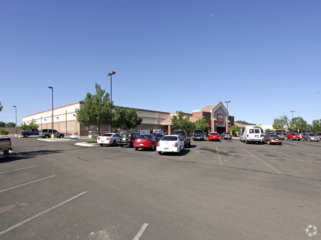
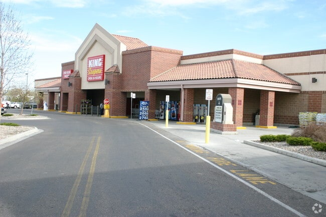
Property Record
3050 W Northern Ave, Pueblo, CO 81005


NEARBY LISTINGS FOR SALE OR LEASE
Property Detail
3050 W Northern Ave
Pueblo, CO
Com-Sunset Bd
1-5-10-1-36-001
LOT 1 PUEBLO KING SOOPERS SUBDIVISION FORMERLY,#15-101-00-005
Commercialacreage
Pueblo
X
Colorado
08101C0707D
1
2024
7.99 AC
2024
Colorado East Area
002600
Other Market Areas
83,123 SF
DEMOGRAPHICS near 3050 W Northern Ave
1 Mile
3 Mile
5 Mile
2024 Total Population
14,024
64,431
101,727
2029 Population
14,298
65,919
104,232
Pop Growth 2024-2029
+ 1.95%
+ 2.31%
+ 2.46%
Average Age
41
41
40
2024 Total Households
5,941
26,302
41,849
HH Growth 2024-2029
+ 2.02%
+ 2.45%
+ 2.58%
Median Household Inc
$46,391
$50,368
$47,467
Avg Household Size
2.30
2.30
2.30
2024 Avg HH Vehicles
2.00
2.00
2.00
Median Home Value
$189,518
$224,057
$212,088
Median Year Built
1960
1962
1962
Nearby Places
Map Layers
Map Styles
 Street
 Aerial
- Restaurants
- Banks
- Shops
- Fitness
- Groceries
SALE & LEASE HISTORY
LISTING DATE
SALE/LEASE

Nov 11, 2022
For Lease
Jun 04, 2024
For Lease
Nearby Properties
Address
Land Use
TOTAL SIZE
Lot Size
Zoning
Address
Land Use
TOTAL SIZE
Lot Size
Zoning
17,710 SF
49.97 AC
Address
Land Use
TOTAL SIZE
Lot Size
Zoning
168,237 SF
3.69 AC
S-1
Address
Land Use
TOTAL SIZE
Lot Size
Zoning
53,269 SF
4.51 AC
Address
Land Use
TOTAL SIZE
Lot Size
Zoning
4,492,279 SF
488.39 AC
Address
Land Use
TOTAL SIZE
Lot Size
Zoning
122,704 SF
2.72 AC
B4:COMM/RE
Address
Land Use
TOTAL SIZE
Lot Size
Zoning
79,394 SF
5.57 AC
R5:RES/MUL
Address
Land Use
TOTAL SIZE
Lot Size
Zoning
42,289 SF
0.54 AC
B4:COMM/RE
Address
Land Use
TOTAL SIZE
Lot Size
Zoning
47,007 SF
8.79 AC
Address
Land Use
TOTAL SIZE
Lot Size
Zoning
40,986 SF
0.65 AC
R5:RES/MUL
Address
Land Use
TOTAL SIZE
Lot Size
Zoning
56,088 SF
4 AC
Address
Land Use
TOTAL SIZE
Lot Size
Zoning
94,278 SF
2.11 AC
R-5
Address
Land Use
TOTAL SIZE
Lot Size
Zoning
33,866 SF
3.34 AC
Address
Land Use
TOTAL SIZE
Lot Size
Zoning
199,914 SF
13.48 AC
B4:COMM/RE
Address
Land Use
TOTAL SIZE
Lot Size
Zoning
1,070,193 SF
43.08 AC
R5:RES/MUL
Address
Land Use
TOTAL SIZE
Lot Size
Zoning
23,025 SF
1.21 AC
R5:RES/MUL
Address
Land Use
TOTAL SIZE
Lot Size
Zoning
45,219 SF
4.46 AC
Address
Land Use
TOTAL SIZE
Lot Size
Zoning
84,872 SF
0.76 AC
B4:COMM/RE
Address
Land Use
TOTAL SIZE
Lot Size
Zoning
35,530 SF
0.55 AC
R-4
Address
Land Use
TOTAL SIZE
Lot Size
Zoning
35,530 SF
0.54 AC
S1:SPC/PUB
Address
Land Use
TOTAL SIZE
Lot Size
Zoning
117,715 SF
3.58 AC
Address
Land Use
TOTAL SIZE
Lot Size
Zoning
22,611 SF
6.85 AC
S1:SPC/PUB
Address
Land Use
TOTAL SIZE
Lot Size
Zoning
13,216 SF
0.55 AC
B4:COMM/RE
Address
Land Use
TOTAL SIZE
Lot Size
Zoning
19,763 SF
2.50 AC
R2:RES/1 F
Address
Land Use
TOTAL SIZE
Lot Size
Zoning
113,152 SF
5.84 AC
R4:RES/MUL
Address
Land Use
TOTAL SIZE
Lot Size
Zoning
62,718 SF
4.76 AC
I3:IND/HEA
Address
Land Use
TOTAL SIZE
Lot Size
Zoning
86,458 SF
20 AC
I3:IND/HEA
Address
Land Use
TOTAL SIZE
Lot Size
Zoning
136,337 SF
14.81 AC
PUD
Address
Land Use
TOTAL SIZE
Lot Size
Zoning
71,751 SF
2.73 AC
R3:RES/2 F
Address
Land Use
TOTAL SIZE
Lot Size
Zoning
28,490 SF
0.23 AC
R4:RES/MUL
Address
Land Use
TOTAL SIZE
Lot Size
Zoning
22,358 SF
0.36 AC
B-4
The World's #1 Commercial Real Estate Marketplace
Connect with us
© 2026 CoStar Group
The information above has been obtained from sources believed reliable. While we do not doubt its accuracy we have not verified it and make no guarantee, warranty or representation about it. It is your responsibility to independently confirm its accuracy and completeness. Any projections, opinions, assumptions, or estimates used are for example only and do not represent the current or future performance of the property. The value of this transaction to you depends on tax and other factors which should be evaluated by your tax, financial, and legal advisors. You and your advisors should conduct a careful, independent investigation of the property to determine to your satisfaction the suitability of the property for your needs.