Property Record
3051 Healthy Way, Birmingham, AL 35243
NEARBY LISTINGS FOR SALE OR LEASE
Property Detail
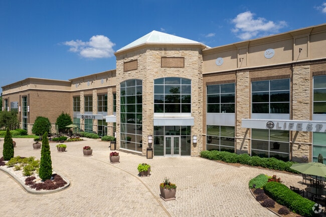
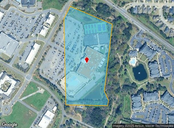
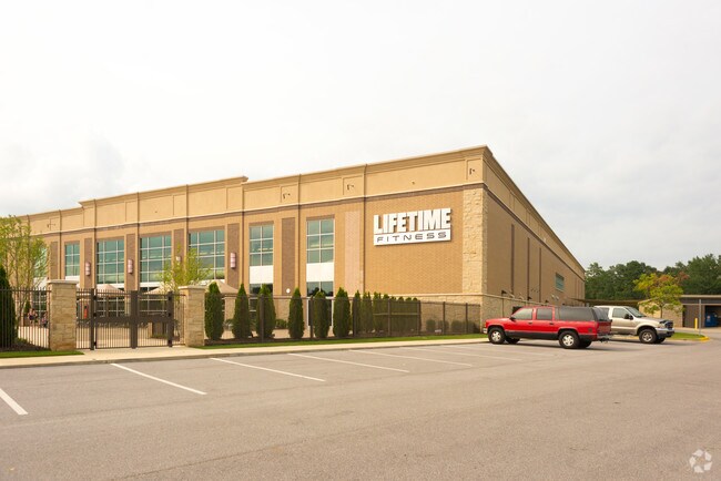
3051 Healthy Way
Birmingham-Hoover, AL
Patchwork Farms 28-34-2 &
28-00-34-1-002-007.004
THAT PT OF LOT 2 PATCHWORK FARMS SUB PB 235 PG 45 WHICH LIES IN NE 1/4 SEC 34 TP 18 R2W
Skatingrink
Jefferson
X
Alabama
01117C0086F
2
2023
12 AC
2024
Hwy 280/Jefferson County
012910
Birmingham
106,431 SF
DEMOGRAPHICS near 3051 Healthy Way
1 Mile
3 Mile
5 Mile
2024 Total Population
4,480
46,019
129,490
2029 Population
4,325
46,727
130,519
Pop Growth 2024-2029
(3.46%)
+ 1.54%
+ 0.79%
Average Age
39
40
39
2024 Total Households
2,269
20,289
52,953
HH Growth 2024-2029
(3.57%)
+ 1.67%
+ 0.70%
Median Household Inc
$86,179
$94,694
$93,927
Avg Household Size
1.90
2.20
2.30
2024 Avg HH Vehicles
2.00
2.00
2.00
Median Home Value
$378,806
$397,358
$400,043
Median Year Built
1999
1988
1985
Nearby Places
Map Layers
Map Styles
 Street
 Aerial
- Restaurants
- Banks
- Shops
- Fitness
- Groceries
PUBLIC TRANSPORTATION
COMMUTER RAIL
Birmingham (Crescent - Amtrak)
DRIVE
WALK
Distance
Birmingham (Crescent - Amtrak)
14 min
8.6 mi
AIRPORT
Birmingham-Shuttlesworth International
DRIVE
WALK
Distance
Birmingham-Shuttlesworth International
20 min
12.4 mi
Freight Ports
Port of Mobile
DRIVE
WALK
Distance
Port of Mobile
276 min
250.0 mi
Nearby Properties
Address
Land Use
TOTAL SIZE
Lot Size
Zoning
Address
Land Use
TOTAL SIZE
Lot Size
Zoning
200,418 SF
6.50 AC
C1
Address
Land Use
TOTAL SIZE
Lot Size
Zoning
15,013 SF
79.12 AC
Address
Land Use
TOTAL SIZE
Lot Size
Zoning
212,615 SF
19.66 AC
B-2
Address
Land Use
TOTAL SIZE
Lot Size
Zoning
500,279 SF
52.57 AC
B2
Address
Land Use
TOTAL SIZE
Lot Size
Zoning
140,853 SF
27 AC
B-2
Address
Land Use
TOTAL SIZE
Lot Size
Zoning
7,280 SF
35 AC
Address
Land Use
TOTAL SIZE
Lot Size
Zoning
347,636 SF
136.83 AC
Address
Land Use
TOTAL SIZE
Lot Size
Zoning
153,413 SF
6.35 AC
C1
Address
Land Use
TOTAL SIZE
Lot Size
Zoning
6 AC
C-1
Address
Land Use
TOTAL SIZE
Lot Size
Zoning
169,501 SF
18 AC
E-2
Address
Land Use
TOTAL SIZE
Lot Size
Zoning
4,674 SF
28.10 AC
Address
Land Use
TOTAL SIZE
Lot Size
Zoning
136,498 SF
11 AC
C1
Address
Land Use
TOTAL SIZE
Lot Size
Zoning
30,967 SF
17.39 AC
Address
Land Use
TOTAL SIZE
Lot Size
Zoning
132,501 SF
50.39 AC
Address
Land Use
TOTAL SIZE
Lot Size
Zoning
235,082 SF
26.10 AC
C1
Address
Land Use
TOTAL SIZE
Lot Size
Zoning
102,373 SF
12.33 AC
R1-E
Address
Land Use
TOTAL SIZE
Lot Size
Zoning
344,434 SF
15.52 AC
R4
Address
Land Use
TOTAL SIZE
Lot Size
Zoning
239,213 SF
17 AC
C1
Address
Land Use
TOTAL SIZE
Lot Size
Zoning
321,157 SF
33 AC
C
Address
Land Use
TOTAL SIZE
Lot Size
Zoning
59,454 SF
4.21 AC
C1
Address
Land Use
TOTAL SIZE
Lot Size
Zoning
11,492 SF
21.30 AC
Address
Land Use
TOTAL SIZE
Lot Size
Zoning
361,937 SF
22 AC
R4
Address
Land Use
TOTAL SIZE
Lot Size
Zoning
125,165 SF
8.07 AC
CP
Address
Land Use
TOTAL SIZE
Lot Size
Zoning
89,134 SF
6.50 AC
C-1
Address
Land Use
TOTAL SIZE
Lot Size
Zoning
2,404 SF
17.42 AC
Address
Land Use
TOTAL SIZE
Lot Size
Zoning
5,506 SF
17.36 AC
Address
Land Use
TOTAL SIZE
Lot Size
Zoning
1,400 SF
21.35 AC
Address
Land Use
TOTAL SIZE
Lot Size
Zoning
16,187 SF
33.04 AC
Address
Land Use
TOTAL SIZE
Lot Size
Zoning
121,872 SF
8.70 AC
PB
Address
Land Use
TOTAL SIZE
Lot Size
Zoning
7,861 SF
29 AC
The World's #1 Commercial Real Estate Marketplace
Connect with us
© 2025 CoStar Group
The information above has been obtained from sources believed reliable. While we do not doubt its accuracy we have not verified it and make no guarantee, warranty or representation about it. It is your responsibility to independently confirm its accuracy and completeness. Any projections, opinions, assumptions, or estimates used are for example only and do not represent the current or future performance of the property. The value of this transaction to you depends on tax and other factors which should be evaluated by your tax, financial, and legal advisors. You and your advisors should conduct a careful, independent investigation of the property to determine to your satisfaction the suitability of the property for your needs.