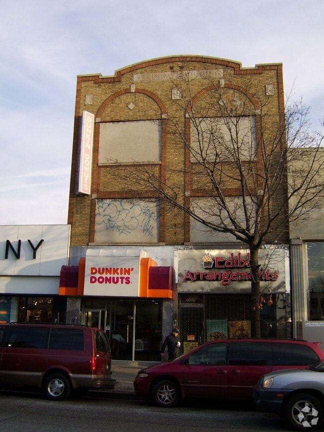
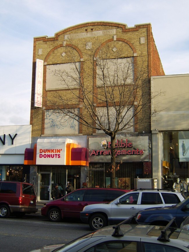
Property Record
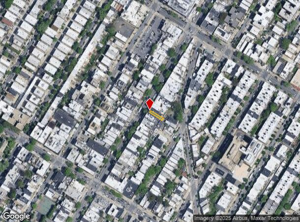
3051 Steinway St, Astoria, NY 11103
NEARBY LISTINGS FOR SALE OR LEASE
Property Detail
3051 Steinway St
00680-0027
Queens
Storebuilding
New York
X
27
3604970093F
0.03 AC
2024
Northwest Queens
2025
Long Island (New York)
014900
New York-Jersey City-White Plains, NY-NJ
2,295 SF
DEMOGRAPHICS near 3051 Steinway St
1 Mile
3 Mile
5 Mile
2024 Total Population
133,639
982,955
2,969,454
2029 Population
126,773
918,354
2,772,912
Pop Growth 2024-2029
(5.14%)
(6.57%)
(6.62%)
Average Age
40
41
40
2024 Total Households
59,746
416,403
1,256,000
HH Growth 2024-2029
(5.48%)
(6.70%)
(6.92%)
Median Household Inc
$84,776
$83,952
$75,118
Avg Household Size
2.20
2.30
2.20
2024 Avg HH Vehicles
.00
.00
.00
Median Home Value
$800,114
$842,852
$820,178
Median Year Built
1948
1955
1955
Nearby Places
- Restaurants
- Banks
- Shops
- Fitness
- Groceries
Nearby Properties
Address
Land Use
TOTAL SIZE
Lot Size
Zoning
Address
Land Use
TOTAL SIZE
Lot Size
Zoning
1,783,434 SF
1.94 AC
C5-3
Address
Land Use
TOTAL SIZE
Lot Size
Zoning
5,519,372 SF
409.21 AC
C8-2
Address
Land Use
TOTAL SIZE
Lot Size
Zoning
2,215,000 SF
6.43 AC
R9
Address
Land Use
TOTAL SIZE
Lot Size
Zoning
2,400,000 SF
15.14 AC
C5-2
Address
Land Use
TOTAL SIZE
Lot Size
Zoning
1,160,500 SF
1.62 AC
C6-6
Address
Land Use
TOTAL SIZE
Lot Size
Zoning
2,230,742 SF
6.33 AC
R9
Address
Land Use
TOTAL SIZE
Lot Size
Zoning
822,014 SF
1.38 AC
C52.5
Address
Land Use
TOTAL SIZE
Lot Size
Zoning
539,643 SF
C5-2
Address
Land Use
TOTAL SIZE
Lot Size
Zoning
1,033,031 SF
1.87 AC
C52.5
Address
Land Use
TOTAL SIZE
Lot Size
Zoning
1,242,587 SF
1.49 AC
C6-6
Address
Land Use
TOTAL SIZE
Lot Size
Zoning
986,246 SF
0.90 AC
C5-3
Address
Land Use
TOTAL SIZE
Lot Size
Zoning
984,485 SF
1.03 AC
C6-6
Address
Land Use
TOTAL SIZE
Lot Size
Zoning
624,883 SF
0.75 AC
C6-6
Address
Land Use
TOTAL SIZE
Lot Size
Zoning
449,876 SF
0.81 AC
C5-3
Address
Land Use
TOTAL SIZE
Lot Size
Zoning
449,876 SF
0.81 AC
C5-3
Address
Land Use
TOTAL SIZE
Lot Size
Zoning
1,200,000 SF
10.24 AC
R9
Address
Land Use
TOTAL SIZE
Lot Size
Zoning
755,000 SF
1.85 AC
R7-2
Address
Land Use
TOTAL SIZE
Lot Size
Zoning
1,065,915 SF
2.13 AC
M16R10
Address
Land Use
TOTAL SIZE
Lot Size
Zoning
757,439 SF
0.91 AC
C1-9
Address
Land Use
TOTAL SIZE
Lot Size
Zoning
733,747 SF
0.98 AC
R10
Address
Land Use
TOTAL SIZE
Lot Size
Zoning
649,576 SF
0.64 AC
C5-3
Address
Land Use
TOTAL SIZE
Lot Size
Zoning
1,502,532 SF
6.35 AC
R7B
Address
Land Use
TOTAL SIZE
Lot Size
Zoning
714,224 SF
0.70 AC
R8
Address
Land Use
TOTAL SIZE
Lot Size
Zoning
493,090 SF
1.87 AC
C52.5
Address
Land Use
TOTAL SIZE
Lot Size
Zoning
805,287 SF
1 AC
R10
Address
Land Use
TOTAL SIZE
Lot Size
Zoning
1,075,000 SF
6.74 AC
R7-2
Address
Land Use
TOTAL SIZE
Lot Size
Zoning
1,321,050 SF
1.89 AC
C1-9
Address
Land Use
TOTAL SIZE
Lot Size
Zoning
984,760 SF
2.04 AC
M3-1
Address
Land Use
TOTAL SIZE
Lot Size
Zoning
775,241 SF
1.87 AC
R8B
Address
Land Use
TOTAL SIZE
Lot Size
Zoning
528,552 SF
0.71 AC
C52.5
The World's #1 Commercial Real Estate Marketplace
Connect with us
© 2025 CoStar Group
The information above has been obtained from sources believed reliable. While we do not doubt its accuracy we have not verified it and make no guarantee, warranty or representation about it. It is your responsibility to independently confirm its accuracy and completeness. Any projections, opinions, assumptions, or estimates used are for example only and do not represent the current or future performance of the property. The value of this transaction to you depends on tax and other factors which should be evaluated by your tax, financial, and legal advisors. You and your advisors should conduct a careful, independent investigation of the property to determine to your satisfaction the suitability of the property for your needs.