Property Record
3052 S County Road 13, Loveland, CO 80537


Property Detail
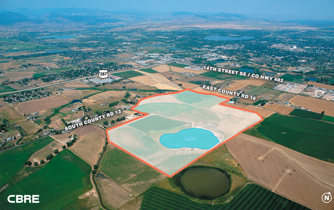
3052 S County Road 13
Fort Collins-Loveland, CO
LOT 3, SKAER MLD FILE NO 11-S3057 (20110060155), LOV
85312-06-703
LARIMER
Farms
Colorado
B and X Area of moderate flood hazard, usually the area between the limits of the 100-year and 500-year floods.
3
2024
204.63 AC
2025
Fort Collins/Loveland
001713
Denver
NEARBY LISTINGS FOR SALE OR LEASE
DEMOGRAPHICS near 3052 S County Road 13
1 mile
3 mile
5 mile
2025 Total Population
226
25,525
79,572
2030 Population
226
26,262
82,094
Pop Growth 2025-2030
0.00%
+ 2.89%
+ 3.17%
Average Age
44
41
42
2025 Total Households
82
10,830
32,879
HH Growth 2025-2030
+ 1.22%
+ 2.89%
+ 3.18%
Median Household Inc
$104,762
$78,381
$86,162
Avg Household Size
2.80
2.30
2.40
2025 Avg HH Vehicles
3.00
2.00
2.00
Median Home Value
$742,537
$475,646
$491,025
Median Year Built
1993
1986
1990
Nearby Places
Map Layers
Map Styles
 Street
 Aerial
Transit
 Traffic
 Biking
Places
Listings with unknown addresses are not visible on the map
- Restaurants
- Banks
- Shops
- Fitness
- Groceries
SALE & LEASE HISTORY
LISTING DATE
SALE/LEASE

Aug 05, 2021
For Sale
Nearby Properties
Address
Land Use
TOTAL SIZE
Lot Size
Zoning
Address
Land Use
TOTAL SIZE
Lot Size
Zoning
125,566 SF
8.27 AC
R3E
Address
Land Use
TOTAL SIZE
Lot Size
Zoning
115,599 SF
13.15 AC
P38
Address
Land Use
TOTAL SIZE
Lot Size
Zoning
147,663 SF
5.01 AC
R3E
Address
Land Use
TOTAL SIZE
Lot Size
Zoning
745,209 SF
63.03 AC
I
Address
Land Use
TOTAL SIZE
Lot Size
Zoning
205,804 SF
22.74 AC
P51
Address
Land Use
TOTAL SIZE
Lot Size
Zoning
96,723 SF
9.16 AC
I
Address
Land Use
TOTAL SIZE
Lot Size
Zoning
83,954 SF
5.79 AC
FA
Address
Land Use
TOTAL SIZE
Lot Size
Zoning
101,362 SF
4.80 AC
Address
Land Use
TOTAL SIZE
Lot Size
Zoning
139,289 SF
23.55 AC
I
Address
Land Use
TOTAL SIZE
Lot Size
Zoning
137,432 SF
12.89 AC
B
Address
Land Use
TOTAL SIZE
Lot Size
Zoning
196,188 SF
13.26 AC
C
Address
Land Use
TOTAL SIZE
Lot Size
Zoning
296,360 SF
11.88 AC
B
Address
Land Use
TOTAL SIZE
Lot Size
Zoning
165,709 SF
10.52 AC
Address
Land Use
TOTAL SIZE
Lot Size
Zoning
118,788 SF
14.01 AC
B
Address
Land Use
TOTAL SIZE
Lot Size
Zoning
137,950 SF
10.16 AC
Address
Land Use
TOTAL SIZE
Lot Size
Zoning
134,054 SF
14.45 AC
P59
Address
Land Use
TOTAL SIZE
Lot Size
Zoning
303,858 SF
30.21 AC
Address
Land Use
TOTAL SIZE
Lot Size
Zoning
269,696 SF
1.97 AC
Address
Land Use
TOTAL SIZE
Lot Size
Zoning
48,952 SF
6.38 AC
FA
Address
Land Use
TOTAL SIZE
Lot Size
Zoning
114,864 SF
0.71 AC
Address
Land Use
TOTAL SIZE
Lot Size
Zoning
43,646 SF
2.01 AC
Address
Land Use
TOTAL SIZE
Lot Size
Zoning
62,966 SF
0.83 AC
Address
Land Use
TOTAL SIZE
Lot Size
Zoning
65,755 SF
2.22 AC
Address
Land Use
TOTAL SIZE
Lot Size
Zoning
65,980 SF
3.04 AC
I
Address
Land Use
TOTAL SIZE
Lot Size
Zoning
72,300 SF
7.23 AC
I1
Address
Land Use
TOTAL SIZE
Lot Size
Zoning
71,337 SF
1.72 AC
BE
Address
Land Use
TOTAL SIZE
Lot Size
Zoning
57,464 SF
2.77 AC
P87
Address
Land Use
TOTAL SIZE
Lot Size
Zoning
88,034 SF
32.74 AC
I
Address
Land Use
TOTAL SIZE
Lot Size
Zoning
78,211 SF
4.56 AC
FA
Address
Land Use
TOTAL SIZE
Lot Size
Zoning
135,814 SF
10.91 AC
The World's #1 Commercial Real Estate Marketplace
Connect with us
© 2026 CoStar Group
The information above has been obtained from sources believed reliable. While we do not doubt its accuracy we have not verified it and make no guarantee, warranty or representation about it. It is your responsibility to independently confirm its accuracy and completeness. Any projections, opinions, assumptions, or estimates used are for example only and do not represent the current or future performance of the property. The value of this transaction to you depends on tax and other factors which should be evaluated by your tax, financial, and legal advisors. You and your advisors should conduct a careful, independent investigation of the property to determine to your satisfaction the suitability of the property for your needs.