Property Record
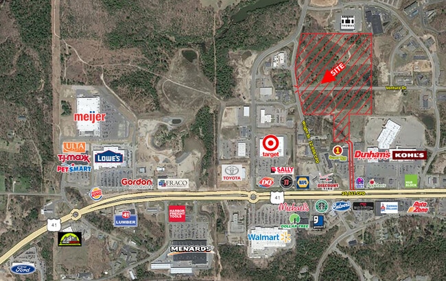
3052 Wright St, Marquette, MI 49855

Property Detail
3052 Wright St
52-08-017-014-20
SEC 17 T48N R25W 1.70 A NE 1/4 OF SW 1/4 BEG AT INT OF W ROW CO RD 492 & N ROW PRVT RD TH S67DEGW 82.52' TH S63DEGW 79.90' TH
Commercialnec
MARQUETTE
DD
Michigan
B and X Area of moderate flood hazard, usually the area between the limits of the 100-year and 500-year floods.
1.70 AC
2025
Upper Peninsula
2025
Other Market Areas
000600
Marquette, MI
5,992 SF
NEARBY LISTINGS FOR SALE OR LEASE
DEMOGRAPHICS near 3052 Wright St
1 mile
3 mile
5 mile
2025 Total Population
1,858
18,320
27,321
2030 Population
1,866
18,486
27,572
Pop Growth 2025-2030
+ 0.43%
+ 0.91%
+ 0.92%
Average Age
42
39
39
2025 Total Households
856
7,184
10,897
HH Growth 2025-2030
+ 0.70%
+ 0.71%
+ 0.77%
Median Household Inc
$62,238
$56,634
$60,371
Avg Household Size
2.10
2.00
2.10
2025 Avg HH Vehicles
2.00
2.00
2.00
Median Home Value
$290,647
$277,568
$287,026
Median Year Built
1990
1975
1972
Nearby Places
Map Layers
Map Styles
 Street
 Aerial
Transit
 Traffic
 Biking
Places
Listings with unknown addresses are not visible on the map
- Restaurants
- Banks
- Shops
- Fitness
- Groceries
PUBLIC TRANSPORTATION
AIRPORT
Marquette/Sawyer Regional
Drive
Walk
Distance
Marquette/Sawyer Regional
30 min
18.1 mi
SALE & LEASE HISTORY
LISTING DATE
SALE/LEASE

Apr 25, 2024
For Sale
Nearby Properties
Address
Land Use
TOTAL SIZE
Lot Size
Zoning
Address
Land Use
TOTAL SIZE
Lot Size
Zoning
605,039 SF
39.11 AC
PUD
Address
Land Use
TOTAL SIZE
Lot Size
Zoning
254,287 SF
11.83 AC
M-U
Address
Land Use
TOTAL SIZE
Lot Size
Zoning
276,832 SF
21.36 AC
MFR
Address
Land Use
TOTAL SIZE
Lot Size
Zoning
104,333 SF
8.14 AC
RC
Address
Land Use
TOTAL SIZE
Lot Size
Zoning
106,380 SF
1.41 AC
PUD
Address
Land Use
TOTAL SIZE
Lot Size
Zoning
195,283 SF
10.25 AC
DD
Address
Land Use
TOTAL SIZE
Lot Size
Zoning
0.29 AC
R-3-L/R
Address
Land Use
TOTAL SIZE
Lot Size
Zoning
206,601 SF
21.83 AC
GB
Address
Land Use
TOTAL SIZE
Lot Size
Zoning
184,024 SF
7.52 AC
MFR
Address
Land Use
TOTAL SIZE
Lot Size
Zoning
79,558 SF
17.85 AC
RC
Address
Land Use
TOTAL SIZE
Lot Size
Zoning
156,460 SF
14.25 AC
GB
Address
Land Use
TOTAL SIZE
Lot Size
Zoning
220,560 SF
22.20 AC
GB
Address
Land Use
TOTAL SIZE
Lot Size
Zoning
23,286 SF
0.76 AC
PUD
Address
Land Use
TOTAL SIZE
Lot Size
Zoning
78,717 SF
19.14 AC
RC
Address
Land Use
TOTAL SIZE
Lot Size
Zoning
152.60 AC
RP
Address
Land Use
TOTAL SIZE
Lot Size
Zoning
49,463 SF
5.16 AC
PUD
Address
Land Use
TOTAL SIZE
Lot Size
Zoning
48,579 SF
0.81 AC
PUD
Address
Land Use
TOTAL SIZE
Lot Size
Zoning
55,204 SF
1.13 AC
GC
Address
Land Use
TOTAL SIZE
Lot Size
Zoning
7.89 AC
DD
Address
Land Use
TOTAL SIZE
Lot Size
Zoning
126,697 SF
8.62 AC
GC
Address
Land Use
TOTAL SIZE
Lot Size
Zoning
125,381 SF
13.11 AC
GB
Address
Land Use
TOTAL SIZE
Lot Size
Zoning
36,600 SF
6.06 AC
GB
Address
Land Use
TOTAL SIZE
Lot Size
Zoning
37,112 SF
3.05 AC
GC
Address
Land Use
TOTAL SIZE
Lot Size
Zoning
95,476 SF
7.29 AC
GB
Address
Land Use
TOTAL SIZE
Lot Size
Zoning
79,508 SF
6.69 AC
MFR
Address
Land Use
TOTAL SIZE
Lot Size
Zoning
45,426 SF
1.86 AC
GB
Address
Land Use
TOTAL SIZE
Lot Size
Zoning
46,037 SF
4.02 AC
MFR
Address
Land Use
TOTAL SIZE
Lot Size
Zoning
75,836 SF
2.24 AC
CBD
Address
Land Use
TOTAL SIZE
Lot Size
Zoning
18,573 SF
2.75 AC
M-U
Address
Land Use
TOTAL SIZE
Lot Size
Zoning
80,156 SF
7.70 AC
DD
The World's #1 Commercial Real Estate Marketplace
Connect with us
© 2026 CoStar Group
The information above has been obtained from sources believed reliable. While we do not doubt its accuracy we have not verified it and make no guarantee, warranty or representation about it. It is your responsibility to independently confirm its accuracy and completeness. Any projections, opinions, assumptions, or estimates used are for example only and do not represent the current or future performance of the property. The value of this transaction to you depends on tax and other factors which should be evaluated by your tax, financial, and legal advisors. You and your advisors should conduct a careful, independent investigation of the property to determine to your satisfaction the suitability of the property for your needs.