Property Record
3057 Highway 10 S, Saint Cloud, MN 56304


NEARBY LISTINGS FOR SALE OR LEASE
-
-
View all Saint Cloud listings for sale on LoopNet.com
Property Detail
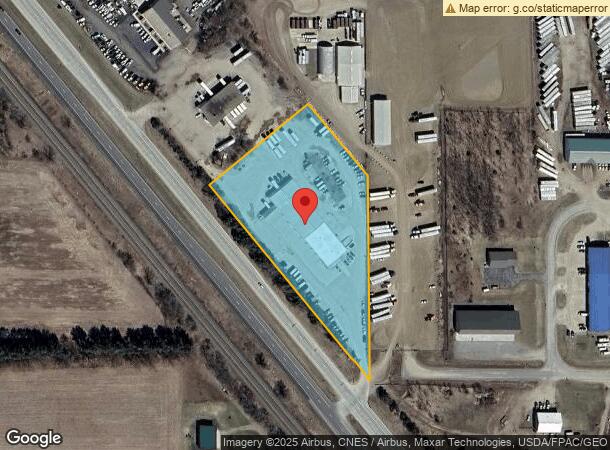
3057 Highway 10 S
25-017-1106
THAT PT OF NE 1-4 DESC AS FOLL; COMM AT THE NE CORNER OF SEC 17;THENCE S 00 DEG 54 MIN 10 SEC W, ASSUMED BEARING, ALONG E LINE OF SEC 17 DIST 1579.24 FT TO A LINE PARA WITH & DIST 350 FT NELY OF, AS MEASURED AT A RT ANGLE TO, THE NELY R-O-W LINE OF U
Commercialnec
Sherburne
X
Minnesota
27141C0040F
3.81 AC
2025
Sherburne County
2025
Minneapolis/St Paul
030301
Minneapolis-St. Paul-Bloomington, MN-WI
18,758 SF
DEMOGRAPHICS near 3057 Highway 10 S
1 mile
3 mile
5 mile
2024 Total Population
32
8,267
49,819
2029 Population
34
8,977
51,817
Pop Growth 2024-2029
+ 6.25%
+ 8.59%
+ 4.01%
Average Age
43
38
35
2024 Total Households
11
3,006
18,785
HH Growth 2024-2029
+ 9.09%
+ 8.55%
+ 4.07%
Median Household Inc
$74,999
$51,077
$54,095
Avg Household Size
2.30
2.40
2.40
2024 Avg HH Vehicles
2.00
2.00
2.00
Median Home Value
$283,333
$205,161
$208,320
Median Year Built
1989
1981
1980
Nearby Places
Map Layers
Map Styles
 Street
 Aerial
Transit
 Traffic
 Biking
Places
Listings with unknown addresses are not visible on the map
- Restaurants
- Banks
- Shops
- Fitness
- Groceries
PUBLIC TRANSPORTATION
COMMUTER RAIL
Drive
Walk
Distance
7 min
4.4 mi
SALE & LEASE HISTORY
LISTING DATE
SALE/LEASE

Sep 23, 2016
For Sale
Nearby Properties
Address
Land Use
TOTAL SIZE
Lot Size
Zoning
Address
Land Use
TOTAL SIZE
Lot Size
Zoning
154.73 AC
I
Address
Land Use
TOTAL SIZE
Lot Size
Zoning
361.40 AC
Address
Land Use
TOTAL SIZE
Lot Size
Zoning
15.77 AC
Address
Land Use
TOTAL SIZE
Lot Size
Zoning
24.47 AC
Address
Land Use
TOTAL SIZE
Lot Size
Zoning
Address
Land Use
TOTAL SIZE
Lot Size
Zoning
13.37 AC
Address
Land Use
TOTAL SIZE
Lot Size
Zoning
4.57 AC
Address
Land Use
TOTAL SIZE
Lot Size
Zoning
6.98 AC
Address
Land Use
TOTAL SIZE
Lot Size
Zoning
3.72 AC
Address
Land Use
TOTAL SIZE
Lot Size
Zoning
32.29 AC
Address
Land Use
TOTAL SIZE
Lot Size
Zoning
Address
Land Use
TOTAL SIZE
Lot Size
Zoning
Address
Land Use
TOTAL SIZE
Lot Size
Zoning
21.69 AC
Address
Land Use
TOTAL SIZE
Lot Size
Zoning
Address
Land Use
TOTAL SIZE
Lot Size
Zoning
5,200 SF
8.96 AC
I
Address
Land Use
TOTAL SIZE
Lot Size
Zoning
3.47 AC
Address
Land Use
TOTAL SIZE
Lot Size
Zoning
1.59 AC
Address
Land Use
TOTAL SIZE
Lot Size
Zoning
Address
Land Use
TOTAL SIZE
Lot Size
Zoning
325.75 AC
Address
Land Use
TOTAL SIZE
Lot Size
Zoning
1.24 AC
Address
Land Use
TOTAL SIZE
Lot Size
Zoning
Address
Land Use
TOTAL SIZE
Lot Size
Zoning
Address
Land Use
TOTAL SIZE
Lot Size
Zoning
15,124 SF
5.34 AC
A
Address
Land Use
TOTAL SIZE
Lot Size
Zoning
4,256 SF
304.86 AC
A
Address
Land Use
TOTAL SIZE
Lot Size
Zoning
1.74 AC
Address
Land Use
TOTAL SIZE
Lot Size
Zoning
3,645 SF
10.06 AC
I
Address
Land Use
TOTAL SIZE
Lot Size
Zoning
8,064 SF
27.24 AC
I
Address
Land Use
TOTAL SIZE
Lot Size
Zoning
1.28 AC
Address
Land Use
TOTAL SIZE
Lot Size
Zoning
7,894 SF
5 AC
A
The World's #1 Commercial Real Estate Marketplace
Connect with us
© 2026 CoStar Group
The information above has been obtained from sources believed reliable. While we do not doubt its accuracy we have not verified it and make no guarantee, warranty or representation about it. It is your responsibility to independently confirm its accuracy and completeness. Any projections, opinions, assumptions, or estimates used are for example only and do not represent the current or future performance of the property. The value of this transaction to you depends on tax and other factors which should be evaluated by your tax, financial, and legal advisors. You and your advisors should conduct a careful, independent investigation of the property to determine to your satisfaction the suitability of the property for your needs.