Property Record
306 E Main St, Norton, MA 02766
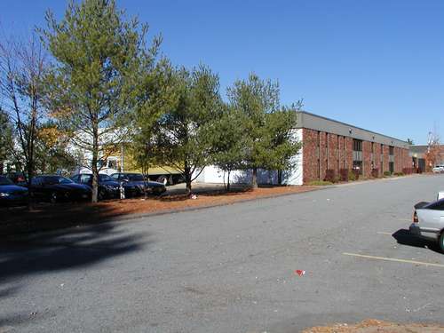


Property Detail
306 E Main St
NORT-000005-000000-000038
BRISTOL
Industrialgeneral
Massachusetts
B and X Area of moderate flood hazard, usually the area between the limits of the 100-year and 500-year floods.
15.28 AC
2025
Attleboro/New Bedford
2025
Boston
611102
Providence-Warwick, RI-MA
NEARBY LISTINGS FOR SALE OR LEASE
DEMOGRAPHICS near 306 E Main St
1 mile
3 mile
5 mile
2025 Total Population
3,154
22,855
63,597
2030 Population
3,210
23,339
64,924
Pop Growth 2025-2030
+ 1.78%
+ 2.12%
+ 2.09%
Average Age
42
41
42
2025 Total Households
1,210
7,994
23,836
HH Growth 2025-2030
+ 1.74%
+ 2.29%
+ 2.23%
Median Household Inc
$112,138
$122,851
$119,600
Avg Household Size
2.60
2.70
2.60
2025 Avg HH Vehicles
2.00
2.00
2.00
Median Home Value
$595,817
$595,414
$594,466
Median Year Built
1985
1985
1980
Nearby Places
Map Layers
Map Styles
 Street
 Aerial
Layers
 Traffic
 Biking
Places
Listings with unknown addresses are not visible on the map
- Restaurants
- Banks
- Shops
- Fitness
- Groceries
PUBLIC TRANSPORTATION
COMMUTER RAIL
Mansfield (Foxboro Line (Special Events Only) - Massachusetts Bay Transportation Authority Commuter Rail (Purple Line), Providence/Stoughton Line - Massachusetts Bay Transportation Authority Commuter Rail (Purple Line))
Drive
Walk
Distance
Mansfield (Foxboro Line (Special Events Only) - Massachusetts Bay Transportation Authority Commuter Rail (Purple Line), Providence/Stoughton Line - Massachusetts Bay Transportation Authority Commuter Rail (Purple Line))
13 min
7.4 mi
Attleboro (Foxboro Event Service - MBTA, Providence/Stoughton Line - MBTA)
Drive
Walk
Distance
Attleboro (Foxboro Event Service - MBTA, Providence/Stoughton Line - MBTA)
16 min
9.0 mi
AIRPORT
Rhode Island Tf Green International
Drive
Walk
Distance
Rhode Island Tf Green International
50 min
33.7 mi
General Edward Lawrence Logan International
Drive
Walk
Distance
General Edward Lawrence Logan International
53 min
34.1 mi
Freight Ports
Port of Boston
Drive
Walk
Distance
Port of Boston
50 min
31.9 mi
Nearby Properties
Address
Land Use
TOTAL SIZE
Lot Size
Zoning
Address
Land Use
TOTAL SIZE
Lot Size
Zoning
20.33 AC
Address
Land Use
TOTAL SIZE
Lot Size
Zoning
559,641 SF
73.61 AC
Address
Land Use
TOTAL SIZE
Lot Size
Zoning
3,838 SF
1.11 AC
R80
Address
Land Use
TOTAL SIZE
Lot Size
Zoning
223,480 SF
37.59 AC
Address
Land Use
TOTAL SIZE
Lot Size
Zoning
225,600 SF
18.47 AC
R80
Address
Land Use
TOTAL SIZE
Lot Size
Zoning
212,672 SF
34.40 AC
Address
Land Use
TOTAL SIZE
Lot Size
Zoning
201,634 SF
12.01 AC
Address
Land Use
TOTAL SIZE
Lot Size
Zoning
145,360 SF
11.80 AC
Address
Land Use
TOTAL SIZE
Lot Size
Zoning
Address
Land Use
TOTAL SIZE
Lot Size
Zoning
Address
Land Use
TOTAL SIZE
Lot Size
Zoning
123,740 SF
10.67 AC
R80
Address
Land Use
TOTAL SIZE
Lot Size
Zoning
105,664 SF
13.16 AC
Address
Land Use
TOTAL SIZE
Lot Size
Zoning
26.70 AC
Address
Land Use
TOTAL SIZE
Lot Size
Zoning
153,057 SF
13.96 AC
INDUST
Address
Land Use
TOTAL SIZE
Lot Size
Zoning
129,261 SF
12.87 AC
Address
Land Use
TOTAL SIZE
Lot Size
Zoning
103,765 SF
19.83 AC
Address
Land Use
TOTAL SIZE
Lot Size
Zoning
117,076 SF
5.16 AC
INDUST
Address
Land Use
TOTAL SIZE
Lot Size
Zoning
79,958 SF
2.90 AC
Address
Land Use
TOTAL SIZE
Lot Size
Zoning
112,500 SF
13.83 AC
Address
Land Use
TOTAL SIZE
Lot Size
Zoning
49,200 SF
11.57 AC
Address
Land Use
TOTAL SIZE
Lot Size
Zoning
79,170 SF
8.17 AC
Address
Land Use
TOTAL SIZE
Lot Size
Zoning
64.80 AC
Address
Land Use
TOTAL SIZE
Lot Size
Zoning
2.50 AC
Address
Land Use
TOTAL SIZE
Lot Size
Zoning
127,230 SF
8.70 AC
INDUST
Address
Land Use
TOTAL SIZE
Lot Size
Zoning
25.85 AC
Address
Land Use
TOTAL SIZE
Lot Size
Zoning
10.31 AC
INDUST
Address
Land Use
TOTAL SIZE
Lot Size
Zoning
44,372 SF
36 AC
Address
Land Use
TOTAL SIZE
Lot Size
Zoning
4.60 AC
Address
Land Use
TOTAL SIZE
Lot Size
Zoning
4.90 AC
The World's #1 Commercial Real Estate Marketplace
Connect with us
© 2026 CoStar Group
The information above has been obtained from sources believed reliable. While we do not doubt its accuracy we have not verified it and make no guarantee, warranty or representation about it. It is your responsibility to independently confirm its accuracy and completeness. Any projections, opinions, assumptions, or estimates used are for example only and do not represent the current or future performance of the property. The value of this transaction to you depends on tax and other factors which should be evaluated by your tax, financial, and legal advisors. You and your advisors should conduct a careful, independent investigation of the property to determine to your satisfaction the suitability of the property for your needs.