Property Record
306 Freel Dr, Ames, IA 50010


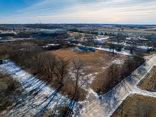
Property Detail
306 Freel Dr
Ames, IA
WOODLAND ACRES PLAT 2 LOT:12 AMES
09-12-201-030
STORY
Commercialacreage
Iowa
GI
12
AE The base floodplain where base flood elevations are provided. AE Zones are now used on new format FIRMs instead of A1-A30 Zones.
1 AC
2024
East Ames
2025
Other Market Areas
000900
NEARBY LISTINGS FOR SALE OR LEASE
DEMOGRAPHICS near 306 Freel Dr
1 mile
3 mile
5 mile
2025 Total Population
705
31,762
68,121
2030 Population
715
32,319
69,520
Pop Growth 2025-2030
+ 1.42%
+ 1.75%
+ 2.05%
Average Age
40
32
33
2025 Total Households
296
10,478
25,870
HH Growth 2025-2030
+ 1.35%
+ 2.40%
+ 2.54%
Median Household Inc
$77,419
$61,093
$61,035
Avg Household Size
2.30
2.00
2.10
2025 Avg HH Vehicles
2.00
2.00
2.00
Median Home Value
$184,999
$238,109
$293,110
Median Year Built
1973
1972
1990
Nearby Places
Map Layers
Map Styles
 Street
 Aerial
Layers
 Traffic
 Biking
Places
Listings with unknown addresses are not visible on the map
- Restaurants
- Banks
- Shops
- Fitness
- Groceries
SALE & LEASE HISTORY
LISTING DATE
SALE/LEASE

May 09, 2024
For Sale
Nearby Properties
Address
Land Use
TOTAL SIZE
Lot Size
Zoning
Address
Land Use
TOTAL SIZE
Lot Size
Zoning
2,400 SF
146.13 AC
PI
Address
Land Use
TOTAL SIZE
Lot Size
Zoning
2,216 SF
25.86 AC
RH
Address
Land Use
TOTAL SIZE
Lot Size
Zoning
54,112 SF
12.70 AC
Address
Land Use
TOTAL SIZE
Lot Size
Zoning
576,476 SF
23.76 AC
GI
Address
Land Use
TOTAL SIZE
Lot Size
Zoning
188,204 SF
70.81 AC
A1
Address
Land Use
TOTAL SIZE
Lot Size
Zoning
215,689 SF
22.56 AC
HOC
Address
Land Use
TOTAL SIZE
Lot Size
Zoning
75,302 SF
16.66 AC
HOC
Address
Land Use
TOTAL SIZE
Lot Size
Zoning
177,201 SF
26.29 AC
Address
Land Use
TOTAL SIZE
Lot Size
Zoning
3,500 SF
56.27 AC
GI
Address
Land Use
TOTAL SIZE
Lot Size
Zoning
156,833 SF
14.54 AC
PRC
Address
Land Use
TOTAL SIZE
Lot Size
Zoning
262,786 SF
16.05 AC
GI
Address
Land Use
TOTAL SIZE
Lot Size
Zoning
78,379 SF
7.92 AC
SHM
Address
Land Use
TOTAL SIZE
Lot Size
Zoning
52,980 SF
8.53 AC
PI
Address
Land Use
TOTAL SIZE
Lot Size
Zoning
93,813 SF
7.11 AC
GI
Address
Land Use
TOTAL SIZE
Lot Size
Zoning
384 SF
62.77 AC
GI
Address
Land Use
TOTAL SIZE
Lot Size
Zoning
171,800 SF
19.34 AC
PI
Address
Land Use
TOTAL SIZE
Lot Size
Zoning
115,338 SF
16.41 AC
HOC
Address
Land Use
TOTAL SIZE
Lot Size
Zoning
35,264 SF
11.88 AC
Address
Land Use
TOTAL SIZE
Lot Size
Zoning
105,550 SF
0.62 AC
CSC
Address
Land Use
TOTAL SIZE
Lot Size
Zoning
7,181 SF
20.11 AC
PRC
Address
Land Use
TOTAL SIZE
Lot Size
Zoning
97,767 SF
0.05 AC
CSC
Address
Land Use
TOTAL SIZE
Lot Size
Zoning
122,502 SF
10.96 AC
HOC
Address
Land Use
TOTAL SIZE
Lot Size
Zoning
114,744 SF
14.35 AC
HOC
Address
Land Use
TOTAL SIZE
Lot Size
Zoning
34,368 SF
5.01 AC
RI
Address
Land Use
TOTAL SIZE
Lot Size
Zoning
75,122 SF
3.79 AC
HOC
Address
Land Use
TOTAL SIZE
Lot Size
Zoning
32,383 SF
8.36 AC
Address
Land Use
TOTAL SIZE
Lot Size
Zoning
24,274 SF
10.39 AC
Address
Land Use
TOTAL SIZE
Lot Size
Zoning
7,200 SF
4.32 AC
HOC
Address
Land Use
TOTAL SIZE
Lot Size
Zoning
8,820 SF
7.37 AC
PRC
Address
Land Use
TOTAL SIZE
Lot Size
Zoning
99,962 SF
4.58 AC
The World's #1 Commercial Real Estate Marketplace
Connect with us
© 2026 CoStar Group
The information above has been obtained from sources believed reliable. While we do not doubt its accuracy we have not verified it and make no guarantee, warranty or representation about it. It is your responsibility to independently confirm its accuracy and completeness. Any projections, opinions, assumptions, or estimates used are for example only and do not represent the current or future performance of the property. The value of this transaction to you depends on tax and other factors which should be evaluated by your tax, financial, and legal advisors. You and your advisors should conduct a careful, independent investigation of the property to determine to your satisfaction the suitability of the property for your needs.