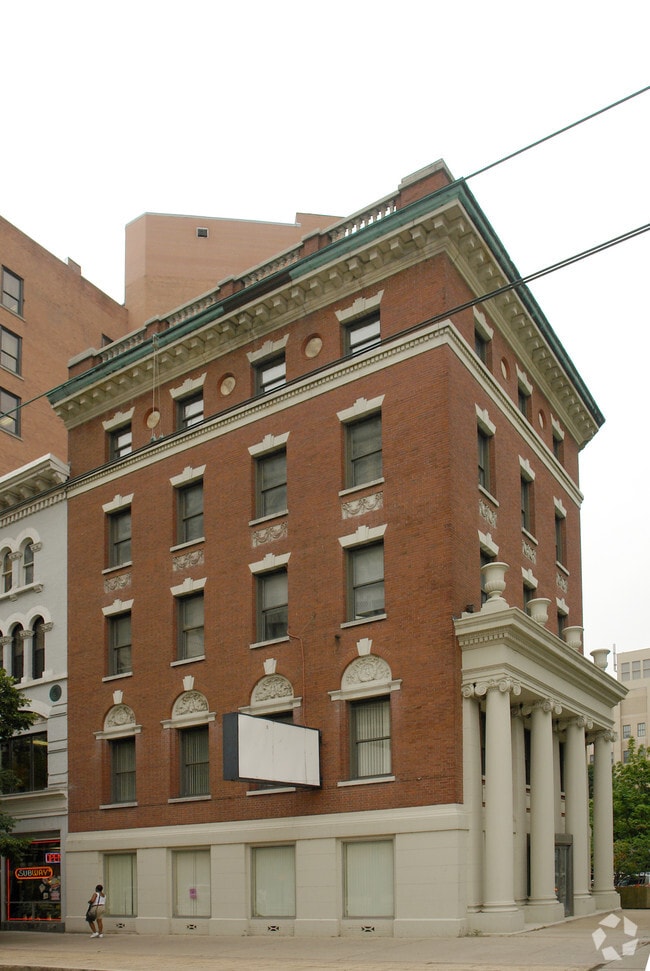
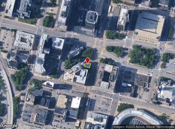
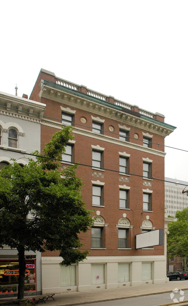
Property Record
306 Main St, Buffalo, NY 14202
NEARBY LISTINGS FOR SALE OR LEASE
Property Detail
306 Main St
140200-111-610-0002-007-000
194.86 N SWAN TO ERIE 44.05 ON IRR S 3OFT N
Officebuilding
Erie
X
New York
36029C0194J
7.000
0
0.06 AC
2024
Outlying Erie County
016500
Buffalo/Niagara Falls
11,307 SF
Buffalo-Cheektowaga-Niagara Falls, NY
DEMOGRAPHICS near 306 Main St
1 Mile
3 Mile
5 Mile
2024 Total Population
3,841
49,177
130,030
2029 Population
3,826
48,946
129,317
Pop Growth 2024-2029
(0.39%)
(0.47%)
(0.55%)
Average Age
46
44
44
2024 Total Households
1,687
21,215
57,508
HH Growth 2024-2029
(0.30%)
(0.48%)
(0.61%)
Median Household Inc
$93,948
$76,977
$70,829
Avg Household Size
2.20
2.30
2.20
2024 Avg HH Vehicles
2.00
2.00
2.00
Median Home Value
$258,441
$204,650
$190,077
Median Year Built
1982
1973
1968
Nearby Places
- Restaurants
- Banks
- Shops
- Fitness
- Groceries
PUBLIC TRANSPORTATION
TRANSIT/SUBWAY
Church (Buffalo Metro Rail - Niagara Frontier Transportation Authority Light Rail (Buffalo Metro Rail))
DRIVE
WALK
Distance
Church (Buffalo Metro Rail - Niagara Frontier Transportation Authority Light Rail (Buffalo Metro Rail))
2 min
2 min
0.1 mi
Seneca (Buffalo Metro Rail - Niagara Frontier Transportation Authority Light Rail (Buffalo Metro Rail))
DRIVE
WALK
Distance
Seneca (Buffalo Metro Rail - Niagara Frontier Transportation Authority Light Rail (Buffalo Metro Rail))
1 min
2 min
0.1 mi
Lafayette Square (Buffalo Metro Rail - Niagara Frontier Transportation Authority Light Rail (Buffalo Metro Rail))
DRIVE
WALK
Distance
Lafayette Square (Buffalo Metro Rail - Niagara Frontier Transportation Authority Light Rail (Buffalo Metro Rail))
3 min
6 min
0.3 mi
Erie Canal Harbor (Buffalo Metro Rail - Niagara Frontier Transportation Authority Light Rail (Buffalo Metro Rail))
DRIVE
WALK
Distance
Erie Canal Harbor (Buffalo Metro Rail - Niagara Frontier Transportation Authority Light Rail (Buffalo Metro Rail))
2 min
7 min
0.4 mi
Special Events Station (Buffalo Metro Rail - Niagara Frontier Transportation Authority Light Rail (Buffalo Metro Rail))
DRIVE
WALK
Distance
Special Events Station (Buffalo Metro Rail - Niagara Frontier Transportation Authority Light Rail (Buffalo Metro Rail))
3 min
9 min
0.5 mi
AIRPORT
Buffalo Niagara International
DRIVE
WALK
Distance
Buffalo Niagara International
19 min
11.8 mi
Freight Ports
Albany, NY Port
DRIVE
WALK
Distance
Albany, NY Port
1 min
260.3 mi
Nearby Properties
Address
Land Use
TOTAL SIZE
Lot Size
Zoning
Address
Land Use
TOTAL SIZE
Lot Size
Zoning
1,053,391 SF
88.26 AC
D-IL
Address
Land Use
TOTAL SIZE
Lot Size
Zoning
704,072 SF
8.61 AC
N-1C
Address
Land Use
TOTAL SIZE
Lot Size
Zoning
401,805 SF
2.04 AC
D-M
Address
Land Use
TOTAL SIZE
Lot Size
Zoning
166,250 SF
0.59 AC
D-M
Address
Land Use
TOTAL SIZE
Lot Size
Zoning
Address
Land Use
TOTAL SIZE
Lot Size
Zoning
151,371 SF
0.51 AC
D-M
Address
Land Use
TOTAL SIZE
Lot Size
Zoning
117,679 SF
0.41 AC
N-1C
Address
Land Use
TOTAL SIZE
Lot Size
Zoning
870,511 SF
4.40 AC
D-M
Address
Land Use
TOTAL SIZE
Lot Size
Zoning
686,000 SF
3.62 AC
N-2R
Address
Land Use
TOTAL SIZE
Lot Size
Zoning
240,783 SF
1.63 AC
N-1D
Address
Land Use
TOTAL SIZE
Lot Size
Zoning
288,014 SF
3.68 AC
N-1C
Address
Land Use
TOTAL SIZE
Lot Size
Zoning
658,732 SF
1.83 AC
N-1D
Address
Land Use
TOTAL SIZE
Lot Size
Zoning
251,908 SF
D-M
Address
Land Use
TOTAL SIZE
Lot Size
Zoning
86,825 SF
1.57 AC
D-M
Address
Land Use
TOTAL SIZE
Lot Size
Zoning
74,316 SF
0.25 AC
D-M
Address
Land Use
TOTAL SIZE
Lot Size
Zoning
569,121 SF
1.04 AC
N-1D
Address
Land Use
TOTAL SIZE
Lot Size
Zoning
896,000 SF
3.99 AC
N-1D
Address
Land Use
TOTAL SIZE
Lot Size
Zoning
21,200 SF
20.94 AC
D-IL
Address
Land Use
TOTAL SIZE
Lot Size
Zoning
66,655 SF
0.25 AC
D-M
Address
Land Use
TOTAL SIZE
Lot Size
Zoning
421,249 SF
10.62 AC
N-1D
Address
Land Use
TOTAL SIZE
Lot Size
Zoning
45,033 SF
1.18 AC
N-1C
Address
Land Use
TOTAL SIZE
Lot Size
Zoning
611,620 SF
2.20 AC
N-1S
Address
Land Use
TOTAL SIZE
Lot Size
Zoning
321,589 SF
1.95 AC
N-1C
Address
Land Use
TOTAL SIZE
Lot Size
Zoning
465,720 SF
1.98 AC
N-1D
Address
Land Use
TOTAL SIZE
Lot Size
Zoning
12,641 SF
0.56 AC
N-2C
Address
Land Use
TOTAL SIZE
Lot Size
Zoning
320,576 SF
1.90 AC
N-1S
Address
Land Use
TOTAL SIZE
Lot Size
Zoning
199,040 SF
2.24 AC
N-1D
Address
Land Use
TOTAL SIZE
Lot Size
Zoning
137,180 SF
4.28 AC
SPLIT ZONE
Address
Land Use
TOTAL SIZE
Lot Size
Zoning
156,870 SF
D-M
Address
Land Use
TOTAL SIZE
Lot Size
Zoning
372,216 SF
2.17 AC
N-1D
The World's #1 Commercial Real Estate Marketplace
Connect with us
© 2025 CoStar Group
The information above has been obtained from sources believed reliable. While we do not doubt its accuracy we have not verified it and make no guarantee, warranty or representation about it. It is your responsibility to independently confirm its accuracy and completeness. Any projections, opinions, assumptions, or estimates used are for example only and do not represent the current or future performance of the property. The value of this transaction to you depends on tax and other factors which should be evaluated by your tax, financial, and legal advisors. You and your advisors should conduct a careful, independent investigation of the property to determine to your satisfaction the suitability of the property for your needs.