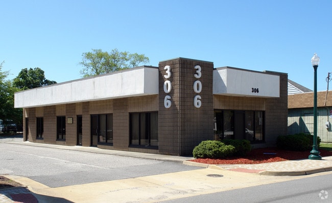
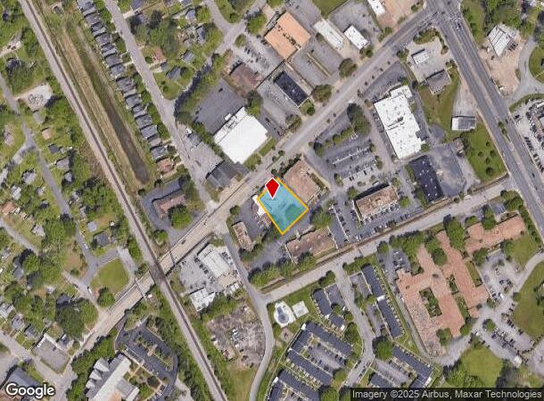
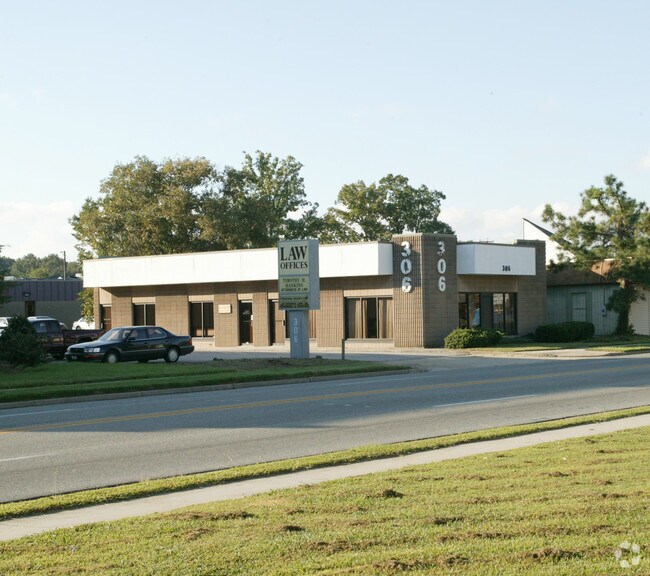
Property Record
306 Main St, Newport News, VA 23601
NEARBY LISTINGS FOR SALE OR LEASE
Property Detail
306 Main St
263.00-05-07
Acreage Parcel
Commercialnec
.39 A PT BRICK HOUSE 100X149.98X126.47X152.19
X
Newport News
5155270015H
Virginia
2025
0.39 AC
2025
Oyster Point
031400
Hampton Roads
3,356 SF
Virginia Beach-Norfolk-Newport News, VA-NC
DEMOGRAPHICS near 306 Main St
1 Mile
3 Mile
5 Mile
2024 Total Population
10,893
65,694
165,842
2029 Population
10,835
65,551
166,782
Pop Growth 2024-2029
(0.53%)
(0.22%)
+ 0.57%
Average Age
38
39
38
2024 Total Households
4,666
27,105
70,034
HH Growth 2024-2029
(0.51%)
(0.26%)
+ 0.50%
Median Household Inc
$57,758
$58,284
$57,224
Avg Household Size
2.30
2.30
2.30
2024 Avg HH Vehicles
2.00
2.00
2.00
Median Home Value
$220,069
$215,907
$219,791
Median Year Built
1961
1968
1976
Nearby Places
Map Layers
Map Styles
 Street
 Aerial
- Restaurants
- Banks
- Shops
- Fitness
- Groceries
PUBLIC TRANSPORTATION
COMMUTER RAIL
DRIVE
WALK
Distance
4 min
1.2 mi
AIRPORT
Newport News/Williamsburg International
DRIVE
WALK
Distance
Newport News/Williamsburg International
17 min
8.2 mi
Norfolk International
DRIVE
WALK
Distance
Norfolk International
36 min
22.3 mi
Nearby Properties
Address
Land Use
TOTAL SIZE
Lot Size
Zoning
Address
Land Use
TOTAL SIZE
Lot Size
Zoning
1 SF
444.26 AC
M2
Address
Land Use
TOTAL SIZE
Lot Size
Zoning
551,257 SF
53.88 AC
O2 P1
Address
Land Use
TOTAL SIZE
Lot Size
Zoning
15,621 SF
67.16 AC
P1
Address
Land Use
TOTAL SIZE
Lot Size
Zoning
271,000 SF
24.28 AC
P1
Address
Land Use
TOTAL SIZE
Lot Size
Zoning
228,261 SF
48.49 AC
6 R-11 ONE
Address
Land Use
TOTAL SIZE
Lot Size
Zoning
68,814 SF
462.33 AC
P1
Address
Land Use
TOTAL SIZE
Lot Size
Zoning
13.01 AC
R7
Address
Land Use
TOTAL SIZE
Lot Size
Zoning
22,652 SF
74.72 AC
P1
Address
Land Use
TOTAL SIZE
Lot Size
Zoning
4.10 AC
R9
Address
Land Use
TOTAL SIZE
Lot Size
Zoning
281,232 SF
17.16 AC
9 R-M MULT
Address
Land Use
TOTAL SIZE
Lot Size
Zoning
100 SF
35.50 AC
R7
Address
Land Use
TOTAL SIZE
Lot Size
Zoning
7,362 SF
19.76 AC
9 R-M MULT
Address
Land Use
TOTAL SIZE
Lot Size
Zoning
8.09 AC
R8
Address
Land Use
TOTAL SIZE
Lot Size
Zoning
255,906 SF
36.57 AC
P1
Address
Land Use
TOTAL SIZE
Lot Size
Zoning
46.94 AC
39 LFA-4 L
Address
Land Use
TOTAL SIZE
Lot Size
Zoning
129,400 SF
28.73 AC
P1
Address
Land Use
TOTAL SIZE
Lot Size
Zoning
123,236 SF
24.90 AC
14 C-2 LIM
Address
Land Use
TOTAL SIZE
Lot Size
Zoning
403,136 SF
37.03 AC
31 HRC-1 H
Address
Land Use
TOTAL SIZE
Lot Size
Zoning
208,400 SF
23.57 AC
P1
Address
Land Use
TOTAL SIZE
Lot Size
Zoning
305,776 SF
25.25 AC
6 R-11 ONE
Address
Land Use
TOTAL SIZE
Lot Size
Zoning
242,308 SF
45.35 AC
5 R-13 ONE
Address
Land Use
TOTAL SIZE
Lot Size
Zoning
22,578 SF
9.69 AC
6 R-11 ONE
Address
Land Use
TOTAL SIZE
Lot Size
Zoning
80,060 SF
12.99 AC
P1
Address
Land Use
TOTAL SIZE
Lot Size
Zoning
132,550 SF
29.82 AC
5 R-13 ONE
Address
Land Use
TOTAL SIZE
Lot Size
Zoning
57,488 SF
11.90 AC
C1
Address
Land Use
TOTAL SIZE
Lot Size
Zoning
83,907 SF
33.80 AC
P1
Address
Land Use
TOTAL SIZE
Lot Size
Zoning
10.89 AC
R8
Address
Land Use
TOTAL SIZE
Lot Size
Zoning
3,482 SF
9.43 AC
9 R-M MULT
Address
Land Use
TOTAL SIZE
Lot Size
Zoning
14,784 SF
10.56 AC
9 R-M MULT
Address
Land Use
TOTAL SIZE
Lot Size
Zoning
1,460 SF
12.40 AC
R7
The World's #1 Commercial Real Estate Marketplace
Connect with us
© 2025 CoStar Group
The information above has been obtained from sources believed reliable. While we do not doubt its accuracy we have not verified it and make no guarantee, warranty or representation about it. It is your responsibility to independently confirm its accuracy and completeness. Any projections, opinions, assumptions, or estimates used are for example only and do not represent the current or future performance of the property. The value of this transaction to you depends on tax and other factors which should be evaluated by your tax, financial, and legal advisors. You and your advisors should conduct a careful, independent investigation of the property to determine to your satisfaction the suitability of the property for your needs.