Property Record
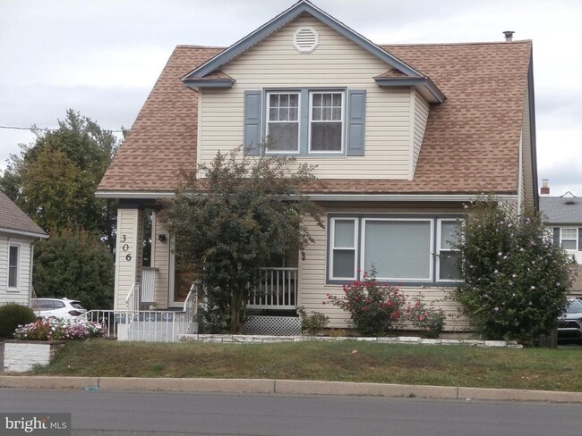
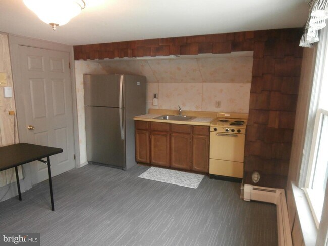
306 N Oxford Valley Rd, Fairless Hills, PA 19030

This Property Is For Sale
NEARBY LISTINGS FOR SALE OR LEASE
Property Detail
306 N Oxford Valley Rd
Philadelphia-Camden-Wilmington, PA-NJ-DE-MD
Oxford Valley Homes Sites
13-004-146
Bucks
Sfr
Pennsylvania
X
0.12 AC
42017C0461J
Lower Bucks County
1,285 SF
Philadelphia
DEMOGRAPHICS near 306 N Oxford Valley Rd
1 Mile
3 Mile
5 Mile
2024 Total Population
7,901
91,581
202,142
2029 Population
7,859
91,722
202,478
Pop Growth 2024-2029
(0.53%)
+ 0.15%
+ 0.17%
Average Age
42
43
43
2024 Total Households
3,145
34,046
76,533
HH Growth 2024-2029
(0.76%)
+ 0.15%
+ 0.14%
Median Household Inc
$88,597
$106,922
$106,913
Avg Household Size
2.50
2.60
2.60
2024 Avg HH Vehicles
2.00
2.00
2.00
Median Home Value
$358,160
$383,095
$394,123
Median Year Built
1960
1961
1969
Nearby Places
Map Layers
Map Styles
 Street
 Aerial
- Restaurants
- Banks
- Shops
- Fitness
- Groceries
PUBLIC TRANSPORTATION
COMMUTER RAIL
Woodbourne (R3 - Southeastern Pennsylvania Transportation Authority Regional Rail (SEPTA Regional Rail))
DRIVE
WALK
Distance
Woodbourne (R3 - Southeastern Pennsylvania Transportation Authority Regional Rail (SEPTA Regional Rail))
4 min
2.6 mi
Langhorne (R3 - Southeastern Pennsylvania Transportation Authority Regional Rail (SEPTA Regional Rail))
DRIVE
WALK
Distance
Langhorne (R3 - Southeastern Pennsylvania Transportation Authority Regional Rail (SEPTA Regional Rail))
7 min
3.0 mi
AIRPORT
Trenton Mercer
DRIVE
WALK
Distance
Trenton Mercer
18 min
10.3 mi
Philadelphia International
DRIVE
WALK
Distance
Philadelphia International
53 min
35.2 mi
Freight Ports
Port of Philadelphia
DRIVE
WALK
Distance
Port of Philadelphia
33 min
21.5 mi
Nearby Properties
Address
Land Use
TOTAL SIZE
Lot Size
Zoning
Address
Land Use
TOTAL SIZE
Lot Size
Zoning
32,912 SF
42.06 AC
AO
Address
Land Use
TOTAL SIZE
Lot Size
Zoning
356,045 SF
7.67 AC
MOZ1
Address
Land Use
TOTAL SIZE
Lot Size
Zoning
4,982 SF
39 AC
C
Address
Land Use
TOTAL SIZE
Lot Size
Zoning
35,542 SF
27.89 AC
NC
Address
Land Use
TOTAL SIZE
Lot Size
Zoning
10,350 SF
35.55 AC
R4
Address
Land Use
TOTAL SIZE
Lot Size
Zoning
21.78 AC
R4
Address
Land Use
TOTAL SIZE
Lot Size
Zoning
116,591 SF
2.65 AC
MI
Address
Land Use
TOTAL SIZE
Lot Size
Zoning
282,799 SF
24.77 AC
GB
Address
Land Use
TOTAL SIZE
Lot Size
Zoning
202,400 SF
20.98 AC
C
Address
Land Use
TOTAL SIZE
Lot Size
Zoning
730,540 SF
82.69 AC
GB
Address
Land Use
TOTAL SIZE
Lot Size
Zoning
43.54 AC
LI
Address
Land Use
TOTAL SIZE
Lot Size
Zoning
132,780 SF
11.09 AC
R3
Address
Land Use
TOTAL SIZE
Lot Size
Zoning
3,490 SF
15.80 AC
R1
Address
Land Use
TOTAL SIZE
Lot Size
Zoning
148,444 SF
24.06 AC
HR
Address
Land Use
TOTAL SIZE
Lot Size
Zoning
100,736 SF
25 AC
C 1
Address
Land Use
TOTAL SIZE
Lot Size
Zoning
10,812 SF
16.87 AC
R3
Address
Land Use
TOTAL SIZE
Lot Size
Zoning
163,779 SF
20.10 AC
MI
Address
Land Use
TOTAL SIZE
Lot Size
Zoning
37,550 SF
5.18 AC
M1
Address
Land Use
TOTAL SIZE
Lot Size
Zoning
92,479 SF
11.48 AC
Address
Land Use
TOTAL SIZE
Lot Size
Zoning
99,124 SF
10.14 AC
C
Address
Land Use
TOTAL SIZE
Lot Size
Zoning
16,990 SF
2.83 AC
C
Address
Land Use
TOTAL SIZE
Lot Size
Zoning
93,562 SF
12.60 AC
AO
Address
Land Use
TOTAL SIZE
Lot Size
Zoning
116,120 SF
2.70 AC
MZO1
Address
Land Use
TOTAL SIZE
Lot Size
Zoning
80,071 SF
17.46 AC
R2
Address
Land Use
TOTAL SIZE
Lot Size
Zoning
33,528 SF
5.38 AC
P
Address
Land Use
TOTAL SIZE
Lot Size
Zoning
15,905 SF
8.43 AC
M1
Address
Land Use
TOTAL SIZE
Lot Size
Zoning
134,750 SF
12.87 AC
C
Address
Land Use
TOTAL SIZE
Lot Size
Zoning
102,908 SF
9.11 AC
C
Address
Land Use
TOTAL SIZE
Lot Size
Zoning
75,089 SF
2.03 AC
R2
Address
Land Use
TOTAL SIZE
Lot Size
Zoning
91,910 SF
6.05 AC
GB
The World's #1 Commercial Real Estate Marketplace
Connect with us
© 2026 CoStar Group
The information above has been obtained from sources believed reliable. While we do not doubt its accuracy we have not verified it and make no guarantee, warranty or representation about it. It is your responsibility to independently confirm its accuracy and completeness. Any projections, opinions, assumptions, or estimates used are for example only and do not represent the current or future performance of the property. The value of this transaction to you depends on tax and other factors which should be evaluated by your tax, financial, and legal advisors. You and your advisors should conduct a careful, independent investigation of the property to determine to your satisfaction the suitability of the property for your needs.