Property Record
306 Ne 175Th Rd, Warrensburg, MO 64093

NEARBY LISTINGS FOR SALE OR LEASE
Property Detail
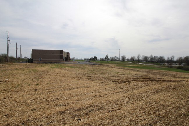
306 Ne 175Th Rd
Warrensburg, MO
D C Developments
12601302006000703
D C DEVELOPMENTS LT 003
Vacantlandnec
Johnson
X
Missouri
29101C0240E
3
2024
1.17 AC
2024
Johnson County MO
960600
Kansas City
DEMOGRAPHICS near 306 Ne 175Th Rd
1 Mile
3 Mile
5 Mile
2024 Total Population
2,133
21,058
25,612
2029 Population
2,188
21,516
26,147
Pop Growth 2024-2029
+ 2.58%
+ 2.17%
+ 2.09%
Average Age
38
33
34
2024 Total Households
863
7,776
9,542
HH Growth 2024-2029
+ 2.67%
+ 2.44%
+ 2.32%
Median Household Inc
$61,150
$55,587
$57,521
Avg Household Size
2.40
2.30
2.30
2024 Avg HH Vehicles
2.00
2.00
2.00
Median Home Value
$254,615
$191,192
$194,718
Median Year Built
1998
1988
1989
Nearby Places
Map Layers
Map Styles
 Street
 Aerial
- Restaurants
- Banks
- Shops
- Fitness
- Groceries
PUBLIC TRANSPORTATION
COMMUTER RAIL
DRIVE
WALK
Distance
5 min
2.2 mi
SALE & LEASE HISTORY
LISTING DATE
SALE/LEASE

Sep 24, 2016
For Sale
Nearby Properties
Address
Land Use
TOTAL SIZE
Lot Size
Zoning
Address
Land Use
TOTAL SIZE
Lot Size
Zoning
150,228 SF
26.79 AC
Address
Land Use
TOTAL SIZE
Lot Size
Zoning
205,785 SF
24.20 AC
Address
Land Use
TOTAL SIZE
Lot Size
Zoning
112,082 SF
10.79 AC
Address
Land Use
TOTAL SIZE
Lot Size
Zoning
Address
Land Use
TOTAL SIZE
Lot Size
Zoning
4,552 SF
8.01 AC
Address
Land Use
TOTAL SIZE
Lot Size
Zoning
43,053 SF
2.79 AC
Address
Land Use
TOTAL SIZE
Lot Size
Zoning
52,925 SF
5.53 AC
Address
Land Use
TOTAL SIZE
Lot Size
Zoning
68,000 SF
12 AC
Address
Land Use
TOTAL SIZE
Lot Size
Zoning
54,960 SF
15 AC
Address
Land Use
TOTAL SIZE
Lot Size
Zoning
27,306 SF
2.69 AC
Address
Land Use
TOTAL SIZE
Lot Size
Zoning
27,022 SF
1.75 AC
Address
Land Use
TOTAL SIZE
Lot Size
Zoning
11,493 SF
2.54 AC
Address
Land Use
TOTAL SIZE
Lot Size
Zoning
3,900 SF
6.77 AC
Address
Land Use
TOTAL SIZE
Lot Size
Zoning
44,818 SF
2.24 AC
Address
Land Use
TOTAL SIZE
Lot Size
Zoning
32,828 SF
2.40 AC
Address
Land Use
TOTAL SIZE
Lot Size
Zoning
3,914 SF
5.92 AC
Address
Land Use
TOTAL SIZE
Lot Size
Zoning
12,212 SF
1.45 AC
Address
Land Use
TOTAL SIZE
Lot Size
Zoning
75,899 SF
5.25 AC
Address
Land Use
TOTAL SIZE
Lot Size
Zoning
9,904 SF
0.21 AC
Address
Land Use
TOTAL SIZE
Lot Size
Zoning
21,290 SF
4.70 AC
Address
Land Use
TOTAL SIZE
Lot Size
Zoning
3,622 SF
4.83 AC
Address
Land Use
TOTAL SIZE
Lot Size
Zoning
3,600 SF
7.29 AC
Address
Land Use
TOTAL SIZE
Lot Size
Zoning
141,627 SF
12 AC
Address
Land Use
TOTAL SIZE
Lot Size
Zoning
34,272 SF
3.06 AC
Address
Land Use
TOTAL SIZE
Lot Size
Zoning
4,500 SF
5.18 AC
Address
Land Use
TOTAL SIZE
Lot Size
Zoning
16,102 SF
4.06 AC
Address
Land Use
TOTAL SIZE
Lot Size
Zoning
19,553 SF
2.74 AC
Address
Land Use
TOTAL SIZE
Lot Size
Zoning
6,599 SF
7.34 AC
Address
Land Use
TOTAL SIZE
Lot Size
Zoning
13,002 SF
0.27 AC
Address
Land Use
TOTAL SIZE
Lot Size
Zoning
6,365 SF
The World's #1 Commercial Real Estate Marketplace
Connect with us
© 2025 CoStar Group
The information above has been obtained from sources believed reliable. While we do not doubt its accuracy we have not verified it and make no guarantee, warranty or representation about it. It is your responsibility to independently confirm its accuracy and completeness. Any projections, opinions, assumptions, or estimates used are for example only and do not represent the current or future performance of the property. The value of this transaction to you depends on tax and other factors which should be evaluated by your tax, financial, and legal advisors. You and your advisors should conduct a careful, independent investigation of the property to determine to your satisfaction the suitability of the property for your needs.