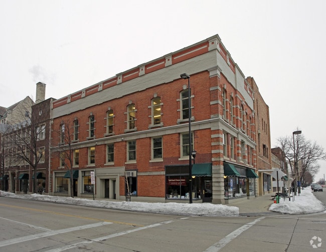
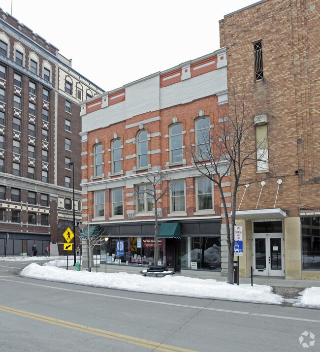
Property Record
306 Pine St, Pulaski, WI 54162

Property Detail
306 Pine St
Green Bay, WI
7,043 SQ FT PLAT OF NAVARINO N 2/3 OF LOT 71
12-147
BROWN
Commercialnec
Wisconsin
D2
71
2025
0.16 AC
2025
Green Bay
021600
Green Bay
20,466 SF
NEARBY LISTINGS FOR SALE OR LEASE
-
-
View all Pulaski listings for sale on LoopNet.com
DEMOGRAPHICS near 306 Pine St
1 mile
3 mile
5 mile
2024 Total Population
13,245
79,827
147,895
2029 Population
13,544
80,896
150,272
Pop Growth 2024-2029
+ 2.26%
+ 1.34%
+ 1.61%
Average Age
36
39
40
2024 Total Households
5,661
34,280
62,591
HH Growth 2024-2029
+ 2.30%
+ 1.41%
+ 1.72%
Median Household Inc
$52,713
$58,023
$66,698
Avg Household Size
2.20
2.20
2.30
2024 Avg HH Vehicles
1.00
2.00
2.00
Median Home Value
$176,906
$174,716
$225,138
Median Year Built
1948
1962
1972
Nearby Places
Map Layers
Map Styles
 Street
 Aerial
Transit
 Traffic
 Biking
Places
Listings with unknown addresses are not visible on the map
- Restaurants
- Banks
- Shops
- Fitness
- Groceries
PUBLIC TRANSPORTATION
AIRPORT
Green Bay/Austin Straubel International
Drive
Walk
Distance
Green Bay/Austin Straubel International
29 min
20.0 mi
Freight Ports
Port Milwaukee
Drive
Walk
Distance
Port Milwaukee
157 min
134.9 mi
Nearby Properties
Address
Land Use
TOTAL SIZE
Lot Size
Zoning
Address
Land Use
TOTAL SIZE
Lot Size
Zoning
10.37 AC
Address
Land Use
TOTAL SIZE
Lot Size
Zoning
4.42 AC
Address
Land Use
TOTAL SIZE
Lot Size
Zoning
Address
Land Use
TOTAL SIZE
Lot Size
Zoning
34.31 AC
Address
Land Use
TOTAL SIZE
Lot Size
Zoning
Address
Land Use
TOTAL SIZE
Lot Size
Zoning
8.37 AC
Address
Land Use
TOTAL SIZE
Lot Size
Zoning
6.23 AC
Address
Land Use
TOTAL SIZE
Lot Size
Zoning
2.88 AC
Address
Land Use
TOTAL SIZE
Lot Size
Zoning
Address
Land Use
TOTAL SIZE
Lot Size
Zoning
Address
Land Use
TOTAL SIZE
Lot Size
Zoning
Address
Land Use
TOTAL SIZE
Lot Size
Zoning
5.41 AC
Address
Land Use
TOTAL SIZE
Lot Size
Zoning
2.29 AC
Address
Land Use
TOTAL SIZE
Lot Size
Zoning
2.62 AC
Address
Land Use
TOTAL SIZE
Lot Size
Zoning
3.87 AC
Address
Land Use
TOTAL SIZE
Lot Size
Zoning
Address
Land Use
TOTAL SIZE
Lot Size
Zoning
3.30 AC
Address
Land Use
TOTAL SIZE
Lot Size
Zoning
2.46 AC
Address
Land Use
TOTAL SIZE
Lot Size
Zoning
4.90 AC
Address
Land Use
TOTAL SIZE
Lot Size
Zoning
3.15 AC
Address
Land Use
TOTAL SIZE
Lot Size
Zoning
1.51 AC
Address
Land Use
TOTAL SIZE
Lot Size
Zoning
2.78 AC
Address
Land Use
TOTAL SIZE
Lot Size
Zoning
4.75 AC
Address
Land Use
TOTAL SIZE
Lot Size
Zoning
9.54 AC
Address
Land Use
TOTAL SIZE
Lot Size
Zoning
5.38 AC
Address
Land Use
TOTAL SIZE
Lot Size
Zoning
5.43 AC
Address
Land Use
TOTAL SIZE
Lot Size
Zoning
16.52 AC
Address
Land Use
TOTAL SIZE
Lot Size
Zoning
1.50 AC
Address
Land Use
TOTAL SIZE
Lot Size
Zoning
3.59 AC
Address
Land Use
TOTAL SIZE
Lot Size
Zoning
19.65 AC
The World's #1 Commercial Real Estate Marketplace
Connect with us
© 2026 CoStar Group
The information above has been obtained from sources believed reliable. While we do not doubt its accuracy we have not verified it and make no guarantee, warranty or representation about it. It is your responsibility to independently confirm its accuracy and completeness. Any projections, opinions, assumptions, or estimates used are for example only and do not represent the current or future performance of the property. The value of this transaction to you depends on tax and other factors which should be evaluated by your tax, financial, and legal advisors. You and your advisors should conduct a careful, independent investigation of the property to determine to your satisfaction the suitability of the property for your needs.