Property Record
306 W Old Glencoe Rd, Burlington, NC 27217
This Property Is For Sale
NEARBY LISTINGS FOR SALE OR LEASE
Property Detail
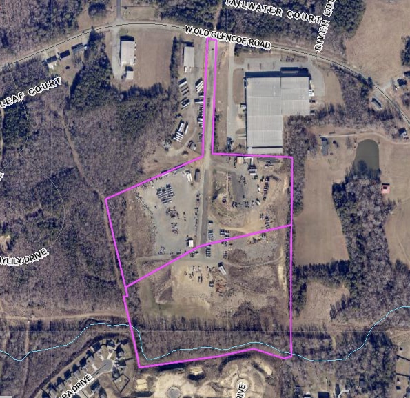
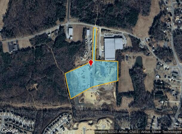
306 W Old Glencoe Rd
Burlington, NC
Sunset Heights 15,Sunset Heights
140413
W OLD GLENCOE RD LOT 1 12-50-43
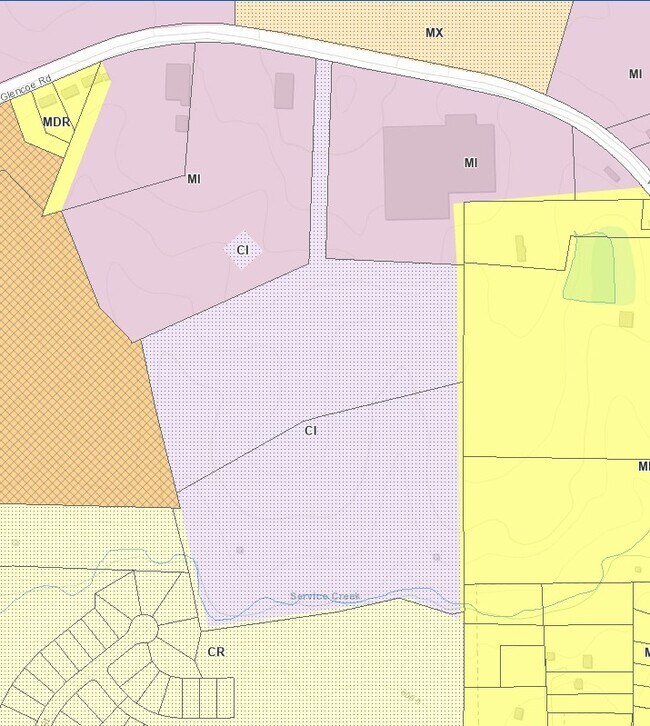
Industrialacreage
Alamance
AE
North Carolina
3710887600K
1
2025
14.05 AC
2025
NW Alamance County
020400
Greensboro/Winston-Salem
DEMOGRAPHICS near 306 W Old Glencoe Rd
1 Mile
3 Mile
5 Mile
2024 Total Population
2,798
32,805
84,278
2029 Population
3,021
34,739
90,030
Pop Growth 2024-2029
+ 7.97%
+ 5.90%
+ 6.83%
Average Age
37
39
39
2024 Total Households
1,026
12,933
32,615
HH Growth 2024-2029
+ 8.19%
+ 6.04%
+ 7.13%
Median Household Inc
$54,897
$50,769
$57,314
Avg Household Size
2.70
2.40
2.40
2024 Avg HH Vehicles
2.00
2.00
2.00
Median Home Value
$152,822
$185,397
$222,942
Median Year Built
1987
1969
1977
Nearby Places
Map Layers
Map Styles
 Street
 Aerial
- Restaurants
- Banks
- Shops
- Fitness
- Groceries
PUBLIC TRANSPORTATION
COMMUTER RAIL
Burlington Station (Piedmont - North Carolina by Train (NC Train))
DRIVE
WALK
Distance
Burlington Station (Piedmont - North Carolina by Train (NC Train))
7 min
3.3 mi
AIRPORT
Piedmont Triad International
DRIVE
WALK
Distance
Piedmont Triad International
54 min
35.6 mi
Freight Ports
Virginia Port Authority - Richmond
DRIVE
WALK
Distance
Virginia Port Authority - Richmond
211 min
180.8 mi
Nearby Properties
Address
Land Use
TOTAL SIZE
Lot Size
Zoning
Address
Land Use
TOTAL SIZE
Lot Size
Zoning
40,220 SF
12.45 AC
MF A
Address
Land Use
TOTAL SIZE
Lot Size
Zoning
110,612 SF
1 AC
B 3
Address
Land Use
TOTAL SIZE
Lot Size
Zoning
23,268 SF
6.11 AC
Address
Land Use
TOTAL SIZE
Lot Size
Zoning
59,897 SF
15.40 AC
Address
Land Use
TOTAL SIZE
Lot Size
Zoning
32,480 SF
18.44 AC
R 9
Address
Land Use
TOTAL SIZE
Lot Size
Zoning
2,923 SF
10.13 AC
Address
Land Use
TOTAL SIZE
Lot Size
Zoning
77,046 SF
1.61 AC
I 3
Address
Land Use
TOTAL SIZE
Lot Size
Zoning
22,301 SF
19.25 AC
OI
Address
Land Use
TOTAL SIZE
Lot Size
Zoning
27,336 SF
10.84 AC
R 6
Address
Land Use
TOTAL SIZE
Lot Size
Zoning
25,200 SF
5.30 AC
Address
Land Use
TOTAL SIZE
Lot Size
Zoning
60,713 SF
3.15 AC
O I
Address
Land Use
TOTAL SIZE
Lot Size
Zoning
41,624 SF
19.77 AC
R 9
Address
Land Use
TOTAL SIZE
Lot Size
Zoning
50,549 SF
4.33 AC
OI
Address
Land Use
TOTAL SIZE
Lot Size
Zoning
6,152 SF
14 AC
R 6
Address
Land Use
TOTAL SIZE
Lot Size
Zoning
24,108 SF
10.62 AC
Address
Land Use
TOTAL SIZE
Lot Size
Zoning
13,232 SF
6.49 AC
I 2
Address
Land Use
TOTAL SIZE
Lot Size
Zoning
18,932 SF
8.06 AC
R OI
Address
Land Use
TOTAL SIZE
Lot Size
Zoning
4,472 SF
8.07 AC
Address
Land Use
TOTAL SIZE
Lot Size
Zoning
2,440 SF
16.01 AC
MF A
Address
Land Use
TOTAL SIZE
Lot Size
Zoning
50,895 SF
2.46 AC
O I
Address
Land Use
TOTAL SIZE
Lot Size
Zoning
39,170 SF
1.44 AC
MF B
Address
Land Use
TOTAL SIZE
Lot Size
Zoning
4,500 SF
11.26 AC
OI
Address
Land Use
TOTAL SIZE
Lot Size
Zoning
2,112 SF
12.03 AC
R 9
Address
Land Use
TOTAL SIZE
Lot Size
Zoning
2,824 SF
8.91 AC
MFA
Address
Land Use
TOTAL SIZE
Lot Size
Zoning
15,600 SF
3.28 AC
Address
Land Use
TOTAL SIZE
Lot Size
Zoning
134,208 SF
12.01 AC
I 2
Address
Land Use
TOTAL SIZE
Lot Size
Zoning
106,210 SF
7.17 AC
I3
Address
Land Use
TOTAL SIZE
Lot Size
Zoning
112,400 SF
10.25 AC
Address
Land Use
TOTAL SIZE
Lot Size
Zoning
29,256 SF
1.52 AC
MFA
Address
Land Use
TOTAL SIZE
Lot Size
Zoning
48,596 SF
4.02 AC
R 9
The World's #1 Commercial Real Estate Marketplace
Connect with us
© 2026 CoStar Group
The information above has been obtained from sources believed reliable. While we do not doubt its accuracy we have not verified it and make no guarantee, warranty or representation about it. It is your responsibility to independently confirm its accuracy and completeness. Any projections, opinions, assumptions, or estimates used are for example only and do not represent the current or future performance of the property. The value of this transaction to you depends on tax and other factors which should be evaluated by your tax, financial, and legal advisors. You and your advisors should conduct a careful, independent investigation of the property to determine to your satisfaction the suitability of the property for your needs.