Property Record
3063 38Th St, Astoria, NY 11103


Save to a Folder
{{folder.Name}}
{{folder.ListingIds.length}} Properties
{{folder.ListingIds.length}} Property
Create a New Folder
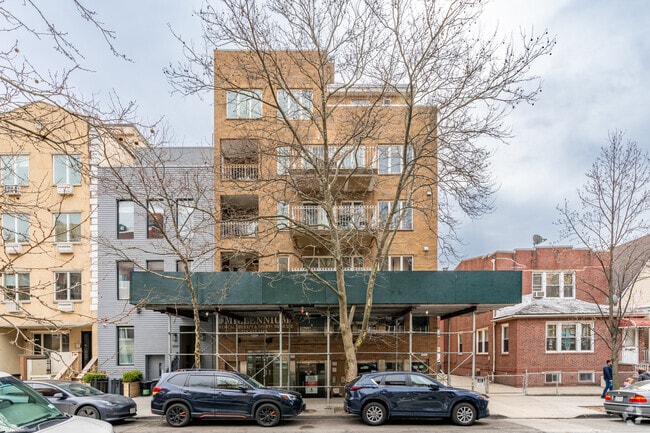
Property Detail
3063 38Th St
Officebuilding
QUEENS
R6B
New York
B and X Area of moderate flood hazard, usually the area between the limits of the 100-year and 500-year floods.
1006
2025
Northwest Queens
2026
Long Island (New York)
015500
New York-Jersey City-White Plains, NY-NJ
1,606 SF
00660-1002
NEARBY LISTINGS FOR SALE OR LEASE
DEMOGRAPHICS near 3063 38Th St
1 mile
3 mile
5 mile
2025 Total Population
137,409
1,034,644
3,125,414
2030 Population
137,849
1,050,523
3,183,119
Pop Growth 2025-2030
+ 0.32%
+ 1.53%
+ 1.85%
Average Age
40
41
40
2025 Total Households
61,000
437,578
1,313,853
HH Growth 2025-2030
(0.03%)
+ 2.18%
+ 2.36%
Median Household Inc
$94,097
$96,103
$87,274
Avg Household Size
2.20
2.30
2.20
2025 Avg HH Vehicles
.00
.00
.00
Median Home Value
$795,517
$887,969
$861,536
Median Year Built
1948
1956
1956
Nearby Places
Map Layers
Map Styles
 Street
 Aerial
Layers
 Traffic
 Biking
Places
Listings with unknown addresses are not visible on the map
- Restaurants
- Banks
- Shops
- Fitness
- Groceries
PUBLIC TRANSPORTATION
TRANSIT/SUBWAY
30 Av (Broadway Local - N - MTA New York City Transit, Broadway Local - W - MTA New York City Transit)
Drive
Walk
Distance
30 Av (Broadway Local - N - MTA New York City Transit, Broadway Local - W - MTA New York City Transit)
2 min
9 min
0.5 mi
Broadway (Broadway Local - N - MTA New York City Transit, Broadway Local - W - MTA New York City Transit)
Drive
Walk
Distance
Broadway (Broadway Local - N - MTA New York City Transit, Broadway Local - W - MTA New York City Transit)
2 min
12 min
0.6 mi
Astoria Blvd (Broadway Local - N - MTA New York City Transit, Broadway Local - W - MTA New York City Transit)
Drive
Walk
Distance
Astoria Blvd (Broadway Local - N - MTA New York City Transit, Broadway Local - W - MTA New York City Transit)
3 min
14 min
0.7 mi
Northern Boulevard (E - New York MTA Subway (The Subway), M - New York MTA Subway (The Subway), R - New York MTA Subway (The Subway))
Drive
Walk
Distance
Northern Boulevard (E - New York MTA Subway (The Subway), M - New York MTA Subway (The Subway), R - New York MTA Subway (The Subway))
3 min
18 min
0.9 mi
36 Av (Broadway Local - N - MTA New York City Transit, Broadway Local - W - MTA New York City Transit)
Drive
Walk
Distance
36 Av (Broadway Local - N - MTA New York City Transit, Broadway Local - W - MTA New York City Transit)
3 min
20 min
1.0 mi
COMMUTER RAIL
Woodside Station (Babylon Branch - Long Island Rail Road, Far Rockaway Branch - Long Island Rail Road, Hempstead Branch - Long Island Rail Road, Long Beach Branch - Long Island Rail Road, Montauk Branch - Long Island Rail Road, Port Jefferson Branch - Long Island Rail Road, Port Washington Branch - Long Island Rail Road, Ronkonkoma Branch - Long Island Rail Road)
Drive
Walk
Distance
Woodside Station (Babylon Branch - Long Island Rail Road, Far Rockaway Branch - Long Island Rail Road, Hempstead Branch - Long Island Rail Road, Long Beach Branch - Long Island Rail Road, Montauk Branch - Long Island Rail Road, Port Jefferson Branch - Long Island Rail Road, Port Washington Branch - Long Island Rail Road, Ronkonkoma Branch - Long Island Rail Road)
6 min
1.7 mi
Hunterspoint Avenue Station (Hempstead Branch - Long Island Rail Road, Oyster Bay Branch - Long Island Rail Road)
Drive
Walk
Distance
Hunterspoint Avenue Station (Hempstead Branch - Long Island Rail Road, Oyster Bay Branch - Long Island Rail Road)
7 min
2.9 mi
AIRPORT
LaGuardia
Drive
Walk
Distance
LaGuardia
8 min
3.1 mi
John F Kennedy International
Drive
Walk
Distance
John F Kennedy International
21 min
14.3 mi
Newark Liberty International
Drive
Walk
Distance
Newark Liberty International
31 min
19.3 mi
Freight Ports
NY - Red Hook Container Terminal
Drive
Walk
Distance
NY - Red Hook Container Terminal
19 min
9.0 mi
SALE & LEASE HISTORY
LISTING DATE
SALE/LEASE

Feb 11, 2021
For Lease
Nearby Properties
Address
Land Use
TOTAL SIZE
Lot Size
Zoning
Address
Land Use
TOTAL SIZE
Lot Size
Zoning
1,783,434 SF
1.94 AC
C5-3
Address
Land Use
TOTAL SIZE
Lot Size
Zoning
5,519,372 SF
409.21 AC
C8-2
Address
Land Use
TOTAL SIZE
Lot Size
Zoning
2,215,000 SF
6.43 AC
R9
Address
Land Use
TOTAL SIZE
Lot Size
Zoning
2,400,000 SF
15.14 AC
C5-2
Address
Land Use
TOTAL SIZE
Lot Size
Zoning
1,160,500 SF
1.62 AC
C6-6
Address
Land Use
TOTAL SIZE
Lot Size
Zoning
2,230,742 SF
6.33 AC
R9
Address
Land Use
TOTAL SIZE
Lot Size
Zoning
539,643 SF
C5-2
Address
Land Use
TOTAL SIZE
Lot Size
Zoning
822,014 SF
1.38 AC
C52.5
Address
Land Use
TOTAL SIZE
Lot Size
Zoning
1,033,031 SF
1.87 AC
C52.5
Address
Land Use
TOTAL SIZE
Lot Size
Zoning
685,125 SF
0.85 AC
C5-3
Address
Land Use
TOTAL SIZE
Lot Size
Zoning
1,064,223 SF
0.88 AC
C52.5
Address
Land Use
TOTAL SIZE
Lot Size
Zoning
1,242,587 SF
1.49 AC
C6-6
Address
Land Use
TOTAL SIZE
Lot Size
Zoning
984,485 SF
1.03 AC
C6-6
Address
Land Use
TOTAL SIZE
Lot Size
Zoning
986,246 SF
0.90 AC
C5-3
Address
Land Use
TOTAL SIZE
Lot Size
Zoning
624,883 SF
0.75 AC
C6-6
Address
Land Use
TOTAL SIZE
Lot Size
Zoning
449,876 SF
0.81 AC
C5-3
Address
Land Use
TOTAL SIZE
Lot Size
Zoning
755,000 SF
1.85 AC
R7-2
Address
Land Use
TOTAL SIZE
Lot Size
Zoning
1,065,915 SF
2.13 AC
M16R10
Address
Land Use
TOTAL SIZE
Lot Size
Zoning
1,200,000 SF
10.24 AC
R9
Address
Land Use
TOTAL SIZE
Lot Size
Zoning
649,576 SF
0.64 AC
C5-3
Address
Land Use
TOTAL SIZE
Lot Size
Zoning
757,439 SF
0.91 AC
C1-9
Address
Land Use
TOTAL SIZE
Lot Size
Zoning
733,747 SF
0.98 AC
R10
Address
Land Use
TOTAL SIZE
Lot Size
Zoning
1,502,532 SF
6.35 AC
R7B
Address
Land Use
TOTAL SIZE
Lot Size
Zoning
646,524 SF
C52.5
Address
Land Use
TOTAL SIZE
Lot Size
Zoning
714,224 SF
0.70 AC
R8
Address
Land Use
TOTAL SIZE
Lot Size
Zoning
493,090 SF
1.87 AC
C52.5
Address
Land Use
TOTAL SIZE
Lot Size
Zoning
536,992 SF
0.64 AC
C5-3
Address
Land Use
TOTAL SIZE
Lot Size
Zoning
1,075,000 SF
6.74 AC
R7-2
Address
Land Use
TOTAL SIZE
Lot Size
Zoning
805,287 SF
1 AC
R10
Address
Land Use
TOTAL SIZE
Lot Size
Zoning
1,321,050 SF
1.89 AC
C1-9
The World's #1 Commercial Real Estate Marketplace
Connect with us
© 2026 CoStar Group
The information above has been obtained from sources believed reliable. While we do not doubt its accuracy we have not verified it and make no guarantee, warranty or representation about it. It is your responsibility to independently confirm its accuracy and completeness. Any projections, opinions, assumptions, or estimates used are for example only and do not represent the current or future performance of the property. The value of this transaction to you depends on tax and other factors which should be evaluated by your tax, financial, and legal advisors. You and your advisors should conduct a careful, independent investigation of the property to determine to your satisfaction the suitability of the property for your needs.