Property Record
3063 E 3300 S, Salt Lake City, UT 84109


NEARBY LISTINGS FOR SALE OR LEASE
Property Detail
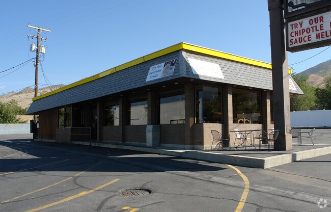
3063 E 3300 S
Salt Lake City, UT
BEG N 00^0457 W 1186.5 FT & N 89^5845 W 200 FT FR S 1/4 OF SEC 26, T1S, R1E, SLM; N 89^5845 W 120 FT; N 0^0457 W191.41 FT; S 89^5845 E 120 FT; S 0^0457 E 191.41 FT TO BEG.
16-26-330-054-0000
Salt Lake
Restaurantdrivein
Utah
2024
0.53 AC
2025
Foothill Corridor
110200
Salt Lake City
1,823 SF
DEMOGRAPHICS near 3063 E 3300 S
1 Mile
3 Mile
5 Mile
2024 Total Population
11,955
85,385
217,788
2029 Population
11,990
86,099
219,629
Pop Growth 2024-2029
+ 0.29%
+ 0.84%
+ 0.85%
Average Age
40
39
39
2024 Total Households
4,109
32,011
88,378
HH Growth 2024-2029
+ 0.17%
+ 0.83%
+ 0.84%
Median Household Inc
$118,521
$104,643
$77,901
Avg Household Size
2.80
2.60
2.40
2024 Avg HH Vehicles
2.00
2.00
2.00
Median Home Value
$661,909
$676,233
$596,168
Median Year Built
1958
1961
1968
Nearby Places
Map Layers
Map Styles
 Street
 Aerial
- Restaurants
- Banks
- Shops
- Fitness
- Groceries
PUBLIC TRANSPORTATION
AIRPORT
Salt Lake City International
DRIVE
WALK
Distance
Salt Lake City International
20 min
15.3 mi
Provo Municipal
DRIVE
WALK
Distance
Provo Municipal
60 min
47.1 mi
Nearby Properties
Address
Land Use
TOTAL SIZE
Lot Size
Zoning
Address
Land Use
TOTAL SIZE
Lot Size
Zoning
207,140 SF
23.06 AC
P
Address
Land Use
TOTAL SIZE
Lot Size
Zoning
257,003 SF
25.87 AC
1108
Address
Land Use
TOTAL SIZE
Lot Size
Zoning
691,463 SF
17.80 AC
RM
Address
Land Use
TOTAL SIZE
Lot Size
Zoning
183,600 SF
10.70 AC
RMF-35
Address
Land Use
TOTAL SIZE
Lot Size
Zoning
297,476 SF
1.62 AC
CSHBD2
Address
Land Use
TOTAL SIZE
Lot Size
Zoning
369,717 SF
2.50 AC
RO
Address
Land Use
TOTAL SIZE
Lot Size
Zoning
412,006 SF
1.70 AC
C3
Address
Land Use
TOTAL SIZE
Lot Size
Zoning
369,377 SF
1.65 AC
Address
Land Use
TOTAL SIZE
Lot Size
Zoning
426,600 SF
1.61 AC
CSHBD1
Address
Land Use
TOTAL SIZE
Lot Size
Zoning
125,518 SF
11.03 AC
RMZC
Address
Land Use
TOTAL SIZE
Lot Size
Zoning
303,240 SF
29.21 AC
1205
Address
Land Use
TOTAL SIZE
Lot Size
Zoning
299,673 SF
2.16 AC
C3
Address
Land Use
TOTAL SIZE
Lot Size
Zoning
295,307 SF
2.46 AC
C-B
Address
Land Use
TOTAL SIZE
Lot Size
Zoning
621,969 SF
10.17 AC
CS
Address
Land Use
TOTAL SIZE
Lot Size
Zoning
132,942 SF
18 AC
1108
Address
Land Use
TOTAL SIZE
Lot Size
Zoning
517,619 SF
4.20 AC
CSHBD1
Address
Land Use
TOTAL SIZE
Lot Size
Zoning
130,948 SF
18.95 AC
1107
Address
Land Use
TOTAL SIZE
Lot Size
Zoning
106,467 SF
4.41 AC
2000
Address
Land Use
TOTAL SIZE
Lot Size
Zoning
345,554 SF
3.21 AC
RO
Address
Land Use
TOTAL SIZE
Lot Size
Zoning
40,414 SF
3.81 AC
C-2
Address
Land Use
TOTAL SIZE
Lot Size
Zoning
479,027 SF
1.98 AC
C3
Address
Land Use
TOTAL SIZE
Lot Size
Zoning
89,546 SF
5.03 AC
1110
Address
Land Use
TOTAL SIZE
Lot Size
Zoning
5,300 SF
56.12 AC
1205
Address
Land Use
TOTAL SIZE
Lot Size
Zoning
127,748 SF
8.87 AC
1210
Address
Land Use
TOTAL SIZE
Lot Size
Zoning
115,128 SF
9.59 AC
1108
Address
Land Use
TOTAL SIZE
Lot Size
Zoning
43,066 SF
3.92 AC
C-2
Address
Land Use
TOTAL SIZE
Lot Size
Zoning
86,695 SF
0.65 AC
C3
Address
Land Use
TOTAL SIZE
Lot Size
Zoning
90,270 SF
2.80 AC
R-M
Address
Land Use
TOTAL SIZE
Lot Size
Zoning
108,106 SF
2.35 AC
C-2
Address
Land Use
TOTAL SIZE
Lot Size
Zoning
119,799 SF
6.29 AC
1108
The World's #1 Commercial Real Estate Marketplace
Connect with us
© 2026 CoStar Group
The information above has been obtained from sources believed reliable. While we do not doubt its accuracy we have not verified it and make no guarantee, warranty or representation about it. It is your responsibility to independently confirm its accuracy and completeness. Any projections, opinions, assumptions, or estimates used are for example only and do not represent the current or future performance of the property. The value of this transaction to you depends on tax and other factors which should be evaluated by your tax, financial, and legal advisors. You and your advisors should conduct a careful, independent investigation of the property to determine to your satisfaction the suitability of the property for your needs.