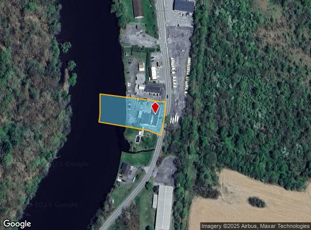
Property Record
3063 State Route 208, Wallkill, NY 12589

Current Lease Availabilities
NEARBY LISTINGS FOR SALE OR LEASE
Property Detail
3063 State Route 208
5200-106.004-0001-044.100-0000
Survey & Subdivision Map Lands Charles H
Autorepair
Ulster
AE
New York
36111C0860E
44.100
2025
1.40 AC
2024
Hudson Valley Area
955400
Other Market Areas
3,950 SF
Kingston, NY
DEMOGRAPHICS near 3063 State Route 208
1 Mile
3 Mile
5 Mile
2024 Total Population
1,463
13,603
26,208
2029 Population
1,423
14,070
27,004
Pop Growth 2024-2029
(2.73%)
+ 3.43%
+ 3.04%
Average Age
41
41
41
2024 Total Households
561
4,675
8,810
HH Growth 2024-2029
(2.67%)
+ 3.53%
+ 3.09%
Median Household Inc
$84,666
$87,367
$99,762
Avg Household Size
2.60
2.70
2.70
2024 Avg HH Vehicles
2.00
2.00
2.00
Median Home Value
$310,473
$300,913
$319,314
Median Year Built
1974
1972
1974
Nearby Places
Map Layers
Map Styles
 Street
 Aerial
- Restaurants
- Banks
- Shops
- Fitness
- Groceries
PUBLIC TRANSPORTATION
AIRPORT
New York Stewart International
DRIVE
WALK
Distance
New York Stewart International
22 min
13.3 mi
Nearby Properties
Address
Land Use
TOTAL SIZE
Lot Size
Zoning
Address
Land Use
TOTAL SIZE
Lot Size
Zoning
109,108 SF
15.60 AC
B2
Address
Land Use
TOTAL SIZE
Lot Size
Zoning
14,376 SF
63.90 AC
01
Address
Land Use
TOTAL SIZE
Lot Size
Zoning
72,852 SF
2.20 AC
Address
Land Use
TOTAL SIZE
Lot Size
Zoning
18,386 SF
54.70 AC
RA-.5
Address
Land Use
TOTAL SIZE
Lot Size
Zoning
38.80 AC
H-1
Address
Land Use
TOTAL SIZE
Lot Size
Zoning
111,517 SF
0.32 AC
R3
Address
Land Use
TOTAL SIZE
Lot Size
Zoning
Address
Land Use
TOTAL SIZE
Lot Size
Zoning
2.10 AC
R5
Address
Land Use
TOTAL SIZE
Lot Size
Zoning
52,267 SF
4.60 AC
RM2
Address
Land Use
TOTAL SIZE
Lot Size
Zoning
35.80 AC
I1
Address
Land Use
TOTAL SIZE
Lot Size
Zoning
34.20 AC
Address
Land Use
TOTAL SIZE
Lot Size
Zoning
51,257 SF
8.50 AC
RM1
Address
Land Use
TOTAL SIZE
Lot Size
Zoning
100.90 AC
RAG-2
Address
Land Use
TOTAL SIZE
Lot Size
Zoning
36,648 SF
3.10 AC
R4
Address
Land Use
TOTAL SIZE
Lot Size
Zoning
84.40 AC
RA-.5
Address
Land Use
TOTAL SIZE
Lot Size
Zoning
9,976 SF
1 AC
MX
Address
Land Use
TOTAL SIZE
Lot Size
Zoning
92,537 SF
3.80 AC
H-1
Address
Land Use
TOTAL SIZE
Lot Size
Zoning
32,219 SF
9.40 AC
R3
Address
Land Use
TOTAL SIZE
Lot Size
Zoning
3,664 SF
133.20 AC
RA5
Address
Land Use
TOTAL SIZE
Lot Size
Zoning
93.10 AC
RA-.5
Address
Land Use
TOTAL SIZE
Lot Size
Zoning
63,710 SF
26.30 AC
H-1
Address
Land Use
TOTAL SIZE
Lot Size
Zoning
9,224 SF
3.60 AC
B4
Address
Land Use
TOTAL SIZE
Lot Size
Zoning
2,520 SF
45.90 AC
B4
Address
Land Use
TOTAL SIZE
Lot Size
Zoning
38,760 SF
6.70 AC
I1
Address
Land Use
TOTAL SIZE
Lot Size
Zoning
9,768 SF
3.50 AC
B4
Address
Land Use
TOTAL SIZE
Lot Size
Zoning
37,479 SF
0.29 AC
B3
Address
Land Use
TOTAL SIZE
Lot Size
Zoning
18,060 SF
0.01 AC
B3
Address
Land Use
TOTAL SIZE
Lot Size
Zoning
6,476 SF
98.90 AC
R2
Address
Land Use
TOTAL SIZE
Lot Size
Zoning
Address
Land Use
TOTAL SIZE
Lot Size
Zoning
30,294 SF
2.90 AC
R3
The World's #1 Commercial Real Estate Marketplace
Connect with us
© 2026 CoStar Group
The information above has been obtained from sources believed reliable. While we do not doubt its accuracy we have not verified it and make no guarantee, warranty or representation about it. It is your responsibility to independently confirm its accuracy and completeness. Any projections, opinions, assumptions, or estimates used are for example only and do not represent the current or future performance of the property. The value of this transaction to you depends on tax and other factors which should be evaluated by your tax, financial, and legal advisors. You and your advisors should conduct a careful, independent investigation of the property to determine to your satisfaction the suitability of the property for your needs.