Property Record
3065 N Bellanca Ave, Casa Grande, AZ 85122


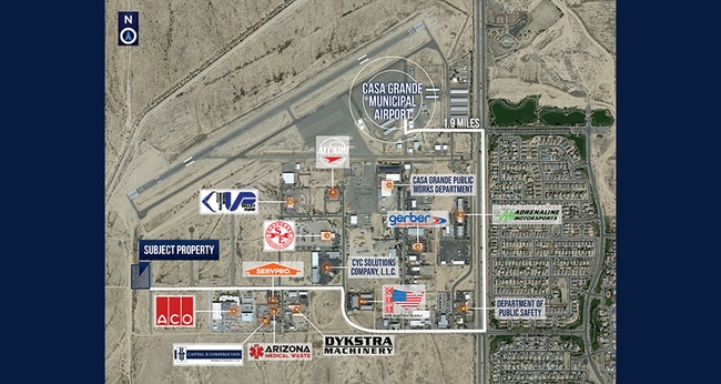
NEARBY LISTINGS FOR SALE OR LEASE
Property Detail
3065 N Bellanca Ave
Phoenix-Mesa-Chandler, AZ
Donovan M Kramer Senior Industrial Park
509-81-134
LOT 4 OF A REPLAT OF LOTS 2 THROUGH 5 OF DONOVAN M KRAMER SR INDU STRIAL PARK AT THE AIRPORT PHASE III ACCORDING TO THE PLAT OF REC ORD IN THE OFFICE OF THE COUNTY RECORDER OF PINAL COUNTY, ARIZONA , RECORDED IN PLAT FEE NO. 2023-027130, SECTION 32,
Warehouse
Pinal
X
Arizona
04021C1175E
4,2-5
2023
2 AC
2025
Pinal County
001306
Phoenix
5,763 SF
DEMOGRAPHICS near 3065 N Bellanca Ave
1 Mile
3 Mile
5 Mile
2024 Total Population
358
18,949
52,655
2029 Population
456
24,117
66,814
Pop Growth 2024-2029
+ 27.37%
+ 27.27%
+ 26.89%
Average Age
35
40
39
2024 Total Households
105
6,791
18,530
HH Growth 2024-2029
+ 27.62%
+ 26.84%
+ 26.44%
Median Household Inc
$39,582
$67,179
$66,276
Avg Household Size
3.10
2.70
2.80
2024 Avg HH Vehicles
2.00
2.00
2.00
Median Home Value
$158,333
$304,310
$260,700
Median Year Built
2000
2002
2001
Nearby Places
Map Layers
Map Styles
 Street
 Aerial
- Restaurants
- Banks
- Shops
- Fitness
- Groceries
PUBLIC TRANSPORTATION
AIRPORT
Phoenix-Mesa Gateway
DRIVE
WALK
Distance
Phoenix-Mesa Gateway
57 min
37.7 mi
Freight Ports
Port of San Diego
DRIVE
WALK
Distance
Port of San Diego
386 min
354.5 mi
SALE & LEASE HISTORY
LISTING DATE
SALE/LEASE

Jun 26, 2023
For Sale
Nearby Properties
Address
Land Use
TOTAL SIZE
Lot Size
Zoning
Address
Land Use
TOTAL SIZE
Lot Size
Zoning
289,599 SF
65.03 AC
Address
Land Use
TOTAL SIZE
Lot Size
Zoning
162,113 SF
20 AC
Address
Land Use
TOTAL SIZE
Lot Size
Zoning
107,832 SF
11.50 AC
Address
Land Use
TOTAL SIZE
Lot Size
Zoning
48,543 SF
3.04 AC
UNDESIGNAT
Address
Land Use
TOTAL SIZE
Lot Size
Zoning
15,122 SF
114.70 AC
UNDESIGNAT
Address
Land Use
TOTAL SIZE
Lot Size
Zoning
Address
Land Use
TOTAL SIZE
Lot Size
Zoning
151 AC
UNDESIGNAT
Address
Land Use
TOTAL SIZE
Lot Size
Zoning
58,564 SF
7.99 AC
UNDESIGNAT
Address
Land Use
TOTAL SIZE
Lot Size
Zoning
64,412 SF
12.75 AC
UNDESIGNAT
Address
Land Use
TOTAL SIZE
Lot Size
Zoning
74,816 SF
299.50 AC
Address
Land Use
TOTAL SIZE
Lot Size
Zoning
21,475 SF
2.63 AC
Address
Land Use
TOTAL SIZE
Lot Size
Zoning
67,365 SF
4.78 AC
UNDESIGNAT
Address
Land Use
TOTAL SIZE
Lot Size
Zoning
206,509 SF
12.40 AC
Address
Land Use
TOTAL SIZE
Lot Size
Zoning
9,286 SF
24.08 AC
RVP
Address
Land Use
TOTAL SIZE
Lot Size
Zoning
14,736 SF
2.04 AC
Address
Land Use
TOTAL SIZE
Lot Size
Zoning
19,200 SF
9.58 AC
Address
Land Use
TOTAL SIZE
Lot Size
Zoning
28.29 AC
UNDESIGNAT
Address
Land Use
TOTAL SIZE
Lot Size
Zoning
13,146 SF
1.84 AC
Address
Land Use
TOTAL SIZE
Lot Size
Zoning
42,865 SF
5.93 AC
Address
Land Use
TOTAL SIZE
Lot Size
Zoning
20,991 SF
0.82 AC
Address
Land Use
TOTAL SIZE
Lot Size
Zoning
15,036 SF
1.83 AC
UNDESIGNAT
Address
Land Use
TOTAL SIZE
Lot Size
Zoning
26,425 SF
3.99 AC
Address
Land Use
TOTAL SIZE
Lot Size
Zoning
14,252 SF
16 AC
Address
Land Use
TOTAL SIZE
Lot Size
Zoning
70.74 AC
UNDESIGNAT
Address
Land Use
TOTAL SIZE
Lot Size
Zoning
15,960 SF
2.45 AC
The World's #1 Commercial Real Estate Marketplace
Connect with us
© 2026 CoStar Group
The information above has been obtained from sources believed reliable. While we do not doubt its accuracy we have not verified it and make no guarantee, warranty or representation about it. It is your responsibility to independently confirm its accuracy and completeness. Any projections, opinions, assumptions, or estimates used are for example only and do not represent the current or future performance of the property. The value of this transaction to you depends on tax and other factors which should be evaluated by your tax, financial, and legal advisors. You and your advisors should conduct a careful, independent investigation of the property to determine to your satisfaction the suitability of the property for your needs.