Property Record
3067 W 15Th St, Plano, TX 75075


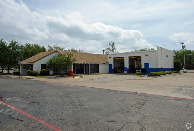
Property Detail
3067 W 15Th St
R-0396-002-011A-1
PRAIRIE CREEK ESTATES SECTION II, BLK B, LOT 11A & 11C
Commercialnec
COLLIN
R
Texas
AE The base floodplain where base flood elevations are provided. AE Zones are now used on new format FIRMs instead of A1-A30 Zones.
11a,1
2025
0.92 AC
2025
Central Plano
031624
Dallas/Ft Worth
6,260 SF
Dallas-Fort Worth-Arlington, TX
NEARBY LISTINGS FOR SALE OR LEASE
DEMOGRAPHICS near 3067 W 15Th St
1 mile
3 mile
5 mile
2025 Total Population
14,590
143,126
372,145
2030 Population
16,430
161,078
414,247
Pop Growth 2025-2030
+ 12.61%
+ 12.54%
+ 11.31%
Average Age
44
40
40
2025 Total Households
5,996
57,969
150,978
HH Growth 2025-2030
+ 12.79%
+ 13.17%
+ 11.72%
Median Household Inc
$94,971
$97,344
$101,207
Avg Household Size
2.40
2.30
2.40
2025 Avg HH Vehicles
2.00
2.00
2.00
Median Home Value
$444,363
$479,369
$495,451
Median Year Built
1981
1987
1988
Nearby Places
Map Layers
Map Styles
 Street
 Aerial
Transit
 Traffic
 Biking
Places
Listings with unknown addresses are not visible on the map
- Restaurants
- Banks
- Shops
- Fitness
- Groceries
PUBLIC TRANSPORTATION
AIRPORT
Dallas Love Field
Drive
Walk
Distance
Dallas Love Field
30 min
19.9 mi
Dallas-Fort Worth International
Drive
Walk
Distance
Dallas-Fort Worth International
32 min
24.5 mi
Nearby Properties
Address
Land Use
TOTAL SIZE
Lot Size
Zoning
Address
Land Use
TOTAL SIZE
Lot Size
Zoning
1,049,441 SF
Address
Land Use
TOTAL SIZE
Lot Size
Zoning
1,614,550 SF
77.76 AC
SFR
Address
Land Use
TOTAL SIZE
Lot Size
Zoning
492,661 SF
4.89 AC
Address
Land Use
TOTAL SIZE
Lot Size
Zoning
343,539 SF
34.74 AC
S-164
Address
Land Use
TOTAL SIZE
Lot Size
Zoning
1,105,509 SF
92.46 AC
A
Address
Land Use
TOTAL SIZE
Lot Size
Zoning
659,402 SF
24.39 AC
O-M
Address
Land Use
TOTAL SIZE
Lot Size
Zoning
686,032 SF
9 AC
R2000
Address
Land Use
TOTAL SIZE
Lot Size
Zoning
606,071 SF
64.75 AC
SFR
Address
Land Use
TOTAL SIZE
Lot Size
Zoning
369,694 SF
Address
Land Use
TOTAL SIZE
Lot Size
Zoning
533,962 SF
29.78 AC
MF-M
Address
Land Use
TOTAL SIZE
Lot Size
Zoning
445,071 SF
107.94 AC
2493-A TO-
Address
Land Use
TOTAL SIZE
Lot Size
Zoning
481,366 SF
6.31 AC
LC
Address
Land Use
TOTAL SIZE
Lot Size
Zoning
430,618 SF
11.33 AC
MF-H
Address
Land Use
TOTAL SIZE
Lot Size
Zoning
394,287 SF
14.96 AC
Address
Land Use
TOTAL SIZE
Lot Size
Zoning
507,693 SF
32.50 AC
MFL
Address
Land Use
TOTAL SIZE
Lot Size
Zoning
520,713 SF
8.03 AC
Address
Land Use
TOTAL SIZE
Lot Size
Zoning
393,416 SF
Address
Land Use
TOTAL SIZE
Lot Size
Zoning
451,672 SF
23.81 AC
LI-1
Address
Land Use
TOTAL SIZE
Lot Size
Zoning
509,566 SF
34.05 AC
PD
Address
Land Use
TOTAL SIZE
Lot Size
Zoning
289,093 SF
8.87 AC
R/O-2
Address
Land Use
TOTAL SIZE
Lot Size
Zoning
284,830 SF
2.98 AC
Address
Land Use
TOTAL SIZE
Lot Size
Zoning
386,448 SF
Address
Land Use
TOTAL SIZE
Lot Size
Zoning
324,000 SF
6.67 AC
O-S
Address
Land Use
TOTAL SIZE
Lot Size
Zoning
421,532 SF
4.29 AC
Address
Land Use
TOTAL SIZE
Lot Size
Zoning
64.94 AC
Address
Land Use
TOTAL SIZE
Lot Size
Zoning
245,542 SF
26.31 AC
RT/O-M
Address
Land Use
TOTAL SIZE
Lot Size
Zoning
408,256 SF
27.66 AC
MF-M
Address
Land Use
TOTAL SIZE
Lot Size
Zoning
417,173 SF
4.48 AC
O-S
Address
Land Use
TOTAL SIZE
Lot Size
Zoning
488,063 SF
31.19 AC
MF-L
The World's #1 Commercial Real Estate Marketplace
Connect with us
© 2026 CoStar Group
The information above has been obtained from sources believed reliable. While we do not doubt its accuracy we have not verified it and make no guarantee, warranty or representation about it. It is your responsibility to independently confirm its accuracy and completeness. Any projections, opinions, assumptions, or estimates used are for example only and do not represent the current or future performance of the property. The value of this transaction to you depends on tax and other factors which should be evaluated by your tax, financial, and legal advisors. You and your advisors should conduct a careful, independent investigation of the property to determine to your satisfaction the suitability of the property for your needs.