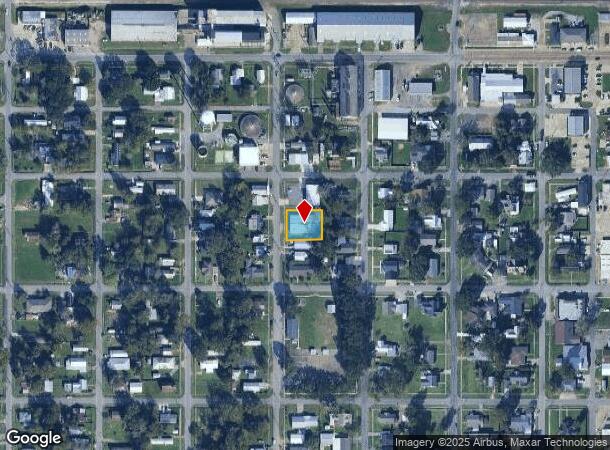
Property Record
307 4Th St, Rayne, LA 70578


NEARBY LISTINGS FOR SALE OR LEASE
Property Detail
307 4Th St
Lafayette, LA
Ealer
0170243400
LOTS 6 & 7, N 12 LOT 10 BLK 23 EALER. (2 12 LOTS)(IMP)(K-5160)(LOT SIZE 40 X 120) ACQ CARSON'S CANDY CO. #450008; #450009; #219335 U8-559; #91674 N3-749; #41177 Y2-474
Commercialnec
Acadia
X
Louisiana
22055C0125J
6-7,10
2024
0.11 AC
2024
Acadia County
960700
Other Market Areas
DEMOGRAPHICS near 307 4Th St
1 Mile
3 Mile
5 Mile
2024 Total Population
6,475
9,748
13,276
2029 Population
6,431
9,664
13,153
Pop Growth 2024-2029
(0.68%)
(0.86%)
(0.93%)
Average Age
41
41
40
2024 Total Households
2,621
3,888
5,149
HH Growth 2024-2029
(0.80%)
(0.87%)
(0.93%)
Median Household Inc
$36,414
$38,077
$39,693
Avg Household Size
2.30
2.40
2.40
2024 Avg HH Vehicles
2.00
2.00
2.00
Median Home Value
$134,436
$133,973
$131,565
Median Year Built
1974
1978
1981
Nearby Places
Map Layers
Map Styles
 Street
 Aerial
- Restaurants
- Banks
- Shops
- Fitness
- Groceries
PUBLIC TRANSPORTATION
AIRPORT
Lafayette Regional/Paul Fournet Field
DRIVE
WALK
Distance
Lafayette Regional/Paul Fournet Field
29 min
20.7 mi
Freight Ports
Port of Iberia
DRIVE
WALK
Distance
Port of Iberia
54 min
41.7 mi
Nearby Properties
Address
Land Use
TOTAL SIZE
Lot Size
Zoning
Address
Land Use
TOTAL SIZE
Lot Size
Zoning
Address
Land Use
TOTAL SIZE
Lot Size
Zoning
Address
Land Use
TOTAL SIZE
Lot Size
Zoning
1.10 AC
Address
Land Use
TOTAL SIZE
Lot Size
Zoning
Address
Land Use
TOTAL SIZE
Lot Size
Zoning
Address
Land Use
TOTAL SIZE
Lot Size
Zoning
62 AC
Address
Land Use
TOTAL SIZE
Lot Size
Zoning
6.15 AC
Address
Land Use
TOTAL SIZE
Lot Size
Zoning
21.39 AC
Address
Land Use
TOTAL SIZE
Lot Size
Zoning
7.47 AC
Address
Land Use
TOTAL SIZE
Lot Size
Zoning
Address
Land Use
TOTAL SIZE
Lot Size
Zoning
8.14 AC
Address
Land Use
TOTAL SIZE
Lot Size
Zoning
151 AC
Address
Land Use
TOTAL SIZE
Lot Size
Zoning
1.20 AC
Address
Land Use
TOTAL SIZE
Lot Size
Zoning
Address
Land Use
TOTAL SIZE
Lot Size
Zoning
0.75 AC
Address
Land Use
TOTAL SIZE
Lot Size
Zoning
7.02 AC
Address
Land Use
TOTAL SIZE
Lot Size
Zoning
2.04 AC
Address
Land Use
TOTAL SIZE
Lot Size
Zoning
1.12 AC
Address
Land Use
TOTAL SIZE
Lot Size
Zoning
1.38 AC
Address
Land Use
TOTAL SIZE
Lot Size
Zoning
26 AC
Address
Land Use
TOTAL SIZE
Lot Size
Zoning
2.01 AC
Address
Land Use
TOTAL SIZE
Lot Size
Zoning
1.50 AC
Address
Land Use
TOTAL SIZE
Lot Size
Zoning
0.39 AC
Address
Land Use
TOTAL SIZE
Lot Size
Zoning
1.50 AC
Address
Land Use
TOTAL SIZE
Lot Size
Zoning
2.24 AC
Address
Land Use
TOTAL SIZE
Lot Size
Zoning
Address
Land Use
TOTAL SIZE
Lot Size
Zoning
Address
Land Use
TOTAL SIZE
Lot Size
Zoning
0.11 AC
Address
Land Use
TOTAL SIZE
Lot Size
Zoning
0.11 AC
Address
Land Use
TOTAL SIZE
Lot Size
Zoning
5.50 AC
The World's #1 Commercial Real Estate Marketplace
Connect with us
© 2026 CoStar Group
The information above has been obtained from sources believed reliable. While we do not doubt its accuracy we have not verified it and make no guarantee, warranty or representation about it. It is your responsibility to independently confirm its accuracy and completeness. Any projections, opinions, assumptions, or estimates used are for example only and do not represent the current or future performance of the property. The value of this transaction to you depends on tax and other factors which should be evaluated by your tax, financial, and legal advisors. You and your advisors should conduct a careful, independent investigation of the property to determine to your satisfaction the suitability of the property for your needs.