Property Record
307 Broad St, Nevada City, CA 95959


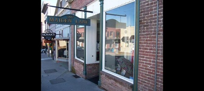

Property Detail
307 Broad St
005-398-005-000
PTN LOT 6 BLK 31 NEVADA CITY
Storebuilding
Nevada
B and X Area of moderate flood hazard, usually the area between the limits of the 100-year and 500-year floods.
California
2024
6
2025
0.04 AC
000802
Other Market Areas
1,800 SF
Truckee-Grass Valley, CA
NEARBY LISTINGS FOR SALE OR LEASE
DEMOGRAPHICS near 307 Broad St
1 mile
3 mile
5 mile
2025 Total Population
3,690
15,025
32,081
2030 Population
3,603
14,742
31,226
Pop Growth 2025-2030
(2.36%)
(1.88%)
(2.67%)
Average Age
50
50
48
2025 Total Households
1,655
6,370
13,866
HH Growth 2025-2030
(2.48%)
(1.88%)
(2.74%)
Median Household Inc
$72,115
$69,839
$69,170
Avg Household Size
2.10
2.20
2.20
2025 Avg HH Vehicles
2.00
2.00
2.00
Median Home Value
$707,751
$678,793
$637,652
Median Year Built
1963
1980
1977
Nearby Places
Map Layers
Map Styles
 Street
 Aerial
Layers
 Traffic
 Biking
Places
Listings with unknown addresses are not visible on the map
- Restaurants
- Banks
- Shops
- Fitness
- Groceries
Nearby Properties
Address
Land Use
TOTAL SIZE
Lot Size
Zoning
Address
Land Use
TOTAL SIZE
Lot Size
Zoning
Address
Land Use
TOTAL SIZE
Lot Size
Zoning
145,522 SF
6.39 AC
Address
Land Use
TOTAL SIZE
Lot Size
Zoning
74,019 SF
4.20 AC
Address
Land Use
TOTAL SIZE
Lot Size
Zoning
45,263 SF
2.61 AC
Address
Land Use
TOTAL SIZE
Lot Size
Zoning
45,427 SF
4.06 AC
Address
Land Use
TOTAL SIZE
Lot Size
Zoning
26,556 SF
0.49 AC
Address
Land Use
TOTAL SIZE
Lot Size
Zoning
77.34 AC
AG-20
Address
Land Use
TOTAL SIZE
Lot Size
Zoning
28,125 SF
7.12 AC
Address
Land Use
TOTAL SIZE
Lot Size
Zoning
14,550 SF
1.95 AC
Address
Land Use
TOTAL SIZE
Lot Size
Zoning
48,000 SF
3.52 AC
Address
Land Use
TOTAL SIZE
Lot Size
Zoning
Address
Land Use
TOTAL SIZE
Lot Size
Zoning
7.84 AC
Address
Land Use
TOTAL SIZE
Lot Size
Zoning
21,505 SF
4.13 AC
Address
Land Use
TOTAL SIZE
Lot Size
Zoning
14,504 SF
2.21 AC
Address
Land Use
TOTAL SIZE
Lot Size
Zoning
19,072 SF
2.93 AC
Address
Land Use
TOTAL SIZE
Lot Size
Zoning
87,696 SF
4.80 AC
Address
Land Use
TOTAL SIZE
Lot Size
Zoning
40,969 SF
3.48 AC
Address
Land Use
TOTAL SIZE
Lot Size
Zoning
47,976 SF
4.52 AC
Address
Land Use
TOTAL SIZE
Lot Size
Zoning
41,130 SF
2.29 AC
Address
Land Use
TOTAL SIZE
Lot Size
Zoning
22,155 SF
2.77 AC
Address
Land Use
TOTAL SIZE
Lot Size
Zoning
33,642 SF
0.95 AC
Address
Land Use
TOTAL SIZE
Lot Size
Zoning
Address
Land Use
TOTAL SIZE
Lot Size
Zoning
17,210 SF
2.29 AC
Address
Land Use
TOTAL SIZE
Lot Size
Zoning
33,450 SF
2.13 AC
M1-SP
Address
Land Use
TOTAL SIZE
Lot Size
Zoning
49,672 SF
6.32 AC
Address
Land Use
TOTAL SIZE
Lot Size
Zoning
9,961 SF
2.13 AC
Address
Land Use
TOTAL SIZE
Lot Size
Zoning
Address
Land Use
TOTAL SIZE
Lot Size
Zoning
32,000 SF
2.26 AC
Address
Land Use
TOTAL SIZE
Lot Size
Zoning
34,500 SF
2.47 AC
The World's #1 Commercial Real Estate Marketplace
Connect with us
© 2026 CoStar Group
The information above has been obtained from sources believed reliable. While we do not doubt its accuracy we have not verified it and make no guarantee, warranty or representation about it. It is your responsibility to independently confirm its accuracy and completeness. Any projections, opinions, assumptions, or estimates used are for example only and do not represent the current or future performance of the property. The value of this transaction to you depends on tax and other factors which should be evaluated by your tax, financial, and legal advisors. You and your advisors should conduct a careful, independent investigation of the property to determine to your satisfaction the suitability of the property for your needs.